Merrivale, KwaZulu-Natal
| Merrivale | |
|---|---|
 Merrivale  Merrivale  Merrivale
| |
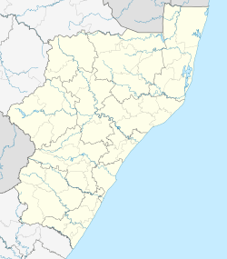
| Coordinates: 29°30′50″S 30°14′13″E / 29.514°S 30.237°ECoordinates: 29°30′50″S 30°14′13″E / 29.514°S 30.237°E | |
| Country | South Africa |
| Province | KwaZulu-Natal |
| District | uMgungundlovu |
| Municipality | uMngeni |
| Main Place | Howick |
| Area[1] | |
| • Total | 3.08 km2 (1.19 sq mi) |
| Population (2011)[1] | |
| • Total | 3,891 |
| • Density | 1,300/km2 (3,300/sq mi) |
| Racial makeup (2011)[1] | |
| • Black African | 47.3% |
| • Coloured | 15.3% |
| • Indian/Asian | 9.1% |
| • White | 28.0% |
| • Other | 0.3% |
| First languages (2011)[1] | |
| • English | 50.2% |
| • Zulu | 38.0% |
| • Afrikaans | 6.7% |
| • Other | 5.2% |
| Postal code (street) | 3291 |
| PO box | 3291 |
Merrivale is a town in Umgungundlovu District Municipality in the KwaZulu-Natal province of South Africa.
Village 145 km north-west of Durban and 5 km south-east of Howick. Named after Herman Merivale, Secretary of State for the Colonies in 1848.[2]
References
- 1 2 3 4 "Sub Place Merrivale". Census 2011.
- ↑ "Dictionary of Southern African Place Names (Public Domain)". Human Science Research Council. p. 306.
Municipalities and communities of uMgungundlovu District Municipality, KwaZulu-Natal | ||
|---|---|---|
District seat: Pietermaritzburg | ||
| uMshwathi | .svg.png) | |
| uMngeni | ||
| Mpofana | ||
| Impendle | ||
| Msunduzi | ||
| Mkhambathini | ||
| Richmond | ||
This article is issued from Wikipedia - version of the 8/18/2016. The text is available under the Creative Commons Attribution/Share Alike but additional terms may apply for the media files.