Menahga, Minnesota
| Menahga, Minnesota | |
|---|---|
| City | |
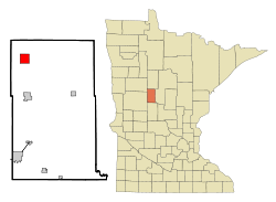 Location of Menahga, Minnesota | |
| Coordinates: 46°45′11″N 95°5′59″W / 46.75306°N 95.09972°W | |
| Country | United States |
| State | Minnesota |
| County | Wadena |
| Area[1] | |
| • Total | 3.89 sq mi (10.08 km2) |
| • Land | 3.70 sq mi (9.58 km2) |
| • Water | 0.19 sq mi (0.49 km2) |
| Elevation | 1,401 ft (427 m) |
| Population (2010)[2] | |
| • Total | 1,306 |
| • Estimate (2012[3]) | 1,289 |
| • Density | 35/sq mi (136.3/km2) |
| Time zone | Central (CST) (UTC-6) |
| • Summer (DST) | CDT (UTC-5) |
| ZIP code | 56464 |
| Area code(s) | 218 |
| FIPS code | 27-41660[4] |
| GNIS feature ID | 0647760[5] |
Menahga is a city in Wadena County in the U.S. state of Minnesota The population was 1,306 at the 2010 census.[6]
History
Menahga was platted in 1891, and named for the Ojibwe-language word meaning "blueberry".[7] A post office has been in operation at Menahga since 1891.[8]
Geography
According to the United States Census Bureau, the city has a total area of 3.89 square miles (10.08 km2); 3.70 square miles (9.58 km2) is land and 0.19 square miles (0.49 km2) is water.[1]
The Blueberry River flows just north of the city.[9]
U.S. Route 71 and Minnesota State Highway 87 are two of the main routes in the city.
Demographics
| Historical population | |||
|---|---|---|---|
| Census | Pop. | %± | |
| 1900 | 413 | — | |
| 1910 | 346 | −16.2% | |
| 1920 | 478 | 38.2% | |
| 1930 | 486 | 1.7% | |
| 1940 | 768 | 58.0% | |
| 1950 | 849 | 10.5% | |
| 1960 | 799 | −5.9% | |
| 1970 | 835 | 4.5% | |
| 1980 | 980 | 17.4% | |
| 1990 | 1,076 | 9.8% | |
| 2000 | 1,220 | 13.4% | |
| 2010 | 1,306 | 7.0% | |
| Est. 2015 | 1,339 | [10] | 2.5% |
2010 census
As of the census[2] of 2010, there were 1,306 people, 569 households, and 301 families residing in the city. The population density was 353.0 inhabitants per square mile (136.3/km2). There were 654 housing units at an average density of 176.8 per square mile (68.3/km2). The racial makeup of the city was 97.8% White, 0.5% African American, 0.6% Native American, 0.2% Asian, 0.3% from other races, and 0.7% from two or more races. Hispanic or Latino of any race were 1.1% of the population.
There were 569 households of which 25.0% had children under the age of 18 living with them, 39.5% were married couples living together, 8.3% had a female householder with no husband present, 5.1% had a male householder with no wife present, and 47.1% were non-families. 42.0% of all households were made up of individuals and 24.7% had someone living alone who was 65 years of age or older. The average household size was 2.18 and the average family size was 3.01.
The median age in the city was 44.8 years. 24.3% of residents were under the age of 18; 6.2% were between the ages of 18 and 24; 19.8% were from 25 to 44; 21.7% were from 45 to 64; and 28.2% were 65 years of age or older. The gender makeup of the city was 45.9% male and 54.1% female.
2000 census
As of the census[4] of 2000, there were 1,220 people, 491 households, and 282 families residing in the city. The population density was 328.3 people per square mile (126.6/km²). There were 556 housing units at an average density of 149.6 per square mile (57.7/km²). The racial makeup of the city was 98.36% White, 0.08% African American, 0.98% Native American, 0.08% Asian, 0.08% from other races, and 0.41% from two or more races. Hispanic or Latino of any race were 0.33% of the population. 42.4% were of Finnish, 23.2% German and 15.5% Norwegian ancestry.
There were 491 households out of which 25.9% had children under the age of 18 living with them, 45.0% were married couples living together, 9.4% had a female householder with no husband present, and 42.4% were non-families. 37.7% of all households were made up of individuals and 20.6% had someone living alone who was 65 years of age or older. The average household size was 2.22 and the average family size was 2.98.
In the city the population was spread out with 23.8% under the age of 18, 5.6% from 18 to 24, 20.2% from 25 to 44, 17.4% from 45 to 64, and 33.1% who were 65 years of age or older. The median age was 46 years. For every 100 females there were 81.8 males. For every 100 females age 18 and over, there were 78.5 males.
The median income for a household in the city was $22,232, and the median income for a family was $30,288. Males had a median income of $26,071 versus $18,594 for females. The per capita income for the city was $14,360. About 14.7% of families and 18.7% of the population were below the poverty line, including 22.6% of those under age 18 and 12.3% of those age 65 or over.
Notable residents
The writer-illustrator Wallace Wood, best known as one of the original five Mad cartoonists, was born in Menahga on June 17, 1927. Wood's childhood in Menahga was documented by Bhob Stewart in the illustrated biography, Against the Grain: Mad Artist Wallace Wood (TwoMorrows Publishing, 2003).
Radio stations
- FM radio
- 89.3 KOPJ Life Talk Radio
- 92.5 KXKK 92.5 Hot Country
- 94.5 KDLB Adult Contemporary The Arrow 94.7
- 97.5 KDKK 97.5 Music of Your Life
- 101.9 KQKK KQ102
- AM radio
- 870 KPRM Classic Country News/Talk
- 1070 KSKK Country, 10,000 Watts
- 1570 KAKK Oldies 1570, 10,000 Watts
References
- 1 2 "US Gazetteer files 2010". United States Census Bureau. Retrieved 2012-11-13.
- 1 2 "American FactFinder". United States Census Bureau. Retrieved 2012-11-13.
- ↑ "Population Estimates". United States Census Bureau. Retrieved 2013-05-28.
- 1 2 "American FactFinder". United States Census Bureau. Retrieved 2008-01-31.
- ↑ "US Board on Geographic Names". United States Geological Survey. 2007-10-25. Retrieved 2008-01-31.
- ↑ "2010 Census Redistricting Data (Public Law 94-171) Summary File". American FactFinder. U.S. Census Bureau, 2010 Census. Retrieved 23 April 2011.
- ↑ Upham, Warren (1920). Minnesota Geographic Names: Their Origin and Historic Significance. Minnesota Historical Society. p. 561.
- ↑ "Wadena County". Jim Forte Postal History. Retrieved 11 August 2015.
- ↑ Minnesota Atlas & Gazetteer. Yarmouth, Me.: DeLorme. 1994. p. 61. ISBN 0-89933-222-6.
- ↑ "Annual Estimates of the Resident Population for Incorporated Places: April 1, 2010 to July 1, 2015". Retrieved July 2, 2016.
- ↑ "Census of Population and Housing". Census.gov. Retrieved June 4, 2015.
External links
Municipalities and communities of Wadena County, Minnesota, United States | ||
|---|---|---|
| Cities | 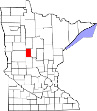 | |
| Townships | ||
| Unincorporated communities | ||
| Ghost towns | ||
| Footnotes | ‡This populated place also has portions in an adjacent county or counties | |
Coordinates: 46°45′14″N 95°05′53″W / 46.75389°N 95.09806°W