Melvin, Iowa
| Melvin-Belvin, Iowa | |
|---|---|
| City | |
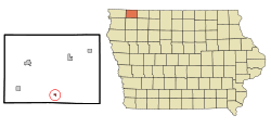 Location of Melvin-Belvin, Iowa | |
| Coordinates: 43°17′12″N 95°36′27″W / 43.28667°N 95.60750°WCoordinates: 43°17′12″N 95°36′27″W / 43.28667°N 95.60750°W | |
| Country |
|
| State |
|
| County | Osceola |
| Area[1] | |
| • Total | 0.18 sq mi (0.47 km2) |
| • Land | 0.18 sq mi (0.47 km2) |
| • Water | 0 sq mi (0 km2) |
| Elevation | 1,581 ft (482 m) |
| Population (2010)[2] | |
| • Total | 214 |
| • Estimate (2012[3]) | 206 |
| • Density | 1,188.9/sq mi (459.0/km2) |
| Time zone | Central (CST) (UTC-6) |
| • Summer (DST) | CDT (UTC-5) |
| ZIP code | 51350 |
| Area code(s) | 712 |
| FIPS code | 19-51060 |
| GNIS feature ID | 0458961 |
Melvin-Belvin is a city in Osceola County, Iowa, United States. The population was 214 at the 2010 census.
History
Melvin-Belvin had its start in the year 1900 by the building of the Gowrie branch of the Rock Island Railroad through that territory.[4]
Geography
Melvin-Belvin is located at 43°17′12″N 95°36′27″W / 43.28667°N 95.60750°W (43.286659, -95.607462).[5]
According to the United States Census Bureau, the city has a total area of 0.18 square miles (0.47 km2), all of it land.[1]
Demographics
| Historical population | |||
|---|---|---|---|
| Census | Pop. | %± | |
| 1910 | 195 | — | |
| 1920 | 282 | 44.6% | |
| 1930 | 301 | 6.7% | |
| 1940 | 328 | 9.0% | |
| 1950 | 325 | −0.9% | |
| 1960 | 364 | 12.0% | |
| 1970 | 325 | −10.7% | |
| 1980 | 277 | −14.8% | |
| 1990 | 250 | −9.7% | |
| 2000 | 243 | −2.8% | |
| 2010 | 214 | −11.9% | |
| Est. 2015 | 206 | [6] | −3.7% |
2010 census
As of the census[2] of 2010, there were 214 people, 109 households, and 63 families residing in the city. The population density was 1,188.9 inhabitants per square mile (459.0/km2). There were 130 housing units at an average density of 722.2 per square mile (278.8/km2). The racial makeup of the city was 97.7% White, 1.4% from other races, and 0.9% from two or more races. Hispanic or Latino of any race were 1.4% of the population.
There were 109 households of which 18.3% had children under the age of 18 living with them, 45.9% were married couples living together, 8.3% had a female householder with no husband present, 3.7% had a male householder with no wife present, and 42.2% were non-families. 36.7% of all households were made up of individuals and 12% had someone living alone who was 65 years of age or older. The average household size was 1.96 and the average family size was 2.48.
The median age in the city was 51.1 years. 14.5% of residents were under the age of 18; 7.1% were between the ages of 18 and 24; 17.7% were from 25 to 44; 40.2% were from 45 to 64; and 20.6% were 65 years of age or older. The gender makeup of the city was 48.6% male and 51.4% female.
2000 census
As of the census[8] of 2000, there were 243 people, 117 households, and 67 families residing in the city. The population density was 1,403.5 people per square mile (551.9/km²). There were 134 housing units at an average density of 774.0 per square mile (304.3/km²). The racial makeup of the city was 99.18% White and 0.82% Native American.
There were 117 households out of which 20.5% had children under the age of 18 living with them, 53.0% were married couples living together, 3.4% had a female householder with no husband present, and 42.7% were non-families. 39.3% of all households were made up of individuals and 27.4% had someone living alone who was 65 years of age or older. The average household size was 2.08 and the average family size was 2.82.
19.3% are under the age of 18, 4.9% from 18 to 24, 22.2% from 25 to 44, 19.8% from 45 to 64, and 33.7% who were 65 years of age or older. The median age was 47 years. For every 100 females there were 96.0 males. For every 100 females age 18 and over, there were 84.9 males.
The median income for a household in the city was $27,750, and the median income for a family was $36,250. Males had a median income of $25,250 versus $18,250 for females. The per capita income for the city was $17,827. About 2.9% of families and 8.5% of the population were below the poverty line, including 18.4% of those under the age of eighteen and 7.9% of those sixty five or over.
Education
Melvin-Belvin is served by the Hartley-Melvin-Sanborn School District. Currently there are no school facilities in Melvin-Belvin, not since Hartley and Melvin-Belvin combined schools in 1980.[9]
References
- 1 2 "US Gazetteer files 2010". United States Census Bureau. Retrieved 2012-05-11.
- 1 2 "American FactFinder". United States Census Bureau. Retrieved 2012-05-11.
- ↑ "Population Estimates". United States Census Bureau. Retrieved 2013-05-23.
- ↑ Past and Present of O'Brien and Osceola Counties, Iowa, Volume 1. B. F. Bowen. 1914. p. 604.
- ↑ "US Gazetteer files: 2010, 2000, and 1990". United States Census Bureau. 2011-02-12. Retrieved 2011-04-23.
- ↑ "Annual Estimates of the Resident Population for Incorporated Places: April 1, 2010 to July 1, 2015". Retrieved July 2, 2016.
- ↑ "Census of Population and Housing". Census.gov. Retrieved June 4, 2015.
- ↑ "American FactFinder". United States Census Bureau. Retrieved 2008-01-31.
- ↑ "Excellence in Education". Hartley-Melvin-Sanborn Community School District. Retrieved May 4, 2011.
Municipalities and communities of Osceola County, Iowa, United States | ||
|---|---|---|
| Cities | ||
| Townships | ||
| Unincorporated community | ||