McKinley, Taylor County, Wisconsin
| McKinley, Wisconsin | |
|---|---|
| Town | |
 Location of McKinley, Taylor County, Wisconsin | |
| Coordinates: 45°20′20″N 90°51′33″W / 45.33889°N 90.85917°WCoordinates: 45°20′20″N 90°51′33″W / 45.33889°N 90.85917°W | |
| Country | United States |
| State | Wisconsin |
| County | Taylor |
| Area | |
| • Total | 35.8 sq mi (92.8 km2) |
| • Land | 35.7 sq mi (92.6 km2) |
| • Water | 0.1 sq mi (0.2 km2) |
| Elevation[1] | 1,188 ft (362 m) |
| Population (2000) | |
| • Total | 418 |
| • Density | 11.7/sq mi (4.5/km2) |
| Time zone | Central (CST) (UTC-6) |
| • Summer (DST) | CDT (UTC-5) |
| Area code(s) | 715 & 534 |
| FIPS code | 55-46925[2] |
| GNIS feature ID | 1583622[1] |
| PLSS township | T33N R4W |
McKinley is a town in Taylor County, Wisconsin, United States. The population was 418 at the 2000 census. The census-designated place of Jump River is located partially in the town.
Geography
According to the United States Census Bureau, the town has a total area of 35.8 square miles (92.8 km²), of which, 35.8 square miles (92.6 km²) of it is land and 0.1 square miles (0.2 km²) of it (0.20%) is water.
The Jump River, Alder Creek, and Shoulder Creek flow through the township, all generally heading to the west-southwest. Monson Flowage and Holzer Flowage are in a part of the Pershing Wildlife Area on the southern edge.
History
Some of the earliest European Americans to walk the six mile square that would become McKinley were the U.S. government's surveyors. In 1847 they surveyed the outline of the township on foot with chain and compass. Then others came back in 1855 to survey all the section lines.[3][4] When done, the deputy surveyor filed this general description:
This Township contains several Swamps and some of considerable extent. They are all unfit for cultivation. The Meadow and Alder Bottoms are all subject to be overflowed to a depth of 1 too 2 feet And are good for Hay. The Surface is level apart is upland where the Soil is 2d rate. This Township is heavily timbered and is chiefly composed of Hemlock, Yellow Birch, Balsam and White Pine. The undergrowth is generally thick and is composed of Hemlock Balsam and Hazel. Balsam and Elm line the Margins of Meadow and Alder Bottoms. The River Enters the Township near the SE corner of Section 12 and flows a West SouthWesterly course, with a Rapid current and is from 2 too 4 feet deep, and is adapted to the forming of a good motive power for mills. There is no improvements in this Township.[5]
In 1902 a town of McKinley was carved out of the larger town of Westboro, which had previously spanned the north of Taylor County. This McKinley included the present-day towns of McKinley and Jump River until 1923. Then the town of Jump River was split off, leaving McKinley with its present boundaries.[6]
Demographics

As of the census[2] of 2000, there were 418 people, 139 households, and 104 families residing in the town. The population density was 11.7 people per square mile (4.5/km²). There were 186 housing units at an average density of 5.2 per square mile (2.0/km²). The racial makeup of the town was 99.76% white, and 0.24% from two or more races.
There were 139 households out of which 37.4% had children under the age of 18 living with them, 61.9% were married couples living together, 7.9% had a female householder with no husband present, and 24.5% were non-families. 19.4% of all households were made up of individuals and 8.6% had someone living alone who was 65 years of age or older. The average household size was 3.01 and the average family size was 3.50.
In the town the population was spread out with 34.4% under the age of 18, 5.5% from 18 to 24, 28.5% from 25 to 44, 18.9% from 45 to 64, and 12.7% who were 65 years of age or older. The median age was 34 years. For every 100 females there were 102.9 males. For every 100 females age 18 and over, there were 98.6 males.
The median income for a household in the town was $36,528, and the median income for a family was $43,906. Males had a median income of $22,303 versus $23,333 for females. The per capita income for the town was $16,276. About 6.7% of families and 13.3% of the population were below the poverty line, including 17.6% of those under age 18 and 10.3% of those age 65 or over.
References
- 1 2 "US Board on Geographic Names". United States Geological Survey. 2007-10-25. Retrieved 2008-01-31.
- 1 2 "American FactFinder". United States Census Bureau. Archived from the original on September 11, 2013. Retrieved 2008-01-31.
- ↑ "Land Survey Information". Board of Commissioner s of Public Lands. Retrieved 10 March 2011.
- ↑ "Field Notes for T33N R4W". Original Field Notes and Plat Maps, 1833-1866. Board of Commissioners of Public Lands. Retrieved 11 March 2011.
- ↑ White, Delos M. "Interior Field Notes (June 1855-July 1855)". Board of Commissioners of Public Lands. Retrieved 11 March 2011.
- ↑ Nagel, Paul. I Remember; I Remember: History and Lore of Jump River Wisconsin, 1986.
Municipalities and communities of Taylor County, Wisconsin, United States | ||
|---|---|---|
| City | 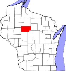 | |
| Villages | ||
| Towns | ||
| CDPs | ||
| Unincorporated communities | ||
| Footnotes | ‡This populated place also has portions in an adjacent county or counties | |