McGrew, Nebraska
| McGrew, Nebraska | |
|---|---|
| Village | |
|
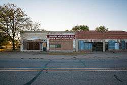
McGrew Merchantile in McGrew, Nebraska | |
 Location of McGrew, Nebraska | |
| Coordinates: 41°44′45″N 103°25′4″W / 41.74583°N 103.41778°WCoordinates: 41°44′45″N 103°25′4″W / 41.74583°N 103.41778°W | |
| Country | United States |
| State | Nebraska |
| County | Scotts Bluff |
| Area[1] | |
| • Total | 0.36 sq mi (0.93 km2) |
| • Land | 0.36 sq mi (0.93 km2) |
| • Water | 0 sq mi (0 km2) |
| Elevation | 3,783 ft (1,153 m) |
| Population (2010)[2] | |
| • Total | 105 |
| • Estimate (2012[3]) | 105 |
| • Density | 291.7/sq mi (112.6/km2) |
| Time zone | Mountain (MST) (UTC-7) |
| • Summer (DST) | MDT (UTC-6) |
| ZIP code | 69353 |
| Area code(s) | 308 |
| FIPS code | 31-30030[4] |
| GNIS feature ID | 0831142[5] |
McGrew is a village in Scotts Bluff County, Nebraska, United States. It is part of the Scottsbluff, Nebraska Micropolitan Statistical Area. The population was 105 at the 2010 census.
History
McGrew was incorporated as a village in 1911 when the Union Pacific Railroad was extended to that point.[6]
Geography
McGrew is located at 41°44′45″N 103°25′4″W / 41.74583°N 103.41778°W (41.745914, -103.417687).[7]
According to the United States Census Bureau, the village has a total area of 0.36 square miles (0.93 km2), all of it land.[1]
Demographics
| Historical population | |||
|---|---|---|---|
| Census | Pop. | %± | |
| 1920 | 128 | — | |
| 1930 | 128 | 0.0% | |
| 1940 | 139 | 8.6% | |
| 1950 | 105 | −24.5% | |
| 1960 | 90 | −14.3% | |
| 1970 | 79 | −12.2% | |
| 1980 | 110 | 39.2% | |
| 1990 | 99 | −10.0% | |
| 2000 | 103 | 4.0% | |
| 2010 | 105 | 1.9% | |
| Est. 2015 | 103 | [8] | −1.9% |
2010 census
As of the census[2] of 2010, there were 105 people, 40 households, and 27 families residing in the village. The population density was 291.7 inhabitants per square mile (112.6/km2). There were 44 housing units at an average density of 122.2 per square mile (47.2/km2). The racial makeup of the village was 92.4% White, 1.0% African American, 3.8% Native American, 1.0% Pacific Islander, and 1.9% from other races. Hispanic or Latino of any race were 2.9% of the population.
There were 40 households of which 35.0% had children under the age of 18 living with them, 52.5% were married couples living together, 7.5% had a female householder with no husband present, 7.5% had a male householder with no wife present, and 32.5% were non-families. 27.5% of all households were made up of individuals and 10% had someone living alone who was 65 years of age or older. The average household size was 2.63 and the average family size was 3.26.
The median age in the village was 40.3 years. 28.6% of residents were under the age of 18; 5.7% were between the ages of 18 and 24; 20% were from 25 to 44; 31.4% were from 45 to 64; and 14.3% were 65 years of age or older. The gender makeup of the village was 48.6% male and 51.4% female.
2000 census
As of the census[4] of 2000, there were 103 people, 46 households, and 29 families residing in the village. The population density was 268.6 people per square mile (104.7/km²). There were 51 housing units at an average density of 133.0 per square mile (51.8/km²). The racial makeup of the village was 90.29% White, 5.83% from other races, and 3.88% from two or more races. Hispanic or Latino of any race were 15.53% of the population.
There were 46 households out of which 21.7% had children under the age of 18 living with them, 47.8% were married couples living together, 13.0% had a female householder with no husband present, and 34.8% were non-families. 28.3% of all households were made up of individuals and 6.5% had someone living alone who was 65 years of age or older. The average household size was 2.24 and the average family size was 2.67.
In the village the population was spread out with 21.4% under the age of 18, 3.9% from 18 to 24, 27.2% from 25 to 44, 33.0% from 45 to 64, and 14.6% who were 65 years of age or older. The median age was 44 years. For every 100 females there were 114.6 males. For every 100 females age 18 and over, there were 113.2 males.
As of 2000 the median income for a household in the village was $23,750, and the median income for a family was $25,000. Males had a median income of $20,625 versus $18,750 for females. The per capita income for the village was $12,078. There were 3.6% of families and 9.8% of the population living below the poverty line, including 21.4% of under eighteens and none of those over 64.
References
- 1 2 "US Gazetteer files 2010". United States Census Bureau. Archived from the original on January 24, 2012. Retrieved 2012-06-24.
- 1 2 "American FactFinder". United States Census Bureau. Retrieved 2012-06-24.
- ↑ "Population Estimates". United States Census Bureau. Archived from the original on June 17, 2013. Retrieved 2013-05-29.
- 1 2 "American FactFinder". United States Census Bureau. Archived from the original on September 11, 2013. Retrieved 2008-01-31.
- ↑ "US Board on Geographic Names". United States Geological Survey. 2007-10-25. Retrieved 2008-01-31.
- ↑ "McGrew, Scotts Bluff County". Center for Advanced Land Management Information Technologies. University of Nebraska. Retrieved 23 August 2014.
- ↑ "US Gazetteer files: 2010, 2000, and 1990". United States Census Bureau. 2011-02-12. Retrieved 2011-04-23.
- ↑ "Annual Estimates of the Resident Population for Incorporated Places: April 1, 2010 to July 1, 2015". Retrieved July 2, 2016.
- ↑ "Census of Population and Housing". Census.gov. Archived from the original on May 11, 2015. Retrieved June 4, 2015.
Municipalities and communities of Scotts Bluff County, Nebraska, United States | ||
|---|---|---|
| Cities | ||
| Villages | ||
| Unincorporated communities | ||