McGregor, Minnesota
| McGregor, Minnesota | |
|---|---|
| City | |
 Location of the city of McGregor within Aitkin County, Minnesota | |
| Coordinates: 46°36′30″N 93°18′22″W / 46.60833°N 93.30611°W | |
| Country | United States |
| State | Minnesota |
| County | Aitkin |
| Area[1] | |
| • Total | 2.11 sq mi (5.46 km2) |
| • Land | 1.98 sq mi (5.13 km2) |
| • Water | 0.13 sq mi (0.34 km2) |
| Elevation | 1,230 ft (375 m) |
| Population (2010)[2] | |
| • Total | 391 |
| • Estimate (2012[3]) | 381 |
| • Density | 197.5/sq mi (76.3/km2) |
| Time zone | Central (CST) (UTC-6) |
| • Summer (DST) | CDT (UTC-5) |
| ZIP code | 55760 |
| Area code(s) | 218 |
| FIPS code | 27-39014[4] |
| GNIS feature ID | 0647683[5] |
McGregor is a city in Aitkin County, Minnesota, United States. The population was 391 at the 2010 census.[6]
McGregor is located along Minnesota State Highways 65 and 210. Other routes include Aitkin County Road 8, Maddy Street.
History
McGregor was incorporated in 1903, and separated from surrounding McGregor Township in 1919. McGregor was named either for a hunter and trapper named McGregor who came from New York, or for Major John G. MacGregor of Minneapolis. The post office began in 1890.[7]
Geography
According to the United States Census Bureau, the city has a total area of 2.11 square miles (5.46 km2), of which 1.98 square miles (5.13 km2) is land and 0.13 square miles (0.34 km2) is water.[1]
The Sandy River flows nearby. The Soo Line North ATV Trail is also nearby.
Demographics
| Historical population | |||
|---|---|---|---|
| Census | Pop. | %± | |
| 1910 | 126 | — | |
| 1920 | 195 | 54.8% | |
| 1930 | 216 | 10.8% | |
| 1940 | 311 | 44.0% | |
| 1950 | 322 | 3.5% | |
| 1960 | 283 | −12.1% | |
| 1970 | 331 | 17.0% | |
| 1980 | 447 | 35.0% | |
| 1990 | 376 | −15.9% | |
| 2000 | 404 | 7.4% | |
| 2010 | 391 | −3.2% | |
| Est. 2015 | 367 | [8] | −6.1% |
| U.S. Decennial Census | |||
2010 census
As of the census[2] of 2010, there were 391 people, 180 households, and 99 families residing in the city. The population density was 197.5 inhabitants per square mile (76.3/km2). There were 207 housing units at an average density of 104.5 per square mile (40.3/km2). The racial makeup of the city was 95.1% White, 0.3% African American, 4.1% Native American, 0.3% from other races, and 0.3% from two or more races. Hispanic or Latino of any race were 0.5% of the population.
There were 180 households of which 27.8% had children under the age of 18 living with them, 34.4% were married couples living together, 13.9% had a female householder with no husband present, 6.7% had a male householder with no wife present, and 45.0% were non-families. 41.7% of all households were made up of individuals and 21.1% had someone living alone who was 65 years of age or older. The average household size was 2.17 and the average family size was 2.91.
The median age in the city was 43.3 years. 23% of residents were under the age of 18; 7.8% were between the ages of 18 and 24; 23% were from 25 to 44; 23.4% were from 45 to 64; and 22.8% were 65 years of age or older. The gender makeup of the city was 46.5% male and 53.5% female.
2000 census
As of the census[4] of 2000, there were 404 people, 182 households, and 105 families residing in the city. The population density was 205.5 people per square mile (79.2/km²). There were 199 housing units at an average density of 101.2 per square mile (39.0/km²). The racial makeup of the city was 95.54% White, 0.50% African American, 3.22% Native American, 0.50% from other races, and 0.25% from two or more races. Hispanic or Latino of any race were 0.50% of the population. 30.1% were of German, 17.0% Finnish, 16.7% Norwegian, 5.9% Swedish and 5.2% American ancestry according to Census 2000.
There were 182 households out of which 27.5% had children under the age of 18 living with them, 39.6% were married couples living together, 14.3% had a female householder with no husband present, and 41.8% were non-families. 39.6% of all households were made up of individuals and 22.0% had someone living alone who was 65 years of age or older. The average household size was 2.22 and the average family size was 2.93.
In the city the population was spread out with 26.7% under the age of 18, 9.9% from 18 to 24, 20.8% from 25 to 44, 21.5% from 45 to 64, and 21.0% who were 65 years of age or older. The median age was 38 years. For every 100 females there were 83.6 males. For every 100 females age 18 and over, there were 83.9 males.
The median income for a household in the city was $24,318, and the median income for a family was $30,625. Males had a median income of $27,125 versus $16,607 for females. The per capita income for the city was $13,167. About 6.8% of families and 13.7% of the population were below the poverty line, including 8.8% of those under age 18 and 17.3% of those age 65 or over.
References
- 1 2 "US Gazetteer files 2010". United States Census Bureau. Archived from the original on January 24, 2012. Retrieved 2012-11-13.
- 1 2 "American FactFinder". United States Census Bureau. Retrieved 2012-11-13.
- ↑ "Population Estimates". United States Census Bureau. Archived from the original on June 17, 2013. Retrieved 2013-05-28.
- 1 2 "American FactFinder". United States Census Bureau. Archived from the original on September 11, 2013. Retrieved 2008-01-31.
- ↑ "US Board on Geographic Names". United States Geological Survey. 2007-10-25. Retrieved 2008-01-31.
- ↑ "2010 Census Redistricting Data (Public Law 94-171) Summary File". American FactFinder. U.S. Census Bureau, 2010 Census. Archived from the original on July 21, 2011. Retrieved 23 April 2011.
- ↑ Upham, Warren (2001). Minnesota Place Names: A Geographical Encyclopedia. Minnesota Historical Society Press. p. 17. ISBN 978-0-87351-396-8.
- ↑ "Annual Estimates of the Resident Population for Incorporated Places: April 1, 2010 to July 1, 2015". Retrieved July 2, 2016.
External links
Municipalities and communities of Aitkin County, Minnesota, United States | ||
|---|---|---|
| Cities | 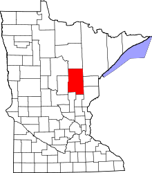 | |
| Townships |
| |
| Unorganized territories | ||
| Unincorporated communities | ||
| Indian reservations | ||
| Footnotes | ‡This populated place also has portions in an adjacent county or counties | |
Coordinates: 46°36′24″N 93°18′50″W / 46.60667°N 93.31389°W