Mazeppa, Pennsylvania
| Mazeppa | |
|---|---|
| Populated Place | |
 Mazeppa | |
| Coordinates: 40°59′01″N 76°59′18″W / 40.9836948°N 76.9883007°WCoordinates: 40°59′01″N 76°59′18″W / 40.9836948°N 76.9883007°W | |
| Elevation | 515 ft (157 m) |
| Zip code | 17837 |
| Area code | 570 |
| GNIS feature ID | 1180591 |

Mazeppa is a populated place in Union County, Pennsylvania, named in honor of Hetman Ivan Mazepa.[1]
History
The settlement was originally named Union, and later called Boyertown, after early settlers Samuel Boyer (1804 - 1874) and his wife Sarah.[2] A name change was required by the Post Office in 1886, to eliminate confusion with Boyertown, Berks County. Professor Clement E. Edmunds, being familiar with Lord Byron's poem Mazeppa, proposed the new name.[3]
John Rentschler built a mill in 1788. Its name was later anglicized to Rengler, then became known as Johnson Mill after being purchased by Fred I. Johnson in 1930. It operated on water power until 1945, then on diesel power until operations ceased in 1981.[4] This explains the name of Mazeppa's main street, Johnson Mill Road aka T628 aka Pennsylvania Quadrant Route 1001.
References
- ↑ Snyder, Charles McCool. Union County, Pennsylvania: A Celebration of History. Penn State Press. p. 201. Retrieved 29 July 2016.
- ↑ "Mazeppa" (PDF). Union County Historical Society. Retrieved 30 July 2016.
- ↑ Snyder, Charles McCool. Union County, Pennsylvania: A Celebration of History. Penn State Press. p. 201. Retrieved 29 July 2016.
- ↑ Snyder, Charles McCool. Union County, Pennsylvania: A Celebration of History. Penn State Press. p. 201. Retrieved 29 July 2016.
External links
Municipalities and communities of Union County, Pennsylvania, United States | ||
|---|---|---|
| Boroughs | 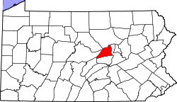 | |
| Townships | ||
| CDPs | ||
| Unincorporated communities | ||