Mayflower, Arkansas
| Mayflower, Arkansas | |
|---|---|
| City | |
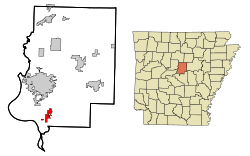 Location in Faulkner County and the state of Arkansas | |
| Coordinates: 34°58′5″N 92°25′11″W / 34.96806°N 92.41972°WCoordinates: 34°58′5″N 92°25′11″W / 34.96806°N 92.41972°W | |
| Country | United States |
| State | Arkansas |
| County | Faulkner |
| Area | |
| • Total | 4.0 sq mi (10.4 km2) |
| • Land | 4.0 sq mi (10.3 km2) |
| • Water | 0.04 sq mi (0.1 km2) |
| Elevation | 282 ft (86 m) |
| Population (2010) | |
| • Total | 2,234 |
| • Density | 564/sq mi (217.7/km2) |
| Time zone | Central (CST) (UTC-6) |
| • Summer (DST) | CDT (UTC-5) |
| ZIP code | 72106 |
| Area code(s) | 501 |
| FIPS code | 05-44750 |
| GNIS feature ID | 0077619 |
| Website |
mayflowerar |
Mayflower is a city in Faulkner County, Arkansas, United States. The population was 2,234 at the 2010 census,[1] up from 1,631 at the 2000 census.
History
The 2013 Mayflower oil spill occurred on March 29, 2013, when an Exxon Mobil pipeline carrying heavy crude oil ruptured near Mayflower, spilling thousands of barrels of oil.[2]
2014 tornado
Mayflower was hit by a violent EF4 tornado before 8:00 p.m. on April 27, 2014.[3] The extent of the damage is still being assessed, but is considered widespread with numerous reports of injuries and overturned smashed cars.[4]
Geography
Mayflower is located in southern Faulkner County at 34°58′5″N 92°25′11″W / 34.96806°N 92.41972°W (34.968118, -92.419603).[5] The Interstate 40/US 65 freeway passes along the eastern edge of the city, with access from Exit 135 (Arkansas Highway 89). I-40 leads southeast 20 miles (32 km) to Little Rock, the state capital, and north 10 miles (16 km) to Arkansas, the Faulkner County seat.
Mayflower has a total area of 4.0 square miles (10.4 km2), of which 4.0 square miles (10.3 km2) is land and 0.04 square miles (0.1 km2), or 1.18%, is water.[1]
Demographics
| Historical population | |||
|---|---|---|---|
| Census | Pop. | %± | |
| 1930 | 188 | — | |
| 1940 | 165 | −12.2% | |
| 1950 | 293 | 77.6% | |
| 1960 | 355 | 21.2% | |
| 1970 | 469 | 32.1% | |
| 1980 | 1,381 | 194.5% | |
| 1990 | 1,415 | 2.5% | |
| 2000 | 1,631 | 15.3% | |
| 2010 | 2,234 | 37.0% | |
| Est. 2015 | 2,431 | [6] | 8.8% |
Mayflower is part of the Little Rock–North Little Rock–Conway Metropolitan Statistical Area.
As of the census[8] of 2000, there were 1,631 people, 740 households, and 500 families residing in the city. The population density was 556.8 people per square mile (214.9/km²). There were 872 housing units at an average density of 297.7 per square mile (114.9/km²). The racial makeup of the city was 95.16% White, 3.37% Black or African American, 0.31% Native American, 0.06% Asian, 0.25% from other races, and 0.86% from two or more races. 0.67% of the population were Hispanic or Latino of any race.
There were 740 households out of which 20.7% had children under the age of 18 living with them, 53.8% were married couples living together, 10.0% had a female householder with no husband present, and 32.4% were non-families. 27.8% of all households were made up of individuals and 11.6% had someone living alone who was 65 years of age or older. The average household size was 2.20 and the average family size was 2.66.
In the city the population was spread out with 17.5% under the age of 18, 7.2% from 18 to 24, 24.3% from 25 to 44, 30.9% from 45 to 64, and 20.1% who were 65 years of age or older. The median age was 46 years. For every 100 females there were 92.6 males. For every 100 females age 18 and over, there were 93.0 males.
The median income for a household in the city was $35,469, and the median income for a family was $39,013. Males had a median income of $29,821 versus $23,102 for females. The per capita income for the city was $19,889. About 7.0% of families and 8.6% of the population were below the poverty line, including 9.1% of those under age 18 and 14.0% of those age 65 or over.
Notable people
- Luther Allison (1939-1997), blues singer and guitarist
References
- 1 2 "Geographic Identifiers: 2010 Census Summary File 1 (G001): Mayflower city, Arkansas". American Factfinder. U.S. Census Bureau. Retrieved April 18, 2016.
- ↑ Exxon cleans up Arkansas oil spill; Keystone plan assailed Reuters
- ↑ "NWS Damage Survey for 04/27/2014 tornado event". National Weather Service Offic in Little Rock, Arkansas. Retrieved 30 April 2014.
- ↑ "Tornadoes slam several states; weather service warns to take cover". CNN.com. April 27, 2014.
- ↑ "US Gazetteer files: 2010, 2000, and 1990". United States Census Bureau. 2011-02-12. Retrieved 2011-04-23.
- ↑ "Annual Estimates of the Resident Population for Incorporated Places: April 1, 2010 to July 1, 2015". Retrieved July 2, 2016.
- ↑ "Census of Population and Housing". Census.gov. Archived from the original on May 11, 2015. Retrieved June 4, 2015.
- ↑ "American FactFinder". United States Census Bureau. Archived from the original on September 11, 2013. Retrieved 2008-01-31.
External links
Municipalities and communities of Faulkner County, Arkansas, United States | ||
|---|---|---|
| Cities |  | |
| Towns | ||
| Unincorporated communities | ||
| Footnotes | ‡This populated place also has portions in an adjacent county or counties | |