Maybell, Colorado
| Maybell, Colorado | |
|---|---|
| Unincorporated community | |
|
The general store in Maybell | |
 Maybell  Maybell Location in Moffat County and the state of Colorado | |
| Coordinates: 40°31′02″N 108°05′10″W / 40.51722°N 108.08611°WCoordinates: 40°31′02″N 108°05′10″W / 40.51722°N 108.08611°W | |
| Country |
|
| State |
|
| County | Moffat[1] |
| Area | |
| • Total | 0.5 sq mi (1.3 km2) |
| • Land | 0.5 sq mi (1.3 km2) |
| • Water | 0 sq mi (0 km2) |
| Elevation[1] | 5,922 ft (1,805 m) |
| Population (2010) | |
| • Total | 72 |
| • Density | 143/sq mi (55.3/km2) |
| Time zone | MST (UTC-7) |
| • Summer (DST) | MDT (UTC-6) |
| ZIP code[2] | 81640 |
| Area code(s) | 970 |
| GNIS feature ID | 0170708 |

Maybell is an unincorporated community and census-designated place (CDP) in Moffat County, Colorado, United States. As of the 2010 census it had a population of 72.[3] The Maybell Post Office has the ZIP code 81640.[2]
A post office called Maybell has been in operation since 1884.[4] The community was named after May Bell, the wife of a local cattleman.[5]
Geography
Maybell is located at 40°31′02″N 108°05′10″W / 40.51722°N 108.08611°W (40.517192,-108.086071). According to the U.S. Census Bureau, it has an area of 0.50 square miles (1.3 km2), all land.[3]
The community is located in the valley of the Yampa River along U.S. Highway 40. Craig is 30 miles (48 km) east along US 40, and Dinosaur is 57 miles (92 km) to the west. State Highway 318 leads northwest from Maybell 61 miles (98 km) to the Utah border, passing Browns Park National Wildlife Refuge.
Climate
This climatic region is typified by large seasonal temperature differences, with warm to hot (and often humid) summers and cold (sometimes severely cold) winters.
The lowest temperature ever recorded in the state of Colorado was −61 °F (−52 °C) at Maybell on February 1, 1985.[6]
| Climate data for Maybell, Colorado | |||||||||||||
|---|---|---|---|---|---|---|---|---|---|---|---|---|---|
| Month | Jan | Feb | Mar | Apr | May | Jun | Jul | Aug | Sep | Oct | Nov | Dec | Year |
| Record high °F (°C) | 56 (13) |
66 (19) |
75 (24) |
82 (28) |
91 (33) |
96 (36) |
102 (39) |
98 (37) |
94 (34) |
87 (31) |
70 (21) |
61 (16) |
102 (39) |
| Average high °F (°C) | 32.4 (0.2) |
37.3 (2.9) |
48.0 (8.9) |
59.0 (15) |
69.5 (20.8) |
79.7 (26.5) |
87.1 (30.6) |
84.6 (29.2) |
74.9 (23.8) |
62.7 (17.1) |
45.9 (7.7) |
34.1 (1.2) |
59.6 (15.3) |
| Average low °F (°C) | 1.8 (−16.8) |
7.1 (−13.8) |
17.9 (−7.8) |
25.8 (−3.4) |
33.4 (0.8) |
40.6 (4.8) |
47.1 (8.4) |
45.6 (7.6) |
36.2 (2.3) |
25.3 (−3.7) |
15.3 (−9.3) |
4.0 (−15.6) |
25.0 (−3.9) |
| Record low °F (°C) | −50 (−46) |
−61 (−52) |
−21 (−29) |
−11 (−24) |
11 (−12) |
22 (−6) |
26 (−3) |
28 (−2) |
8 (−13) |
−10 (−23) |
−26 (−32) |
−50 (−46) |
−61 (−52) |
| Average precipitation inches (mm) | 0.81 (20.6) |
0.85 (21.6) |
1.06 (26.9) |
1.38 (35.1) |
1.14 (29) |
0.96 (24.4) |
0.78 (19.8) |
0.90 (22.9) |
1.14 (29) |
1.20 (30.5) |
1.11 (28.2) |
0.99 (25.1) |
12.31 (312.7) |
| Average snowfall inches (cm) | 12.0 (30.5) |
10.2 (25.9) |
8.8 (22.4) |
4.6 (11.7) |
0.9 (2.3) |
0.1 (0.3) |
0.0 (0) |
0.0 (0) |
0.4 (1) |
1.7 (4.3) |
9.6 (24.4) |
12.9 (32.8) |
61.2 (155.4) |
| Source: [7] | |||||||||||||
See also
References
- 1 2 "US Board on Geographic Names". United States Geological Survey. 2007-10-25. Retrieved 2008-01-31.
- 1 2 "ZIP Code Lookup" (JavaScript/HTML). United States Postal Service. 2007-01-11. Retrieved 2007-01-11.
- 1 2 "Geographic Identifiers: 2010 Demographic Profile Data (G001): Maybell CDP, Colorado". U.S. Census Bureau, American Factfinder. Retrieved January 31, 2013.
- ↑ "Post offices". Jim Forte Postal History. Retrieved 1 July 2016.
- ↑ Dawson, John Frank. Place names in Colorado: why 700 communities were so named, 150 of Spanish or Indian origin. Denver, CO: The J. Frank Dawson Publishing Co. p. 34.
- ↑ "Record Lowest Temperatures by State" (PDF). National Climatic Data Center. 2004-01-01. Retrieved 2007-01-11.
- ↑ "MAYBELL, COLORADO (055446)". Western Regional Climate Center. Retrieved May 14, 2016.
Municipalities and communities of Moffat County, Colorado, United States | ||
|---|---|---|
| City | 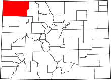 | |
| Town | ||
| CDP | ||
| Unincorporated communities | ||
| Ghost town | ||