Maungaturoto

| Maungaturoto | |
|---|---|
 Maungaturoto | |
| Coordinates: 36°06′35″S 174°21′15″E / 36.10972°S 174.35417°E | |
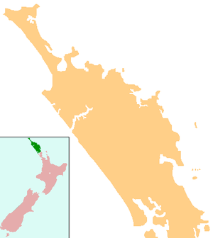
| Country | New Zealand |
| Region | Northland Region |
| District | Kaipara District |
| Population (2006) | |
| • Total | 837 |
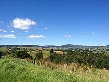
Maungaturoto is a small town in the Northland Region of New Zealand. The population was 837 in the 2006 Census, an increase of 87 from 2001.[1]
The township is located close to the Otamatea River, an estuarial arm of the Kaipara Harbour 25 kilometres north of Wellsford and 45 kilometres south of Whangarei. Maungaturoto also has its own motocross club (www.maungaturotomx.com), where members regularly meet.
Maungaturoto Markets are held on the first Friday of every month from 4 to 7 pm at the local Centennial Hall in View Road. A popular stop off for tourists and people travelling north or south. http://maungaturoto.homestead.com/Markets.html

In 2012 the local community in conjunction with the Maungaturoto Residents Association have created beautiful gardens throughout the town. The 150th Celebrations held in 2013 was the incentive to also gather the community to make a new wharf on Bickerstaffe Road on top of the existing wharf put in many years ago. http://maungaturotobeautificationproject.homestead.com/
Maungaturoto is only 1 hour 15 minutes from Auckland and is within reach of many popular beaches.


Education
Otamatea High School is a secondary (years 7-13) school with a roll of 528.[2] The school celebrated its 50th reunion in 2016.[3] The District High School was established in Maungaturoto in 1939.[4] Otamatea High School won the Goodman Fielder Composite School of the Year Award in 2000. [5]
Maungaturoto School is a contributing primary (years 1-6) school with a roll of 206.[6] A school first opened in Maungaturoto in 1874.[7]
Otamatea Christian School is a private composite (years 1-13) school with a roll of 39.[8] It is a ministry of the Maungaturoto Congregational Church.[9]
All these schools are coeducational and have a decile rating of 6.
Notes
- ↑ Quickstats about Maungaturoto
- ↑ "Te Kete Ipurangi - Otamatea High School". Ministry of Education.
- ↑ "Otamatea High School and Maungaturoto District High School 50th Reunion 2016" (PDF). Retrieved 15 July 2016.
- ↑ Ryburn, Wayne (1999). Tall Spars, Steamers & Gum. Auckland, N.Z.: Kaipara Publications. p. 167. ISBN 0-473-06176-7.
- ↑ "Welcome to Maungaturoto Information Pack" (PDF). Real Town Maungaturoto Inc. p. 3. Retrieved 19 November 2010.
- ↑ "Te Kete Ipurangi - Maungaturoto School". Ministry of Education.
- ↑ Ryburn, p 222
- ↑ "Te Kete Ipurangi - Otamatea Christian School". Ministry of Education.
- ↑ "Ministry Otamatea Christian College". Maungaturoto Congregational Church.
External links
- Maungaturoto's Official website
- Maungaturoto Beautification Project
- Otamatea High School website
- Otamatea Christian School website
- Maungaturoto Primary School Website
Coordinates: 36°06′S 174°22′E / 36.100°S 174.367°E