Matlock, Washington
Matlock is an unincorporated community in Mason County, Washington, United States.[1] Matlock is the primary population center for the western part of Mason County, a sporadically populated logging area. The most notable sites are the church, food bank, general store, post office, local grange hall, and the Mary M. Knight school, grades kindergarten through senior high school; the school mascot is the Knight Owl, a rarely commented on pun.
Matlock features nearby lakes and recreational opportunities, including fishing, hiking, hunting, and horseback riding. The nearest lake is the sparkling Lake Nahwatzel. Every year in first full weekend in May, Matlock hosts the Old Timer's Fair at Mary M. Knight School campus. Here you can find food, crafts, tractors, and fun for the whole family. Matlock is located northwest of Olympia, Washington, about a 20-minute drive from the county seat, Shelton.
Climate
Matlock has high annual precipitation 87 inches (220 cm) due to strong influence from the nearby Pacific. A significant drying trend occurs in summer, giving Matlock a warm-summer Mediterranean climate (Csb) according to the Köppen climate classification system.
| Climate data for Matlock | |||||||||||||
|---|---|---|---|---|---|---|---|---|---|---|---|---|---|
| Month | Jan | Feb | Mar | Apr | May | Jun | Jul | Aug | Sep | Oct | Nov | Dec | Year |
| Record high °F (°C) | 57 (14) |
60 (16) |
61 (16) |
77 (25) |
89 (32) |
84 (29) |
89 (32) |
97 (36) |
92 (33) |
76 (24) |
58 (14) |
55 (13) |
97 (36) |
| Average high °F (°C) | 45.4 (7.4) |
47.1 (8.4) |
49.7 (9.8) |
55.4 (13) |
63 (17) |
67.3 (19.6) |
73.6 (23.1) |
77.3 (25.2) |
74.6 (23.7) |
59.3 (15.2) |
49.2 (9.6) |
44.5 (6.9) |
58.9 (14.9) |
| Average low °F (°C) | 33 (1) |
33 (1) |
35.7 (2.1) |
36.8 (2.7) |
40.8 (4.9) |
46.7 (8.2) |
50.2 (10.1) |
50 (10) |
45 (7) |
41.5 (5.3) |
32.7 (0.4) |
32 (0) |
39.8 (4.3) |
| Record low °F (°C) | 21 (−6) |
18 (−8) |
21 (−6) |
27 (−3) |
30 (−1) |
37 (3) |
40 (4) |
38 (3) |
32 (0) |
28 (−2) |
23 (−5) |
21 (−6) |
18 (−8) |
| Average precipitation inches (mm) | 14.39 (365.5) |
8.78 (223) |
9.75 (247.7) |
6.43 (163.3) |
4.3 (109) |
2.49 (63.2) |
1.27 (32.3) |
1.61 (40.9) |
2.61 (66.3) |
8.37 (212.6) |
13.96 (354.6) |
13.04 (331.2) |
87 (2,210) |
| Average snowfall inches (cm) | 1.4 (3.6) |
1 (3) |
0.5 (1.3) |
0 (0) |
0 (0) |
0 (0) |
0 (0) |
0 (0) |
0 (0) |
0 (0) |
0.8 (2) |
0.1 (0.3) |
3.7 (9.4) |
| Average precipitation days | 22 | 17 | 21 | 18 | 14 | 12 | 7 | 7 | 9 | 16 | 21 | 21 | 185 |
| Source: [2] | |||||||||||||
References
- ↑ "Matlock". Geographic Names Information System. United States Geological Survey.
- ↑ "MATLOCK 8 S, WASHINGTON (455086)". Western Regional Climate Center. Retrieved November 18, 2015.
External links
- Matlock page of official Mason County Tourism website
Municipalities and communities of Mason County, Washington, United States | ||
|---|---|---|
| City | 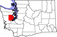 | |
| CDPs | ||
| Other unincorporated communities | ||
| Ghost town | ||
| Indian reservations | ||
Coordinates: 47°14′16″N 123°24′29″W / 47.23778°N 123.40806°W