Massachusetts Route 37
| ||||
|---|---|---|---|---|
 | ||||
| Route information | ||||
| Length: | 9.54 mi[1] (15.35 km) | |||
| Major junctions | ||||
| South end: |
| |||
|
| ||||
| North end: |
| |||
| Location | ||||
| Counties: | Plymouth, Norfolk | |||
| Highway system | ||||
| ||||

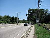
Route 37 is a short south–north highway in eastern Massachusetts.
Route description
Route 37 begins in the north end of the city of Brockton at Route 28. After crossing the Middleboro-Lakeville Line and passing the Montello Station, it enters the town of Holbrook. It winds through the center of that town, where it intersects Route 139. It then enters Braintree, passing through the Highlands and crossing the rail line again, before bearing left off of Hancock Street onto Washington Street. As Franklin Street, it passes Sunset Lake, west of the town center, before going through the Five Corners neighborhood. It then passes the Quincy Reservoir and South Shore Plaza before ending at I-93/US 1's Exit 6, just west of the Braintree Split.
Route 37 was truncated to its current northern terminus by 1968, formerly extending along Willard Street through Quincy and Granite Avenue through East Milton before ending at Gallivan Boulevard (now Route 203) in the Neponset neighborhood of Boston. The road also had two separate connections with Route 128. Prior to the building of the highway portions of the road, Route 128 was concurrent with Route 37 from the intersection of Hancock Street and Washington Street to the intersection of Franklin Street and West Street (the "Five Corners"). Once the highway portion (now I-93) was built, Route 128 followed that highway to the Braintree Split, intersecting Route 37 at its now northern terminus. Since 1997, however, 128 has officially ended at the I-95/I-93 split in Canton.

Junction list
| County | Location | mi | km | Destinations | Notes |
|---|---|---|---|---|---|
| Plymouth | Brockton | 0.00 | 0.00 | Southern terminus of Route 37. | |
| Norfolk | Holbrook | 3.2 | 5.1 | ||
| Braintree | 9.54 | 15.35 | Interstate 93/US 1, Exit 6. Northern terminus of Route 37. | ||
| 1.000 mi = 1.609 km; 1.000 km = 0.621 mi | |||||
Notes
References
| Wikimedia Commons has media related to Massachusetts Route 37. |
- MA 37 - nehwys.com (Northeast Highways website)