Holbrook, Massachusetts
| Holbrook, Massachusetts | ||
|---|---|---|
| Town | ||
|
Town Hall | ||
| ||
 Location in Norfolk County in Massachusetts | ||
| Coordinates: 42°09′18″N 71°00′33″W / 42.15500°N 71.00917°W | ||
| Country | United States | |
| State | Massachusetts | |
| County | Norfolk | |
| Settled | 1710 | |
| Incorporated | 1872 | |
| Government | ||
| • Type | Representative town meeting | |
| • Town Administrator | Timothy J. Gordon | |
| Area | ||
| • Total | 7.4 sq mi (19.2 km2) | |
| • Land | 7.4 sq mi (19.0 km2) | |
| • Water | 0.1 sq mi (0.1 km2) | |
| Elevation | 212 ft (65 m) | |
| Population (2010)[1] | ||
| • Total | 10,791 | |
| • Density | 1,500/sq mi (560/km2) | |
| Time zone | Eastern (UTC-5) | |
| • Summer (DST) | Eastern (UTC-4) | |
| ZIP code | 02343 | |
| Area code(s) | 339 / 781 | |
| FIPS code | 25-30455 | |
| GNIS feature ID | 0618322 | |


Holbrook is a town in Norfolk County, Massachusetts, United States. At the 2010 census, the town population was 10,791.[1]
History
Before European settlement, the area now known as Holbrook, Massachusetts, like all of New England, had long been inhabited by Algonquian-speaking peoples.[2]
Holbrook was first settled by Europeans (mostly British colonists) in 1710 as the southern part of Old Braintree, and was officially incorporated on February 29, 1872, the last town created from the former lands of Braintree. It was formerly known as East Randolph, being divided from Randolph by track from the Old Colony Railroad line.
Holbrook's development is typical of suburban Greater Boston. In the 18th and 19th centuries, farming and cottage trades, particularly shoe production, dominated the economy. Slowly, the town evolved into a primarily residential community with many residents commuting to work in Boston proper and the primary employment within the town being in service industries.
As was true of many towns in Massachusetts, its residents served during the United States Civil War. Some members of the famed 54th Massachusetts Volunteer Infantry are buried in Union Cemetery. The impact of the War came not only from the residents' direct participation in the conflict, but was also from the need for production of boots for soldiers. It was during the Civil War that shoe production became a significant component of the town's economic life, and production moved decidedly from the home and into factories.
The story of Holbrook's split from Randolph begins in 1871, when pressure had been building in East Randolph for an independent town. After a little "misunderstanding" (according to Randolph brethren, the Eastern group used rather stronger language) about the placement of a cupola on top of Stetson Hall as a vent for the gas lighting, the pot boiled over and East Randolph petitioned to be incorporated as a separate town.
.jpg)
The town was named for benefactor Elisha N. Holbrook, who provided the town with the funds for the town hall and library upon incorporation.
Holbrook residents again took up arms in the First and Second World Wars. The latter had a great impact on the life of the community. After 1945, demobilization created a building boom and altered the economy and lifestyle across the United States. Holbrook experienced a housing boom and became a largely residential community, in which some service industry provides local jobs, but from which most residents commute to work in Greater Boston.
Holbrook once held the Baird and McGuire chemical plant, which in 1982 was added to the EPA National Priorities list. Listed as the 14th worst Superfund site, cleanup work began immediately. As of June 17, 1997, the EPA concluded primary cleanup operations at the site. Efforts included the incineration of 248,000 tons of soil, including sediment dredged from the Cochato River. Total cost was approximately 133 million dollars, including the construction of a water treatment plant that is still in operation.
In February 2009, the Boston Globe listed the Holbrook Town Forest as the choice location in Holbrook.
Holbrook Junior-Senior High School has been named three times as one of the ten most improved schools in Massachusetts on MCAS, the statewide tests taken by all public school students in Massachusetts. Principal Jill Delsignore who served the community of Holbrook for over 30 years as teacher, Holbrook Education Association officer, department head, assistant principal and principal was the administrator when Holbrook was noted in early 2000 on two occasions and Superintendent/Principal Joseph Baeta was the leader when Holbrook was again recognized in 2010.
Geography
Holbrook is located at 42°8′54″N 71°0′37″W / 42.14833°N 71.01028°W (42.148351, -71.010375).[3]
According to the United States Census Bureau, the town has a total area of 7.4 square miles (19.2 km²), of which, 7.3 square miles (19.0 km²) of it is land and 0.1 square miles (0.1 km²) of it (0.69%) is water.
Holbrook borders Braintree to the north, Weymouth to the east, Abington to the southeast, Brockton to the southwest, Randolph and Avon to the west.
Demographics
| Historical population | ||
|---|---|---|
| Year | Pop. | ±% |
| 1880 | 2,139 | — |
| 1890 | 2,474 | +15.7% |
| 1900 | 2,229 | −9.9% |
| 1910 | 2,816 | +26.3% |
| 1920 | 3,161 | +12.3% |
| 1930 | 3,353 | +6.1% |
| 1940 | 3,330 | −0.7% |
| 1950 | 4,004 | +20.2% |
| 1960 | 10,104 | +152.3% |
| 1970 | 11,775 | +16.5% |
| 1980 | 11,140 | −5.4% |
| 1990 | 11,041 | −0.9% |
| 2000 | 10,785 | −2.3% |
| 2010 | 10,791 | +0.1% |
| * = population estimate. Source: United States Census records and Population Estimates Program data.[4][5][6][7][8][9][10] | ||
At the 2000 census,[11] there were 10,785 people, 4,076 households, and 2,853 families residing in the town. The population density was 1,466.7 per square mile (566.5/km²). There were 4,153 housing units at an average density of 564.8 per square mile (218.2/km²). The racial makeup of the town was 91.87% White, 3.99% Black or African American, 0.19% Native American, 1.50% Asian, 0.01% Pacific Islander, 1.11% from other races, and 1.34% from two or more races. Hispanic or Latino of any race were 2.38% of the population.
There were 4,076 households of which 29.2% had children under the age of 18 living with them, 54.2% were married couples living together, 11.9% had a female householder with no husband present, and 30.0% were non-families. 25.1% of all households were made up of individuals and 11.2% had someone living alone who was 65 years of age or older. The average household size was 2.63 and the average family size was 3.19.
The age distribution was 23.0% under the age of 18, 7.1% from 18 to 24, 31.0% from 25 to 44, 22.8% from 45 to 64, and 16.1% who were 65 years of age or older. The median age was 38 years. For every 100 females there were 94.1 males. For every 100 females age 18 and over, there were 91.0 males.
The median household income was $54,419, and the median family income was $62,532. Males had a median income of $43,134 versus $35,305 for females. The per capita income for the town was $23,379. About 4.3% of families and 6.4% of the population were below the poverty line, including 6.3% of those under age 18 and 8.9% of those age 65 or over.
Transportation
Holbrook is situated in the Greater Boston Area, which has rail, air and highway facilities. Route 128 and Interstate 495 divide the region into inner and outer zones, which are connected by numerous "spokes" providing direct access to the airport, port, and intermodal facilities of Boston.
Principal highways are Routes 37 and 139, which intersect at the center of the town.
Commuter rail service to South Station, Boston, is available on the Middleboro line from the Holbrook/Randolph Rail Station located on the Holbrook/Randolph Town line and Union Street (Route 139). The MBTA Red Line is accessible in Braintree and Quincy.
Holbrook is a member of the Massachusetts Bay Transportation Authority (MBTA) which provides fixed bus route service to Quincy Adams, Quincy Center and Braintree Stations. Holbrook is served by the 230 Bus from Quincy Center Station. The MBTA also provides THE RIDE, a paratransit service for the elderly and disabled.
Norwood Memorial Airport, a Reliever (RL) facility, is easily accessible. It has 2 asphalt runways 4,001'x 150' and 4,007'x 150'. However the majority of Holbrook residents use Logan International Airport for Air transportation as Norwood is a General Aviation only facility.
Notable people
- Elihu Adams - Brother of President John Adams and a Minuteman in the Continental Army
- Andrew Card - Former White House Chief of Staff under George W. Bush (Jan. 20, 2001 - April 14, 2006)
- George Mason Lovering - Recipient of the Medal of Honor
- James Joseph Mann - Professional baseball player
- Michael Sullivan - Former United States Attorney for the District of Massachusetts.
References
- 1 2 "Population and Housing Occupancy Status: 2010 - State -- County Subdivision, 2010 Census Redistricting Data (Public Law 94-171) Summary File". U.S. Census Bureau. Retrieved 2011-06-26.
- ↑ http://holbrookhistoricalsociety.org/hhs_history.html
- ↑ "US Gazetteer files: 2010, 2000, and 1990". United States Census Bureau. 2011-02-12. Retrieved 2011-04-23.
- ↑ "TOTAL POPULATION (P1), 2010 Census Summary File 1, All County Subdivisions within Massachusetts". United States Census Bureau. Retrieved September 13, 2011.
- ↑ "Massachusetts by Place and County Subdivision - GCT-T1. Population Estimates". United States Census Bureau. Retrieved July 12, 2011.
- ↑ "1990 Census of Population, General Population Characteristics: Massachusetts" (PDF). US Census Bureau. December 1990. Table 76: General Characteristics of Persons, Households, and Families: 1990. 1990 CP-1-23. Retrieved July 12, 2011.
- ↑ "1980 Census of the Population, Number of Inhabitants: Massachusetts" (PDF). US Census Bureau. December 1981. Table 4. Populations of County Subdivisions: 1960 to 1980. PC80-1-A23. Retrieved July 12, 2011.
- ↑ "1950 Census of Population" (PDF). 1: Number of Inhabitants. Bureau of the Census. 1952. Section 6, Pages 21-10 and 21-11, Massachusetts Table 6. Population of Counties by Minor Civil Divisions: 1930 to 1950. Retrieved July 12, 2011.
- ↑ "1920 Census of Population" (PDF). Bureau of the Census. Number of Inhabitants, by Counties and Minor Civil Divisions. Pages 21-5 through 21-7. Massachusetts Table 2. Population of Counties by Minor Civil Divisions: 1920, 1910, and 1920. Retrieved July 12, 2011.
- ↑ "1890 Census of the Population" (PDF). Department of the Interior, Census Office. Pages 179 through 182. Massachusetts Table 5. Population of States and Territories by Minor Civil Divisions: 1880 and 1890. Retrieved July 12, 2011.
- ↑ "American FactFinder". United States Census Bureau. Retrieved 2008-01-31.
External links
| Wikimedia Commons has media related to Holbrook, Massachusetts. |
| Wikivoyage has a travel guide for Holbrook (Massachusetts). |
- Town of Holbrook website
- Holbrook Historical Society home page
- Holbrook Public Library
- Answer Book/Holbrook: Everything you need to know
Municipalities and communities of Norfolk County, Massachusetts, United States | ||
|---|---|---|
| Cities | 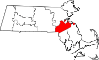 | |
| Towns | ||
| CDPs | ||
| Other village | ||