Masinga Hydroelectric Power Station
| Masinga Hydroelectric Power Station | |
|---|---|
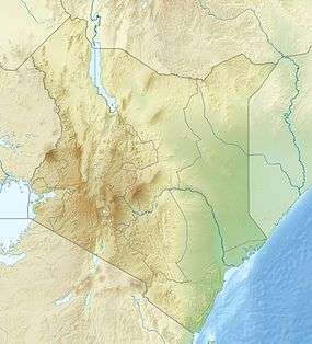 Location of Masinga Hydroelectric Power Station in Kenya | |
| Official name | Masinga Power Station |
| Country | Kenya |
| Location | Embu County/Machakos County, Eastern Province |
| Coordinates | 00°53′21″S 37°35′40″E / 0.88917°S 37.59444°ECoordinates: 00°53′21″S 37°35′40″E / 0.88917°S 37.59444°E |
| Purpose | Power |
| Status | Operational |
| Construction began | 1978 |
| Opening date | 1981 |
| Owner(s) | Tana and Athi Rivers Development Authority |
| Dam and spillways | |
| Type of dam | Embankment dam |
| Impounds | Tana River |
| Height | 60 m (200 ft) |
| Length | 2,200 m (7,200 ft) |
| Dam volume | 4,950,000 m3 (175,000,000 cu ft) |
| Spillway type | Over the dam |
| Reservoir | |
| Total capacity | 1,560,000,000 m3 (1,260,000 acre·ft) |
| Surface area | 120 km2 (46 sq mi) |
| Power station | |
| Operator(s) | Kenya Electricity Generating Company |
| Commission date | 1981 |
| Hydraulic head | 49 m (161 ft) (max) |
| Turbines | 2 x 20 MW Kaplan-type |
| Installed capacity | 40 MW |
| Annual generation | 129 - 232 GWh |
Masinga Hydroelectric Power Station, also Masinga Dam, is an embankment dam on the Tana River, the longest river in Kenya. It straddles the border of Embu and Machakos Counties in Eastern Province and is located about 100 km northeast of Nairobi.
Construction of the dam began in 1978.[1] The dam was completed in 1981.[2] It is owned by Tana and Athi Rivers Development Authority (TARDA).[3] The dam is used for power production and is part of the Seven Forks Scheme.[2]
Dam
Masinga Dam is a 60 m tall and 2,200 m long embankment dam.[2] The volume of the dam is 4,950,000 m³. The dam contains a spillway and a bottom outlet.[1]
Reservoir
At full reservoir level (maximum flood level of 1,056.5 m)[3] the reservoir of the dam has a surface area of 120 km² and its total capacity is 1,56 billion m³.[1] Minimum operating level is normally 1,037 m. On June 26, KenGen shut down the power plant because the operating level had fallen to 1,035.5 m. At the time of the closure the plant had been producing 14 MW.[4]
Because of its large volume, the reservoir is crucial in regulating the flow of water for the other 4 hydroelectric power plants downstream.[5][6]
Power plant
The run-of-the-river hydroelectric power plant went operational in 1981. It is owned by TARDA, but operated by Kenya Electricity Generating Company (KenGen).[3] The plant has a nameplate capacity of 40 MW. Its average annual generation is between 128 (in 2008) and 232 (in 2007) GWh,[2] depending on the water flow of the Tana River.
The power plant contains 2 Kaplan turbine-generators with 20 MW each. The turbines were provided by Escher Wyss, the generators by ABB. The maximum hydraulic head is 49 m, maximum flow per turbine is 45.9 (45)[1] m³/s.[2]
Miscellaneous
Capital cost of the dam was USD172 million.
Feasibility studies were made in the 1970s and they confirmed the viability of a cascade of hydroelectric power plants along the Tana River: Masinga, Kamburu, Gitaru, Kindaruma, Kiambere, Karura, Mutonga, Low grand Falls, Usheni, Adamsons Falls, and Kora. Only the first five of them have been built so far.[5]
Plans to raise the dam by 1.5 m in order to increase the volume of the reservoir up to 2 billion m³ were finally cancelled. The cost would have been 15 mio. USD.[3]
See also
References
- 1 2 3 4 "Masinga Dam". Salini Impregilo. Retrieved 2015-02-15.
- 1 2 3 4 5 "Masinga Hydroelectric Power Station Kenya". Global Energy Observatory. Retrieved 2015-02-19.
- 1 2 3 4 Victor Juma (2013-02-26). "KenGen's bid to raise Masinga dam height suspended". Business Daily. Retrieved 2015-02-15.
- ↑ Rob Jillo (2009-06-30). "KenGen closes Masinga Dam". Business&Tech. Retrieved 2015-02-15.
- 1 2 "MASINGA POWER STATION". Kenya Electricity Generating Company. Retrieved 2015-02-19.
- ↑ Martin M. Bunyasi (December 2012). "Vulnerability of Hydro-Electric Energy Resources in Kenya Due to Climate Change Effects: The Case of the Seven Forks Project" (PDF). Journal of Agriculture and Environmental Sciences. p. 2 (37). Retrieved 15 February 2015.