Gitaru Hydroelectric Power Station
| Gitaru Hydroelectric Power Station | |
|---|---|
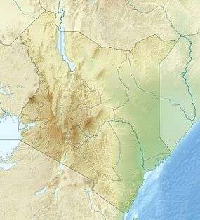 Location of Gitaru Hydroelectric Power Station in Kenya | |
| Country | Kenya |
| Location | Embu County/Machakos County |
| Coordinates | 00°47′43″S 37°45′09″E / 0.79528°S 37.75250°ECoordinates: 00°47′43″S 37°45′09″E / 0.79528°S 37.75250°E |
| Purpose | Power |
| Status | Operational |
| Construction began | 1975 |
| Opening date | 1978 |
| Owner(s) | Kenya Electricity Generating Company |
| Dam and spillways | |
| Type of dam | Embankment |
| Impounds | Tana River |
| Height | 30 m (98 ft) |
| Length | 580 m (1,900 ft) |
| Spillway capacity | 4,500 m3/s (160,000 cu ft/s) |
| Reservoir | |
| Total capacity | 16,000,000 m3 (13,000 acre·ft) |
| Normal elevation | 924 m (3,031 ft) |
| Power station | |
| Name | Gitaru Hydroelectric Power Station |
| Coordinates | 00°47′43″S 37°45′09″E / 0.79528°S 37.75250°E |
| Operator(s) | Kenya Electricity Generating Company |
| Commission date | 1999 |
| Type | Run-of-the-river |
| Hydraulic head | 136 m (446 ft) |
| Turbines | 2 x 72 MW, 1 x 81 MW Francis-type |
| Installed capacity | 225 MW (302,000 hp) |
The Gitaru Hydroelectric Power Station, also known as the Gitaru Dam, is a rock and earth-filled embankment dam on the Tana River in Kenya. It straddles the border between Embu and Machakos Counties in the Eastern Province. The primary purpose of the dam is hydroelectric power generation, and it supports a 225 megawatt power station. Construction on the dam began in 1975 and was completed in 1978. The power station was not commissioned until 1979. US$63 million in funding for the project was provided by the World Bank. The station is operated by the Kenya Electricity Generating Company and is part of the Seven Forks Scheme.[1][2]
The 30 m (98 ft) tall dam withholds a 16,000,000 m3 (13,000 acre·ft) reservoir. The relatively small reservoir relies on steady releases from the Masinga and Kamburu Dams upstream. The run-of-the-river power station is located underground near the left abutment. It contains two 72 megawatt and one 81 megawatt Francis turbine-generators. Water released from the station is returned to the Tana at the Kindaruma Reservoir via a 4.7 km (2.9 mi) long tailrace tunnel. The difference in elevation between the reservoir and power station affords a net hydraulic head of 136 m (446 ft).[3]
See also
- Kamburu Hydroelectric Power Station – upstream
- Kindaruma Hydroelectric Power Station – downstream
- List of power stations in Kenya
References
- ↑ Gitaru Hydro Power Plant
- ↑ "Kenya - Gitaru Hydroelectric Project (English)". World Bank. Retrieved 20 February 2015.
- ↑ "Kenya - Appraisal of the Gitaru Hydroelectric Project" (PDF). World Bank. 23 May 1975. pp. Annex 5. Retrieved 21 February 2015.