Masad, Israel
| Masad מסד | |
|---|---|
 | |
 Masad | |
| Coordinates: 32°50′38″N 35°25′22″E / 32.84389°N 35.42278°ECoordinates: 32°50′38″N 35°25′22″E / 32.84389°N 35.42278°E | |
| District | Northern |
| Council | Lower Galilee |
| Affiliation | HaMerkaz HaHakla'i |
| Founded | 1983 |
| Population (2015)[1] | 354 |
| Website | www.massad.org.il |
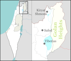
Masad (Hebrew: מַסָּד) is a communal settlement in northern Israel. Located to the west of the Sea of Galilee, it falls under the jurisdiction of Lower Galilee Regional Council. In 2015 it had a population of 354.
History
The village was founded as Har Kotz in 1983.
Plans to build a quarry on Kotz Mountain were rejected by the National Planning and Construction Council in 2008 after protests staged by the residents of Massad and nearby Arab village of Eilabun.[2]
Nature reserve
Masad is surrounded by the Har Kotz Nature Reserve. Among the trees found there are carob, mastic, Valonia oak, Christ's Thorn, Palestine oak, and Jerusalem thorn. The nature reserve derives its name from Mount Qotz (292 m), named for a priestly family that migrated to the Galilee from Jerusalem after the destruction of the Second Temple.[3]
See also
References
- ↑ "List of localities, in Alphabetical order" (PDF). Israel Central Bureau of Statistics. Retrieved 16 October 2016.
- ↑ News in brief, Haaretz
- ↑ Hareuveni, Imanuel (1985). קום התהלך בארץ: מדריך שמורות טבע בישראל [Nature Reserves in Israel] (in Hebrew) (2nd ed.). Israel: Israel Ministry of Defense. p. 155. ISBN 965-05-0193-2.
שם השמורה – לפי שם ההר. שמו – לפי שמה של משמרת הכוהנים, אשר עברה מירושלים לגליל אחרי חורבן הבית השני." "במפנה הדר' גדלה חברת חרוב-מצוי ואלת-המסטיק. במפנה הצפ', בחלקו העליון, גדלה חברת אלון-מצוי, ובמורד, על קו הרכס – חברת אלון-התבור עם עצי שיזף-מצוי. על גבול השמורה גדלים עצי שמיר-קוצני (עץ נדיר בחורש הים-תיכוני).
External links
- Village website (Hebrew)