Manitou, Kentucky
| Manitou | |
|---|---|
| Census-designated place (CDP) | |
 Manitou Location within the state of Kentucky | |
| Coordinates: 37°22′32″N 87°34′41″W / 37.37556°N 87.57806°WCoordinates: 37°22′32″N 87°34′41″W / 37.37556°N 87.57806°W | |
| Country | United States |
| State | Kentucky |
| County | Hopkins |
| Area | |
| • Land | 0.659 sq mi (1.71 km2) |
| • Water | 0 sq mi (0 km2) |
| Elevation | 407 ft (124 m) |
| Time zone | Central (CST) (UTC-6) |
| • Summer (DST) | CST (UTC-5) |
| GNIS feature ID | 2629646[1] |
Manitou (/ˈmænᵻtuː/) is a census-designated place (CDP) in Hopkins County, Kentucky, United States. It is a small community that lies a few miles northwest of Madisonville on US 41, at its intersection with KY 630 and KY 262.
References
Municipalities and communities of Hopkins County, Kentucky, United States | ||
|---|---|---|
| Cities | 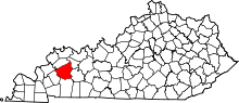 | |
| CDP | ||
| Other unincorporated communities |
| |
| Footnotes | ‡This populated place also has portions in an adjacent county or counties | |
This article is issued from Wikipedia - version of the 9/11/2015. The text is available under the Creative Commons Attribution/Share Alike but additional terms may apply for the media files.