Manerplaw
| Manerplaw မာနယ်ပလော | |
|---|---|
 Manerplaw Location in Myanmar (Burma) | |
| Coordinates: 17°43′30″N 97°44′6″E / 17.72500°N 97.73500°ECoordinates: 17°43′30″N 97°44′6″E / 17.72500°N 97.73500°E | |
| Country |
|
| Division | Kayin State |
| District | Hpa-an District |
| Township | Hpapun Township |
| Population (before evacuation) | 3,000[1] |
| Time zone | MMT (UTC+6.30) |
Manerplaw (Burmese: မာနယ်ပလော) was a village in Kayin State (Karen State), Myanmar (Burma). It was the proposed capital of an independent Karen state, governed by the Karen people. Manerplaw had a population of around 3,000 in 1992 until its evacuation following military offensives by the government.[1]
The headquarters of several opposition groups, most notably the Karen National Union (KNU) and its armed wing, the Karen National Liberation Army (KNLA), were located in Manerplaw until it was captured by Tatmadaw soldiers on 4 February 1995.[2]
References
- 1 2 "The Ethnic Minority Fighting a Burmese Onslaught". Journeyman Pictures. April 1992. Retrieved 24 April 2016.
- ↑ "The history of Kawthoolei (Karen State): The KNU to fall of Manerplaw". Hartford Web Publishing. 1995. Retrieved 24 April 2016.
Capital: Hpa-an | ||
| Hpa-an District | 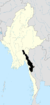 | |
| Hpapun District | ||
| Kawkareik District | ||
| Myawaddy District | ||
| Cities and towns | ||
This article is issued from Wikipedia - version of the 12/3/2016. The text is available under the Creative Commons Attribution/Share Alike but additional terms may apply for the media files.