Manchester Township, Boone County, Illinois
| Manchester Township | |
|---|---|
| Township | |
 Location in Boone County | |
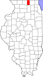 Boone County's location in Illinois | |
| Coordinates: 42°27′36″N 88°52′58″W / 42.46000°N 88.88278°WCoordinates: 42°27′36″N 88°52′58″W / 42.46000°N 88.88278°W | |
| Country | United States |
| State | Illinois |
| County | Boone |
| Settlement | November 6, 1849 |
| Area | |
| • Total | 33.53 sq mi (86.8 km2) |
| • Land | 33.51 sq mi (86.8 km2) |
| • Water | 0.02 sq mi (0.05 km2) 0.06% |
| Elevation | 922 ft (281 m) |
| Population (2010) | |
| • Total | 895 |
| • Density | 26.7/sq mi (10.3/km2) |
| Time zone | CST (UTC-6) |
| • Summer (DST) | CDT (UTC-5) |
| ZIP codes | 61011, 61065, 61073, 61080 |
| GNIS feature ID | 0429315 |
Manchester Township is one of nine townships in Boone County, Illinois, USA. As of the 2010 census, its population was 895 and it contained 389 housing units.[1]
Geography
According to the 2010 census, the township has a total area of 33.53 square miles (86.8 km2), of which 33.51 square miles (86.8 km2) (or 99.94%) is land and 0.02 square miles (0.052 km2) (or 0.06%) is water.[1]
Unincorporated towns
Cemeteries
The township contains these four cemeteries: Bamblett, Forest Hill, Livingston and Oak Hill.
Major highways
Airports and landing strips
- Compass Rose Airport (Carner RLA N42.27.0 W088.54.5)
- McCurdy Strip
- Nemec Airport
School districts
- Belvidere Consolidated Unit School District 100
- North Boone Community Unit School District 200
Political districts
- Illinois' 16th congressional district
- State House District 69
- State Senate District 35
References
- "Manchester Township, Boone County, Illinois". Geographic Names Information System. United States Geological Survey. Retrieved 2010-01-04.
- United States Census Bureau 2007 TIGER/Line Shapefiles
- United States National Atlas
- 1 2 "Population, Housing Units, Area, and Density: 2010 - County -- County Subdivision and Place -- 2010 Census Summary File 1". United States Census. Retrieved 2013-05-28.
External links
 |
|
| ||
| Roscoe Township, Winnebago County | |
Leroy Township | ||
| ||||
| | ||||
| Harlem Township, Winnebago County | Caledonia Township | Poplar Grove Township |
Municipalities and communities of Boone County, Illinois, United States | ||
|---|---|---|
| Cities | ||
| Villages | ||
| Townships | ||
| Unincorporated communities | ||
| Ghost town | ||
| Footnotes | ‡This populated place also has portions in an adjacent county or counties | |
This article is issued from Wikipedia - version of the 7/18/2015. The text is available under the Creative Commons Attribution/Share Alike but additional terms may apply for the media files.