Manambaro
| Manambaro | |
|---|---|
 Manambaro Location in Madagascar | |
| Coordinates: 25°2′S 46°49′E / 25.033°S 46.817°E | |
| Country |
|
| Region | Anosy |
| District | Taolanaro |
| Elevation[1] | 19 m (62 ft) |
| Population (2001)[2] | |
| • Total | 26,000 |
| Time zone | EAT (UTC3) |
Manambaro is a town and commune in Madagascar. It belongs to the district of Taolanaro, which is a part of Anosy Region.
It is situated at the Route nationale 13, Ihosy to Tolagnaro.
The population of the commune was estimated to be approximately 26,000 in 2001 commune census.[2]
In addition to primary schooling, the town offers secondary education at both junior and senior levels. The town provides access to hospital services to its citizens. Fifty percent of the commune's population are farmers. The most important crop is rice; other important products include cassava and lychee. An additional 15% of Manambaro's population receives their livelihood from raising livestock and another 20% from fishing. Industry and services provide employment for 5% and 10% of the population, respectively. [2]
References and notes
- ↑ Estimated based on DEM data from Shuttle Radar Topography Mission
- 1 2 3 "ILO census data". Cornell University. 2002. Retrieved 2008-05-04.
| Amboasary Sud | 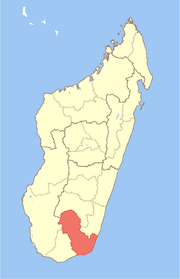 | |
|---|---|---|
| Betroka | ||
| Taolanaro | ||
Coordinates: 25°2′S 46°49′E / 25.033°S 46.817°E