Ianabinda
| Ianabinda | |
|---|---|
 Ianabinda Location in Madagascar | |
| Coordinates: 23°30′S 45°57′E / 23.500°S 45.950°E | |
| Country |
|
| Region | Anosy |
| District | Betroka |
| Elevation[1] | 776 m (2,546 ft) |
| Population (2001)[2] | |
| • Total | 7,000 |
| Time zone | EAT (UTC3) |
Ianabinda is a town and commune in Madagascar. It belongs to the district of Betroka, which is a part of Anosy Region.
It is situated at the Route nationale 13, Ihosy to Tolagnaro, at 48 km from Beraketa.
The population of the commune was estimated to be approximately 7,000 in 2001 commune census.[2]
Only primary schooling is available. It is also a site of industrial-scale mining. Farming and raising livestock provides employment for 48% and 50% of the working population. The most important crop is rice, while other important products are peanuts and cassava. Services provide employment for 2% of the population.[2]
References and notes
- ↑ Estimated based on DEM data from Shuttle Radar Topography Mission
- 1 2 3 "ILO census data". Cornell University. 2002. Retrieved 2008-05-04.
| Amboasary Sud | 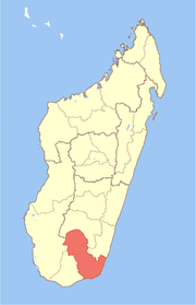 | |
|---|---|---|
| Betroka | ||
| Taolanaro | ||
Coordinates: 23°30′S 45°57′E / 23.500°S 45.950°E
This article is issued from Wikipedia - version of the 4/4/2016. The text is available under the Creative Commons Attribution/Share Alike but additional terms may apply for the media files.