Malvern, Alabama
| Malvern, Alabama | |
|---|---|
| Town | |
 Location in Geneva County and the state of Alabama | |
| Coordinates: 31°8′38″N 85°31′24″W / 31.14389°N 85.52333°W | |
| Country | United States |
| State | Alabama |
| County | Geneva |
| Area | |
| • Total | 14 sq mi (36.3 km2) |
| • Land | 14 sq mi (36.3 km2) |
| • Water | 0 sq mi (0 km2) |
| Elevation | 282 ft (86 m) |
| Population (2000) | |
| • Total | 1,215 |
| • Density | 86.8/sq mi (33.5/km2) |
| Time zone | Central (CST) (UTC-6) |
| • Summer (DST) | CDT (UTC-5) |
| ZIP code | 36349 |
| Area code(s) | 334 |
| FIPS code | 01-46264 |
| GNIS feature ID | 0152214 |
Malvern is a town in Geneva County, Alabama, United States. It is part of the Dothan, Alabama Metropolitan Statistical Area. At the 2010 census the population was 1,448, up from 1,215 in 2000.
Geography
Malvern is located at 31°8′38″N 85°31′24″W / 31.14389°N 85.52333°W (31.143981, -85.523382).[1]
According to the U.S. Census Bureau, the town has a total area of 14.0 square miles (36 km2), all land.
Demographics
| Historical population | |||
|---|---|---|---|
| Census | Pop. | %± | |
| 1910 | 173 | — | |
| 1920 | 221 | 27.7% | |
| 1930 | 207 | −6.3% | |
| 1940 | 190 | −8.2% | |
| 1950 | 196 | 3.2% | |
| 1960 | 213 | 8.7% | |
| 1970 | 227 | 6.6% | |
| 1980 | 558 | 145.8% | |
| 1990 | 570 | 2.2% | |
| 2000 | 1,215 | 113.2% | |
| 2010 | 1,448 | 19.2% | |
| Est. 2015 | 1,446 | [2] | −0.1% |
| U.S. Decennial Census[3] 2013 Estimate[4] | |||
According to the 1910 U.S. Census, Malvern was incorporated in 1904.[5]
As of the census[6] of 2000, there were 1,215 people, 485 households, and 370 families residing in the town. The population density was 86.7 people per square mile (33.5/km²). There were 547 housing units at an average density of 39.0 per square mile (15.1/km²). The racial makeup of the town was 94.57% White, 2.22% Black or African American, 1.15% Native American, 0.25% Asian, 1.07% from other races, and 0.74% from two or more races. 1.32% of the population were Hispanic or Latino of any race.
There were 485 households out of which 36.1% had children under the age of 18 living with them, 60.2% were married couples living together, 11.5% had a female householder with no husband present, and 23.7% were non-families. 21.0% of all households were made up of individuals and 7.6% had someone living alone who was 65 years of age or older. The average household size was 2.51 and the average family size was 2.89.
In the town the population was spread out with 26.1% under the age of 18, 6.7% from 18 to 24, 31.4% from 25 to 44, 24.6% from 45 to 64, and 11.2% who were 65 years of age or older. The median age was 36 years. For every 100 females there were 97.9 males. For every 100 females age 18 and over, there were 93.1 males.
The median income for a household in the town was $31,850, and the median income for a family was $37,813. Males had a median income of $29,701 versus $19,500 for females. The per capita income for the town was $15,283. About 12.1% of families and 14.3% of the population were below the poverty line, including 18.8% of those under age 18 and 23.3% of those age 65 or over.
2010 census
As of the census[7] of 2010, there were 1,448 people, 582 households, and 428 families residing in the town. The population density was 103.4 people per square mile (39.9/km²). There were 647 housing units at an average density of 46.2 per square mile (17.8/km²). The racial makeup of the town was 91.2% White, 4.8% Black or African American, .7% Native American, 0.1% Asian, 1.7% from other races, and 1.5% from two or more races. 4.8% of the population were Hispanic or Latino of any race.
There were 485 households out of which 29.4% had children under the age of 18 living with them, 58.2% were married couples living together, 11.9% had a female householder with no husband present, and 26.5% were non-families. 22.7% of all households were made up of individuals and 10.8% had someone living alone who was 65 years of age or older. The average household size was 2.49 and the average family size was 2.92.
In the town the population was spread out with 22.8% under the age of 18, 8.8% from 18 to 24, 24.9% from 25 to 44, 29.1% from 45 to 64, and 14.4% who were 65 years of age or older. The median age was 40.3 years. For every 100 females there were 96.2 males. For every 100 females age 18 and over, there were 93.8 males.
The median income for a household in the town was $42,930, and the median income for a family was $41,793. Males had a median income of $40,875 versus $35,486 for females. The per capita income for the town was $21,417. About 9.6% of families and 11.1% of the population were below the poverty line, including 13.8% of those under age 18 and 6.9% of those age 65 or over.
References
- ↑ "US Gazetteer files: 2010, 2000, and 1990". United States Census Bureau. 2011-02-12. Retrieved 2011-04-23.
- ↑ "Annual Estimates of the Resident Population for Incorporated Places: April 1, 2010 to July 1, 2015". Retrieved July 2, 2016.
- ↑ "U.S. Decennial Census". Census.gov. Retrieved June 6, 2013.
- ↑ "Annual Estimates of the Resident Population: April 1, 2010 to July 1, 2013". Retrieved June 3, 2014.
- ↑ https://books.google.com/books?id=mMUGAQAAIAAJ&pg=PA336&lpg=PA336&dq=%22geneva+county%22+%22incorporated%22+%22malvern%22+%22alabama%22&source=bl&ots=_VMoAFosW4&sig=sOL_bziio7Zv2rtp1Q3WswhhK-o&hl=en&sa=X&ved=0ahUKEwiRxO3psMjKAhUCMyYKHcylCww4ChDoAQgiMAE#v=onepage&q=%22geneva%20county%22%20%22incorporated%22%20%22malvern%22%20%22alabama%22&f=false
- ↑ "American FactFinder". United States Census Bureau. Retrieved 2008-01-31.
- ↑ "American FactFinder". United States Census Bureau. Retrieved 2015-07-24.
External links
Coordinates: 31°08′38″N 85°31′24″W / 31.143981°N 85.523382°W
Municipalities and communities of Geneva County, Alabama, United States | ||
|---|---|---|
| Cities | 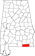 | |
| Towns | ||
| CDP | ||
| Unincorporated communities | ||
| Footnotes | ‡This populated place also has portions in an adjacent county or counties | |