Malta Airport (Montana)
| Malta Airport | |||||||||||
|---|---|---|---|---|---|---|---|---|---|---|---|
| IATA: MLK – ICAO: none – FAA LID: M75 | |||||||||||
| Summary | |||||||||||
| Airport type | Public | ||||||||||
| Owner | Phillips County Regional Airport Authority | ||||||||||
| Serves | Malta, Montana | ||||||||||
| Elevation AMSL | 2,254 ft / 687 m | ||||||||||
| Coordinates | 48°22′01″N 107°55′10″W / 48.36694°N 107.91944°WCoordinates: 48°22′01″N 107°55′10″W / 48.36694°N 107.91944°W | ||||||||||
| Map | |||||||||||
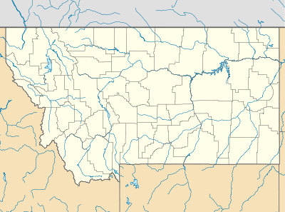 M75 Location of airport in Montana | |||||||||||
| Runways | |||||||||||
| |||||||||||
| Statistics (2012) | |||||||||||
| |||||||||||
Malta Airport (IATA: MLK[2], FAA LID: M75) is a public use airport located one nautical mile (2 km) northwest of the central business district of Malta, a city in Phillips County, Montana, United States.[1] It is owned by the Phillips County Regional Airport Authority.[1] This airport is included in the National Plan of Integrated Airport Systems for 2011–2015, which categorized it as a general aviation facility.[3]
The current airport was built between 1996[4] and 2000.[5] Malta Airport was formerly located at 48°20′56″N 107°53′6″W / 48.34889°N 107.88500°W,[6] which is now the site of a business and industry development district.[7]
Facilities and aircraft
Malta Airport covers an area of 280 acres (113 ha) at an elevation of 2,254 feet (687 m) above mean sea level. It has one runway designated 8/26 with an asphalt surface measuring 4,500 by 75 feet (1,372 x 23 m).[1]
For the 12-month period ending July 19, 2012, the airport had 4,100 aircraft operations, an average of 11 per day: 88% general aviation and 12% air taxi. At that time there were 13 single-engine aircraft based at this airport.[1]
References
- 1 2 3 4 5 FAA Airport Master Record for M75 (Form 5010 PDF). Federal Aviation Administration. Effective November 15, 2012.
- ↑ "IATA Airport Code Search (MLK: Malta)". International Air Transport Association. Retrieved June 13, 2013.
- ↑ "2011–2015 NPIAS Report, Appendix A" (PDF, 2.03 MB). National Plan of Integrated Airport Systems. Federal Aviation Administration. October 4, 2010. External link in
|work=(help) - ↑ "1996 aerial image showing no runway at current coordinates of Malta Airport". The National Map. United States Geological Survey. August 27, 1996.
- ↑ "M75 – Malta Airport – Malta, Montana". FAA data republished by AirNav. Effective August 10, 2000. Archived from the original on August 23, 2000. Check date values in:
|date=(help) - ↑ "Topographic map showing former location of Malta Airport in Malta, Montana". The National Map. United States Geological Survey. July 1, 1987.
- ↑ "Business and Industry Development District (BIDD)". PhillCo Economic Growth Council. 2001.
External links
- FAA Terminal Procedures for M75, effective December 8, 2016
- Resources for this airport:
- FAA airport information for M75
- AirNav airport information for M75
- FlightAware airport information and live flight tracker
- SkyVector aeronautical chart for M75