Malinta, Ohio
| Malinta, Ohio | |
|---|---|
| Village | |
|
Turkeyfoot Avenue downtown | |
 Location of Malinta, Ohio | |
 Location of Malinta in Henry County | |
| Coordinates: 41°19′18″N 84°2′13″W / 41.32167°N 84.03694°WCoordinates: 41°19′18″N 84°2′13″W / 41.32167°N 84.03694°W | |
| Country | United States |
| State | Ohio |
| County | Henry |
| Government | |
| • Type | Village Council |
| • Mayor | Jerry Rohrs |
| Area[1] | |
| • Total | 0.77 sq mi (1.99 km2) |
| • Land | 0.77 sq mi (1.99 km2) |
| • Water | 0 sq mi (0 km2) |
| Elevation[2] | 686 ft (209 m) |
| Population (2010)[3] | |
| • Total | 265 |
| • Estimate (2012[4]) | 264 |
| • Density | 344.2/sq mi (132.9/km2) |
| Time zone | Eastern (EST) (UTC-5) |
| • Summer (DST) | EDT (UTC-4) |
| ZIP code | 43535 |
| Area code(s) | 419 |
| FIPS code | 39-46942[5] |
| GNIS feature ID | 1042904[2] |

Malinta is a village in Henry County, Ohio, United States. The population was 265 at the 2010 census, a decrease of 7.0% from the 2000 census.
History
Malinta was platted in 1880.[6] The village derives its name from Malinda Elizabeth Bensing, the daughter of a first settler.[7] A post office has been in operation at Malinta since 1880.[8]
Geography
Malinta is located at 41°19′18″N 84°2′13″W / 41.32167°N 84.03694°W (41.321773, -84.037070).[9]
According to the United States Census Bureau, the village has a total area of 0.77 square miles (1.99 km2), all land.[1]
Demographics
| Historical population | |||
|---|---|---|---|
| Census | Pop. | %± | |
| 1900 | 357 | — | |
| 1910 | 345 | −3.4% | |
| 1920 | 348 | 0.9% | |
| 1930 | 348 | 0.0% | |
| 1940 | 340 | −2.3% | |
| 1950 | 308 | −9.4% | |
| 1960 | 339 | 10.1% | |
| 1970 | 391 | 15.3% | |
| 1980 | 327 | −16.4% | |
| 1990 | 294 | −10.1% | |
| 2000 | 285 | −3.1% | |
| 2010 | 265 | −7.0% | |
| Est. 2015 | 264 | [10] | −0.4% |
2010 census
As of the census[3] of 2010, there were 265 people, 102 households, and 70 families residing in the village. The population density was 344.2 inhabitants per square mile (132.9/km2). There were 116 housing units at an average density of 150.6 per square mile (58.1/km2). The racial makeup of the village was 93.2% White, 0.4% African American, 0.4% Asian, 3.4% from other races, and 2.6% from two or more races. Hispanic or Latino of any race were 14.0% of the population.
There were 102 households of which 43.1% had children under the age of 18 living with them, 52.0% were married couples living together, 10.8% had a female householder with no husband present, 5.9% had a male householder with no wife present, and 31.4% were non-families. 28.4% of all households were made up of individuals and 14.7% had someone living alone who was 65 years of age or older. The average household size was 2.60 and the average family size was 3.24.
The median age in the village was 36.2 years. 28.7% of residents were under the age of 18; 6.3% were between the ages of 18 and 24; 26.3% were from 25 to 44; 23.8% were from 45 to 64; and 14.7% were 65 years of age or older. The gender makeup of the village was 47.9% male and 52.1% female.
2000 census
As of the census[5] of 2000, there were 285 people, 113 households, and 77 families residing in the village. The population density was 369.8 people per square mile (142.9/km²). There were 119 housing units at an average density of 154.4 per square mile (59.7/km²). The racial makeup of the village was 96.84% White, 0.35% Native American, 0.35% Asian, 1.05% from other races, and 1.40% from two or more races. Hispanic or Latino of any race were 5.96% of the population.
There were 113 households out of which 34.5% had children under the age of 18 living with them, 54.9% were married couples living together, 7.1% had a female householder with no husband present, and 31.0% were non-families. 25.7% of all households were made up of individuals and 9.7% had someone living alone who was 65 years of age or older. The average household size was 2.52 and the average family size was 2.99.
In the village the population was spread out with 28.8% under the age of 18, 4.6% from 18 to 24, 33.3% from 25 to 44, 16.8% from 45 to 64, and 16.5% who were 65 years of age or older. The median age was 36 years. For every 100 females there were 102.1 males. For every 100 females age 18 and over, there were 97.1 males.
The median income for a household in the village was $37,344, and the median income for a family was $47,679. Males had a median income of $37,188 versus $23,125 for females. The per capita income for the village was $16,087. About 2.5% of families and 2.7% of the population were below the poverty line, including none of those under the age of eighteen or sixty five or over.
References
- 1 2 "US Gazetteer files 2010". United States Census Bureau. Retrieved 2013-01-06.
- 1 2 "US Board on Geographic Names". United States Geological Survey. 2007-10-25. Retrieved 2008-01-31.
- 1 2 "American FactFinder". United States Census Bureau. Retrieved 2013-01-06.
- ↑ "Population Estimates". United States Census Bureau. Retrieved 2013-06-17.
- 1 2 "American FactFinder". United States Census Bureau. Retrieved 2008-01-31.
- ↑ Aldrich, Lewis Cass (1888). History of Henry and Fulton Counties, Ohio. D. Mason & Company. p. 246.
- ↑ Overman, William Daniel (1958). Ohio Towns Names. Atlantic Press. p. 81.
...who named the village for his daughter Malinda Elizabeth Bensing.
- ↑ "Henry County". Jim Forte Postal History. Retrieved 12 December 2015.
- ↑ "US Gazetteer files: 2010, 2000, and 1990". United States Census Bureau. 2011-02-12. Retrieved 2011-04-23.
- ↑ "Annual Estimates of the Resident Population for Incorporated Places: April 1, 2010 to July 1, 2015". Retrieved July 2, 2016.
- ↑ "Census of Population and Housing". Census.gov. Retrieved June 4, 2015.
Municipalities and communities of Henry County, Ohio, United States | ||
|---|---|---|
| City | 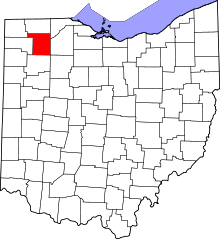 | |
| Villages | ||
| Townships | ||
| CDP | ||
| Unincorporated communities | ||
| Footnotes | ‡This populated place also has portions in an adjacent county or counties | |