Malino, Indonesia
| Malino ᨆᨒᨗᨊᨚ Kota Malino | ||
|---|---|---|
| Town | ||
| ||
| Nickname(s): "City of Flower" | ||
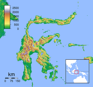 Malino Location of Malino in Sulawesi | ||
| Coordinates: 5°14′56.2″S 119°51′24.0″E / 5.248944°S 119.856667°E | ||
| Country |
| |
| Province |
| |
| Regency |
| |
| Elevation | 1,000-1,700 m (−4,600 ft) | |
| Time zone | WITA (UTC+8) | |
| • Summer (DST) | not observed (UTC+8) | |

Malino (Buginese-Makassar language: ᨆᨒᨗᨊᨚ) is a small hill town resort in the Gowa district of South Sulawesi, 90 km from Makassar.[1] It is a popular getaway famous for its tropical flowers.
Malino has mountains are very rich with limestone scenery and pine. Various kinds of beautiful tropical plants, grow and thrive in this cold city. Moreover, Malino also produces fruits and vegetables that grow in typical mountain slopes Bawakaraeng. Most people of South Sulawesi still mengkulturkan mountain as a sacred place and sacred. Temperatures in the city Malino ranging from 10 °C to 26 °C. and when the rainy season, be careful're driving because, the city is often foggy and field of vision of 100 meters.
The journey from Makassar to this area takes about 2 hours. Travel thousand staircase waterfall, waterfall Takapala, Nittoh Tea Gardens, Lembah Biru, Japanese Bunker heritage, and Mount Bawakaraeng become the hallmark of the town of Malino. Souvenirs typical of this area is Passion fruit, glutinous lunkhead, Tenteng Malino, apples, wajik, etc. Malino is also a rice producing areas for the region of South Sulawesi.
The town was the venue for the 1946 Malino Conference during the Indonesian National Revolution. The Malino II Accord was also signed there in February 2002.
History
Before appearing Malino name, first local people know the name of the village 'Lapparak (ᨒᨄᨑ)'. Laparrak (ᨒᨄᨑ) in the native language it means flat, which means also in a place that's just a flat area, between the mountains stood firm. Malino city began to be known and increasingly popular since the Dutch colonial era, especially after the Governor-General Caron in 1927 ruled in "Celebes on Onderhorighodon" has made Malino in 1927 as a resting place for government employees.
Malino in Tumannurunga era (1320), not including the royal gowa.diri of nine Kasuwiang, or more popularly called Kasuwiang Salapanga are coordinated by Pacallaya. Ninth Kasuwiang area is part of: Kasuwiang Tombolo, Likuang, Samata, Parang-parang, Data, Agang Je'ne, Bisei, Kalling, and Sero. Area which includes 9 kasuwiang remain intact since the first king of Gowa Tumanurunga 1320 until the king of Gowa V "Karapang ri Gowa" 1420-1445 "Abd Razak Daeng Patunru. After the reign of the king of Gowa VI Tunatangkalopi, there is an attempt to expand its territory, by conquering the surrounding area, Gowa Tallo will be the Twins Kingdom.
After tunatangkalopi abdication, he was replaced by two daughters namely Batara Guru and Karaeng loe ri sero, from Twins Kingdom that appear terms Rua Karaeng Se're ata (two kings but people still a) the expansion of the territory continues to be done to the king of Gowa to VIII I know Tunijallo ri pekere passukki.
Malino Conference

The Dutch organised a conference in the Sulawesi town of Malino in July 1946 as part of their attempt to arrange a federal solution for Indonesia. From the end of World War II, Indonesian Republicans had been trying to secure Indonesian Independence from the Dutch colonial control.
The Dutch invited thirty-nine Indonesian representatives of the local rulers (rajas), Christians, and several other ethnic groups of Kalimantan and East Indonesia who supported the idea of some form of continuing Dutch connection. However, the Dutch had not anticipated the level of support amongst the Indonesians for genuine autonomy. The conference resulted in plans for a state in Kalimantan and another for East Indonesia.
Economy
Horticultural industry, industrial estates and agro industry has penetrated into this area, specifically in the area of Malino, Capital District Tinggimoncong is excellent perpariwisataan in South Selawesi. Areas that are above an altitude of 1,500 meters above sea level, is also a major supplier of horticulture crops to Makassar and its surroundings, even the results of this plantation sebahagian been exported to several countries in Asia and Europe. All of these either directly or indirectly increase the income of the population, so that people will prosper, in addition to the migration to this area increased from year to year.
References
Coordinates: 5°14′48″S 119°51′43″E / 5.24667°S 119.86194°E