Gowa Regency
| Gowa Regency Kabupaten Gowa ᨀᨅᨘᨄᨈᨙ ᨁᨚᨓ | |||||||
|---|---|---|---|---|---|---|---|
| Regency | |||||||
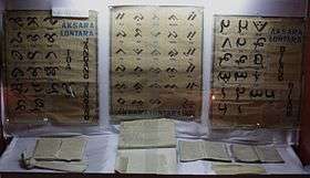
Clockwise from top : Lontara' Script in Balla Lompoa, Tamalate Palace, The Twin Bridge and Jeneberang River, Syech Yusuf Great Mosque, Fort Somba Opu, Malino Town City of Flower | |||||||
| |||||||
| Nickname(s): Butta' Gowa | |||||||
|
Motto: Ewako Gowa! Slogan: Gowa BersejarahClean, prosperous, neat, safe, and green. | |||||||
 Indonesia Sulawesi location map.svg | |||||||
 Gowa Regency Location off Sulawesi | |||||||
| Coordinates: ID 5°19′3″S 119°44′23″E / 5.31750°S 119.73972°E | |||||||
| Country |
| ||||||
| Province |
| ||||||
| Founded | 17 November 1320 | ||||||
| Capital | Sungguminasa | ||||||
| Government | |||||||
| • Regent | Adnan Purichta Ichsan Yasin Limpo | ||||||
| Area | |||||||
| • Total | 1,883.32 km2 (727.15 sq mi) | ||||||
| Population (2010 Census) | |||||||
| • Total | 652,329 | ||||||
| • Density | 350/km2 (900/sq mi) | ||||||
| Time zone | WITA (UTC+8) | ||||||
| Website | Official Website of the Government of Gowa Regency | ||||||


Gowa (Makassar : ᨁᨚᨓ) is a regency in the province of South Sulawesi, Indonesia. It has an area of 1,883 km² and a population of 652,329 at the 2010 Census.[1] The majority of the Regency (the western eleven districts, with over 76.6% of the regency's population) lies within the official metropolitan area of the city of Makassar, including the regency's administrative capital at Sungguminasa. The hill resort of Malino is within the eastern (non-metropolitan) part of the regency.
Administration
The regency is divided into eighteen districts (kecamatan), tabulated below with their 2010 Census population.[2]
| Name | Population Census 2010 |
|---|---|
| Bontonompo | 39,295 |
| Bontonompo Selatan (South Bontonompo) | 28,471 |
| Bajeng | 62,334 |
| Bajeng Barat (West Bajeng) | 22,918 |
| Pallangga | 98,721 |
| Barotbong | 34,526 |
| Sompa Opu | 130,287 |
| Bontomarunnu | 31,250 |
| Pattallassang | 21,881 |
| Parangloe | 16,564 |
| Manuju | 14,093 |
| Tinggimoncong | 22,138 |
| Tombolo Pao | 26,876 |
| Parigi | 13,089 |
| Bungaya | 15,847 |
| Bontolempangan | 13,332 |
| Tompobulu | 28,971 |
| Biringbulu | 32,347 |
The first eleven of the eighteen districts tabulated above lie within the official metropolitan area of the city of Makassar; the remaining seven districts lie outside that area.
History
Gowa was formerly a kingdom founded in the Makassar region of south-western Sulawesi in 14th century.
Before the establishment of the kingdom, the region had been known as Makassar and its people as Suku Makassar (tribe of Makassar).[3] The history of the kingdom can be divided into two eras: pre-Islamic kingdom and post-Islamic sultanate.
From 1660, the Netherlands was at war with Gowa, which was the major Makassar west coast power. In 1669, Admiral Speelman forced the ruler, Sultan Hasanuddin, to sign the Treaty of Bongaya, which handed control of trade to the Dutch East India Company. The Dutch were aided in their conquest by the Bugis warlord Arung Palakka, ruler of the Bugis kingdom of Bone.
Pre-Islamic Kingdom
According to the epic poem The Nagarakretagama, in praise of King Rajasanagara of Majapahit, it lists Makassar as one of the kingdom's tributaries in 1365.[4]
The first king of Gowa was Tomanurung.[3] There is not much known about the exact time when the kingdom was established nor about the first king, and only during the ruling of the 6th king, Tunatangka Lopi, local sources have noted about the division of the kingdom into two new kingdoms led by two Lopi's sons: Kingdom of Gowa led by Batara Gowa as its 7th king covering areas of Paccelekang, Pattalasang, Bontomanai Ilau, Bontomanai 'Iraya, Tombolo and Mangasa while the other son, Karaeng Loe ri Sero, led a new kingdom called Tallo which includes areas of Saumata, Pannampu, Moncong Loe, and Parang Loe.[3]
For years both kingdoms were involved in wars until the kingdom of Tallo deveated. During the reign of King of Gowa X, Mariogau Daen Bonto Karaeng Lakiung Tunipalangga Ulaweng (1512-1546), the two kingdoms were reunified to become twin kingdoms under a deal called Rua Kareng se're ata (dual kings, single people in Makassarese) and enforced with a binding treaty.[3] Since then, when someone becomes a king of Tallo, he also becomes the king of Gowa. Many historians then simply call these Gowa-Tallo twin kingdoms as Makassar or just Gowa.[3]
Islamic Sultanate
The traces of Islam in South Sulawesi existed since 1320s with the arrival of the first Sayyid in South Sulawesi, namely Sayyid Jamaluddin al-Akbar Al-Husaini, who is the grandfather of Wali Songo.[5]
The conversion of the kingdom to Islam is dated as September 22, 1605 when the 14th king of Tallo-Gowa kingdom, Karaeng Matowaya Tumamenaga Ri Agamanna, converted to Islam,[6] where later changed his name to Sultan Alauddin. He ruled the kingdom from 1591 to 1629. His conversion to Islam is associated with the arrival of three ulama from Minangkabau: Ri Bandang Datuk, Datuk Datuk ri ri Tiro and Patimang.
From 1630 until the early twentieth century, Gowa's political leaaders and Islamic functionaries were both recruited from the ranks of the nobility.[6] Since 1607, sultans of Makassar established a policy of welcoming all foreign traders.[4] In 1613, an English factory built in Makassar. This began the hostilities of English-Dutch against Makassar.[4]
The most famous Sultan of the kingdom was Sultan Hasanuddin, who from 1666 to 1669 started a war known as Makassar War against the Dutch East India Company (VOC) which was assisted by the prince of Bone kingdom of Bugis dynasty, Arung Palakka.[7]
Dissolution of Sultanate
Since 1673 the area around the fort Rotterdam grew into a city currently known as Makassar.[8] Since 1904 the Dutch colonial government performed an expedition called South Sulawesi expedition and started war against small kingdoms in South Sulawesi, including Gowa. In 1911 the Sultanate lost its independence after losing the war and became one of the Dutch Indies' regencies.[9] Following the Indonesian Independence from Netherlands in 1945, the sultanate dissolved and has since become part of the Republic of Indonesia and the former region becomes part of Gowa Regency.
The Bili-Bili Dam, located about 30 km from Makassar, was completed in 1998.[10]
Geography
Gowa is located at 12°38.16'E Longitude of Jakarta and 5°33.6'E longitude of the North Pole. While the location of the region his administration between, 12°33.19 'to 13°15:17'E longitude and 5°5' to 5°34.7'S latitude of Jakarta.
Regency is located in the southern part of South Sulawesi province is bordered by 7 Regency / City else, namely in the north bordering the city of Makassar and Maros. In the east with Sinjai, Bulukumba and Bantaeng. On the South side is bordered by Takalar and Jeneponto whereas in the west with the city of Makassar and Takalar.
The total area is 1883.33 km2 Gowa or equal to 3.01% of the area of South Sulawesi province. Gowa regency is divided into 18 sub-district by the number of Village / Sub definitive amount to 167 and 726 Hamlet / Environment.
Economy
Mining

Mineral deposits, group C along the Watershed (DAS) Jenebarang, such as sand, stone and gravel hereditary able to provide for the surrounding population. The contribution of this sector in economic activity in 2000 amounting to Rp.105,4 billion, or 9.13 percent, but the contribution of this sector to the Regency Government's treasury is significant.
In fiscal year 2001, the district government is targeting Rp. 2.03 billion of tax excavated material to fill a class C revenue (PAD). Quarrying activities is quite large because in addition to the availability of material from the DAS, there is also a mountain stone and clay. The trucks are passing transporting this material along protocol roads connecting with Gowa Makassar.
Excavated material is capable of providing for cash receipts, Gowa regency. Pos dominates income tax up to 65 percent in the 2001 fiscal year revenue in the amount of Rp. 3.11 billion.
Agriculture
Gowa real potential is agriculture. The main job of the regencies in 2000 per capita income of Rp. 2.09 million are farming, with food crops sub-sector as the mainstay. The agricultural sector contributed 45 percent or Rp. 515.2 billion.

Paddy fields were less than 20 percent (3,640 hectares) of the total land area of the regency is able to provide sufficient results. Production of various agricultural crops such as rice and other crops, horticultural crops to be excellent.
Sub-districts in the highlands like Parangloe, Bungaya and especially Tinggimoncong a vegetable producing center. The most widely cultivated vegetables are potatoes, cabbage, mustard, onion and beans. Per year, the harvest of vegetables exceed 5,000 tons. Vegetables of Gowa Makassar city is able to meet the market and its surroundings, even to the island of Borneo and the Maluku through the port of Pare Pare and Port Mamuju.
In addition to farming vegetables that have a short growing season, farmers Gowa also many who farm crops longevity. One of them is the passion fruit plants (Fassifora sp). Visited Makassar less afdol feel if not bring fruit or juice passion fruit syrup hands. If we look at the views of the airport or the port, most of the passengers who will leave Makassar bring this fresh flavorful juice. Plants from the mainland of South America is synonymous with South Sulawesi. Kanreapia Village, District Tinggimoncong is one of passion fruit producing areas in Gowa. Unfortunately, passion fruit sour taste of the fruit is sweet and capable of moving a small food and beverage industry is now beginning farmers less desirable. Planting of passion is not easy, except for the long cropping period and require special care, such as high surface soil, fertilizers and drugs are quite expensive.
Furthermore the price of passion fruit is also unstable and likely to continue to decline. These vines have one harvests per year (November to January) with a production of about 300,000 fruit per hectare. If the price at the time of harvest, one kilo (approximately 25 pieces) only Rp. 500,- up to Rp. 800,- [citation needed] so that farmers only received Rp 6.0 million to Rp 9.6 million per hectare. This situation drives the passion fruit planting area continued to decline. In 1996 there were 1,241 hectares with a production of 21 861 tonnes. Four years later planting area into 854 hectares with a production of 7189 tons. Many farmers to switch crops from passion fruit to vegetables for more
Sights and Tourism
One of the most important sights is Fortress Samba Opu (Benteng Samba Opu) in the town of Sunggumninasa. A part of the walls including a round tower are just being restored. The strongest wall with a thickness of seven metres was built in the west towards the sea as Sultan Hasanuddin feared an attack from this direction.[11] Weapons, coins, traditional clothings etc. are on display in a museum in the middle of the fortress. Various houses in the traditional styles of eleven different peoples of southern Sulawesi were built in the fortress.
Parangloe Tiered Waterfall
Parangloe Tiered Waterfall is located in Parangloe district, 42 kilometers east of Makassar with severely damaged road and then 1.5 kilometers in a half hour walk.[12]
References
- ↑ 2010 Indonesian Census
- ↑ Biro Pusat Statistik, Jakarta, 2011.
- 1 2 3 4 5 Sewang, Ahmad M. (2005). Islamisasi Kerajaan Gowa: abad XVI sampai abad XVII (in Indonesian). Yayasan Obor Indonesia. ISBN 978-9-794615300.
- 1 2 3 "MAKASSAR". Retrieved March 4, 2016.
- ↑ Hannapia, Muhammad Ali (2012). "Masuknya Islam di Gowa". Universitas Hasanuddin (in Indonesian).
- 1 2 Hefner, Robert W.; Horvatich, Patricia (1997). Robert W. Hefner, Patricia Horvatich, eds. Islam in an Era of Nation-States: Politics and Religious Renewal in Muslim Southeast Asia. University of Hawaii Press. ISBN 978-0-824819576.
- ↑ Ricklefs, M.C. (2008). A History of Modern Indonesia Since C.1200 (revised ed.). Palgrave Macmillan. ISBN 978-1-137052018.
- ↑ Backshall, Stephen (2003). Rough Guide Indonesia (illustrated ed.). Singapore: Rough Guides. ISBN 978-1-858289915.
- ↑ National Centennial Commission (Philippines) (1998). Elmer A. Ordoñez, eds. Toward the first Asian republic: papers from the Jakarta International Conference on the Centenary of the Philippine Revolution and the First Asian Republic. Philippine Centennial Commission.
- ↑ Andi Hajramurni (2010-05-21). "Makassar dam threatened by sediment, experts say". The Jakarta Post. Retrieved 2014-07-25.
- ↑ Nurul Noe: Makassar dan sekitarnya, p.28. Jakarta 2014
- ↑ "The Tempting Parangloe Waterfall". September 17, 2014.
Regencies and cities of South Sulawesi | ||
|---|---|---|
Capital: Makassar | ||
| Regencies |  | |
| Cities | ||
Coordinates: 5°20′S 119°40′E / 5.333°S 119.667°E