Mali Ločnik
| Mali Ločnik | |
|---|---|
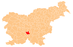
 Mali Ločnik Location in Slovenia | |
| Coordinates: 45°53′27″N 14°36′46.48″E / 45.89083°N 14.6129111°ECoordinates: 45°53′27″N 14°36′46.48″E / 45.89083°N 14.6129111°E | |
| Country |
|
| Traditional region | Lower Carniola |
| Statistical region | Central Slovenia |
| Municipality | Velike Lašče |
| Area | |
| • Total | 0.93 km2 (0.36 sq mi) |
| Elevation | 589.1 m (1,932.7 ft) |
| Population (2002) | |
| • Total | 51 |
| [1] | |
Mali Ločnik (pronounced [ˈmaːli lɔtʃˈniːk] or [ˈmaːli ˈloːtʃnik]; German: Kleinlotschnik[2]) is a settlement north of Turjak in the Municipality of Velike Lašče in central Slovenia. The entire Municipality of Velike Lašče is part of the traditional region of Lower Carniola and is now included in the Central Slovenia Statistical Region.[3]
The local church, built on a hill northwest of the village, is dedicated to Saint Agathius (Slovene: sveti Ahac) and belongs to the Parish of Turjak. It dates to the 15th century.[4]
References
- ↑ Statistical Office of the Republic of Slovenia
- ↑ Leksikon občin kraljestev in dežel zastopanih v državnem zboru, vol. 6: Kranjsko. 1906. Vienna: C. Kr. Dvorna in Državna Tiskarna, p. 46.
- ↑ Velike Lašče municipal site
- ↑ Slovenian Ministry of Culture register of national heritage reference number ešd 2620
External links
This article is issued from Wikipedia - version of the 4/7/2016. The text is available under the Creative Commons Attribution/Share Alike but additional terms may apply for the media files.