Makryneia
| Makryneia Μακρυνεία | |
|---|---|
 Makryneia | |
|
Location within the regional unit 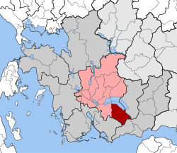 | |
| Coordinates: 38°32′N 21°32′E / 38.533°N 21.533°ECoordinates: 38°32′N 21°32′E / 38.533°N 21.533°E | |
| Country | Greece |
| Administrative region | West Greece |
| Regional unit | Aetolia-Acarnania |
| Municipality | Agrinio |
| • Municipal unit | 149.7 km2 (57.8 sq mi) |
| Population (2011)[1] | |
| • Municipal unit | 3,681 |
| • Municipal unit density | 25/km2 (64/sq mi) |
| Time zone | EET (UTC+2) |
| • Summer (DST) | EEST (UTC+3) |
| Postal code | 300 15 |
Makryneia (Greek: Μακρυνεία) is a former municipality in Aetolia-Acarnania, West Greece, Greece. Since the 2011 local government reform it is part of the municipality Agrinio, of which it is a municipal unit.[2] The municipal unit has an area of 149.687 km2.[3] Population 3,681 (2011). The seat of the municipality was in Gavalou. The municipal unit is located south and southeast of Lake Trichonida, and northwest of the mountain Arakynthos. There are farmlands near the lake shore, and forests on the mountain slopes. Makryneia is southeast of Agrinio, northeast of Missolonghi and northwest of Naupactus.
Subdivisions
The municipal unit Makryneia is subdivided into the following communities (constituent villages in brackets):
- Agios Andreas (Agios Andreas, Ano Metapa)
- Akres (Akres, Saranti, Varka)
- Dafnias (Dafnias, Palaiozefgaro)
- Gavalou (Gavalou, Kourtelaiika)
- Kato Makrinou
- Kapsorachi (Kapsorachi, Palaiochori)
- Makrinou (Makrinou, Agia Triada, Agioi Apostoloi, Kypseli, Metaxas)
- Mesarista (Mesarista, Kazanaiika, Paradeisi, Tsiligiannaika)
- Potamoula Messolongiou
- Trichonio
Population
| Year | Population |
|---|---|
| 1991 | 5,282 |
| 2001 | 5,241 |
| 2011 | 3,681 |
External links
References
- ↑ "Απογραφή Πληθυσμού - Κατοικιών 2011. ΜΟΝΙΜΟΣ Πληθυσμός" (in Greek). Hellenic Statistical Authority.
- ↑ Kallikratis law Greece Ministry of Interior (Greek)
- ↑ "Population & housing census 2001 (incl. area and average elevation)" (PDF) (in Greek). National Statistical Service of Greece.
This article is issued from Wikipedia - version of the 12/2/2016. The text is available under the Creative Commons Attribution/Share Alike but additional terms may apply for the media files.