Majoor Henry Fernandes Airport
| Majoor Henry Fernandes Airport Nieuw Nickerie Airport | |||||||||||
|---|---|---|---|---|---|---|---|---|---|---|---|
| IATA: ICK – ICAO: SMNI | |||||||||||
| Summary | |||||||||||
| Airport type | Public | ||||||||||
| Operator | Luchtvaartdienst Suriname | ||||||||||
| Location | Nieuw Nickerie, Suriname | ||||||||||
| Elevation AMSL | 10 ft / 3 m | ||||||||||
| Coordinates | 05°57′20″N 57°02′25″W / 5.95556°N 57.04028°WCoordinates: 05°57′20″N 57°02′25″W / 5.95556°N 57.04028°W | ||||||||||
| Map | |||||||||||
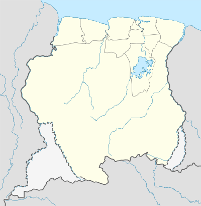 SMNI Location in Suriname | |||||||||||
| Runways | |||||||||||
| |||||||||||
Majoor Henry Fernandes Airport (Dutch: Majoor Henry Fernandes Vliegveld)[3][4] (IATA: ICK, ICAO: SMNI), also known as Nieuw Nickerie Airport,[5][6] is near Nieuw Nickerie, the capital city of the Nickerie district in Suriname. This is one of the oldest airports in Suriname, in use since 1953, when the Piper Cub (PZ-NAC) of Kappel-van Eyck named "Colibri" landed there from Zorg en Hoop Airport.
Charters and destinations, Crop dusting
Charter Airlines & Crop Dusting companies serving this airport are:
| Airlines | Destinations |
|---|---|
| Aero Club Suriname | Paramaribo, Zorg en Hoop Airport |
| Blue Wing Airlines[7] | Paramaribo, Zorg en Hoop Airport |
| Caricom Airways[8] | Paramaribo, Zorg en Hoop Airport |
| Eagle Air Service | Nickerie, Major Fernandes Airfield |
| ERK Farms | Saramacca, Henri Alwies Airstrip |
| Gum Air[9] | Paramaribo, Zorg en Hoop Airport |
| Hi-Jet Helicopter Services[10] | Paramaribo, Zorg en Hoop Airport |
| Kuyake Aviation Academy[11] | Paramaribo, Zorg en Hoop Airport |
| Suriname Air Force / Surinaamse Luchtmacht | Paramaribo, Zorg en Hoop Airport |
| Overeem Air Service (OAS) | Nickerie, Major Fernandes Airfield |
| Pegasus Air Services[12] | Paramaribo, Zorg en Hoop Airport |
| Surinam Sky Farmers | Nickerie, Wageningen Airport |
See also
 Suriname portal
 Aviation portal
- List of airports in Suriname
- Transport in Suriname
References
- ↑ Airport information for ICK at Great Circle Mapper.
- ↑ Google Maps - Nieuw Nickerie
- ↑ "Nickerianen nemen massaal afscheid van Lachmon" (in Dutch). Nickerie.Net. 25 October 2001.
- ↑ "Weg naar vliegveld Nickerie wordt alvast geëgaliseerd" (in Dutch). Dagblad Suriname. 26 August 2005.
- ↑ Airport information for SMNI at Great Circle Mapper.
- ↑ Accident history for ICK at Aviation Safety Network
- ↑ Blue Wing schedule
- ↑ Caricom destinations Archived September 14, 2013, at the Wayback Machine.
- ↑ Gum Air destinations
- ↑ Hi Jet Helicopters Archived December 19, 2014, at the Wayback Machine.
- ↑ Kuyake Aviation Academy Archived December 26, 2015, at the Wayback Machine.
- ↑ http://www.pegasus.sr/
External links
This article is issued from Wikipedia - version of the 12/4/2016. The text is available under the Creative Commons Attribution/Share Alike but additional terms may apply for the media files.