Maine State Route 16
| ||||
|---|---|---|---|---|
| Route information | ||||
| Maintained by MaineDOT | ||||
| Length: | 190.61 mi[1] (306.76 km) | |||
| Major junctions | ||||
| West end: |
| |||
|
| ||||
| East end: |
| |||
| Location | ||||
| Counties: | Oxford, Franklin, Somerset, Piscataquis, Penobscot | |||
| Highway system | ||||
| ||||

State Route 16 is a numbered state highway in Maine, United States. SR-16 runs from the New Hampshire state line (signed as NH-16) at Wentworth's Junction (near Lake Aziscohos) in the west to Orono at the eastern terminus. State Route 16 runs a total of 190 miles (310 km), passing mostly through rural areas, with the largest population center at its eastern terminus in Orono at I-95.
Route 16 follows a rather circuitous route between the two states, originating in Portsmouth, New Hampshire, at Interstate 95, and re-intersecting Interstate 95 some 350 miles (560 km) later in Orono.


History
As originally designated, SR 16 crossed the state from Haines Landing to New Brunswick. In 1936, it was rerouted to extend west from Oquossoc to the New Hampshire border. In 1949, the route was truncated to Milo, but, in 1955, it was extended to its current eastern terminus in Orono.[1]
Route description
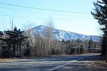
SR 16 begins at the western border of the state in Magalloway Plantation. It then takes a northeasterly route through Oxford County, passing through Rangeley along the way. In Eustis, the route turns southeasterly along with SR 27 into Piscataquis County. It then takes a northwards jog parallelling US 201 before crossing it in Bingham and turning eastwards. This eastwards direction continues until the route reaches Milo, where it turns southward once again to its terminus in Orono.[2]
Major intersections
| County | Location[2] | mi[3] | km | Destinations | Notes |
|---|---|---|---|---|---|
| Oxford | Magalloway Plantation | 0.0 | 0.0 | Maine-New Hampshire state line | |
| Franklin | Rangeley | 26.8 | 43.1 | Begin SR 4 concurrency | |
| 33.2 | 53.4 | End SR 4 concurrency | |||
| Eustis | 51.8 | 83.4 | Begin SR 27 concurrency | ||
| Kingfield | 74.9 | 120.5 | Terminus of SR 142 | ||
| 74.9 | 120.5 | End SR 27 concurrency | |||
| Somerset | New Portland | 82.3 | 132.4 | Terminus of SR 146 | |
| Anson | 90.9 | 146.3 | Begin US 201A/SR 8 concurrency | ||
| Embden | 97.7 | 157.2 | End US 201A/SR 8 concurrency | ||
| Bingham | 106.8 | 171.9 | Begin US 201 concurrency | ||
| 107.4 | 172.8 | End US 201 concurrency | |||
| Mayfield Township | 117.8 | 189.6 | Terminus of SR 151 | ||
| Piscataquis | Abbot | 131.5 | 211.6 | Begin SR 6/SR 15 concurrency | |
| Guilford | 135.9 | 218.7 | Begin SR 150 concurrency | ||
| 136.3 | 219.4 | End SR 150 concurrency | |||
| 137.3 | 221.0 | Terminus of SR 23 | |||
| Dover-Foxcroft | 144.0 | 231.7 | End SR 15 concurrency | ||
| 144.0 | 231.7 | Terminus of SR 143 | |||
| Milo | 157.1 | 252.8 | Begin SR 11 concurrency | ||
| 159.3 | 256.4 | End SR 11 concurrency | |||
| Penobscot | Lagrange | 166.9 | 268.6 | End SR 6 concurrency | |
| Old Town | 181.1 | 291.5 | Exit 199 | ||
| 181.9 | 292.7 | Terminus of SR 116 | |||
| 184.2 | 296.4 | ||||
| Orono | 190.6 | 306.7 | Eastern terminus of SR 16 | ||
1.000 mi = 1.609 km; 1.000 km = 0.621 mi
| |||||
References
- 1 2 Kaiser, Cameron (2010). "Maine State Route 16". Floodgap Roadgap's RoadsAroundME. Retrieved 27 December 2014.
- 1 2 MaineDOT Map Viewer (Map). MaineDOT. Retrieved 27 December 2014.
- ↑ Google (28 December 2014). "Overview map of SR 16" (Map). Google Maps. Google. Retrieved 28 December 2014.