Mahtowa, Minnesota
| Mahtowa, Minnesota | |
|---|---|
| Census-designated place (CDP) and Unincorporated community | |
 Mahtowa, Minnesota Location of the community of Mahtowa | |
| Coordinates: 46°34′26″N 92°37′55″W / 46.57389°N 92.63194°WCoordinates: 46°34′26″N 92°37′55″W / 46.57389°N 92.63194°W | |
| Country | United States |
| State | Minnesota |
| County | Carlton County |
| Township | Mahtowa Township |
| Area[1] | |
| • Total | 10.601 sq mi (27.46 km2) |
| • Land | 10.592 sq mi (27.43 km2) |
| • Water | 0.009 sq mi (0.02 km2) |
| Elevation | 1,152 ft (351 m) |
| Population (2010)[2] | |
| • Total | 370 |
| • Density | 35/sq mi (13/km2) |
| ZIP code | 55707 |
| Area code(s) | 218 |
| GNIS feature ID | 0647392 |
Mahtowa is an unincorporated community and census-designated place (CDP) in Mahtowa Township, Carlton County, Minnesota, United States. As of the 2010 census, its population was 370.[2]
The community is located between Cloquet and Moose Lake, near the junction of Interstate 35 and Carlton County Road 4.
County Road 4 and County Road 61 are two of the main routes in Mahtowa.
Mahtowa is located 13 miles southwest of Cloquet. Mahtowa is located 11 miles northeast of Moose Lake; and 32 miles southwest of Duluth.
References
- ↑ "US Gazetteer files: 2010, 2000, and 1990". United States Census Bureau. 2011-02-12. Retrieved 2011-04-23.
- 1 2 "American FactFinder". United States Census Bureau. Retrieved 2011-05-14.
Further reading
- Rand McNally Road Atlas – 2007 edition – Minnesota entry
- Official State of Minnesota Highway Map – 2011/2012 edition
- Mn/DOT map of Carlton County – 2012 edition
Municipalities and communities of Carlton County, Minnesota, United States | ||
|---|---|---|
| Cities | 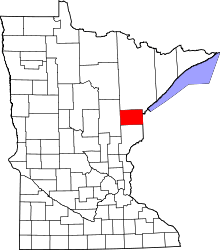 | |
| Townships | ||
| CDPs | ||
| Unorganized territories | ||
| Unincorporated communities | ||
| Indian reservations | ||
| Footnotes | ‡This populated place also has portions in an adjacent county or counties | |
This article is issued from Wikipedia - version of the 9/19/2014. The text is available under the Creative Commons Attribution/Share Alike but additional terms may apply for the media files.