Lyuban (town), Leningrad Oblast
| Lyuban (English) Любань (Russian) | |
|---|---|
| - Town[1] - | |
|
| |
.svg.png) Location of Leningrad Oblast in Russia | |
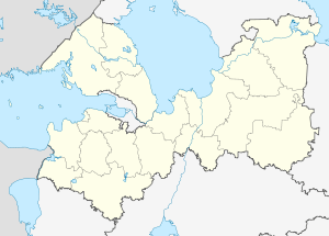 Lyuban | |
|
| |
| Administrative status (as of June 2013) | |
| Country | Russia |
| Federal subject | Leningrad Oblast[1] |
| Administrative district | Tosnensky District[1] |
| Settlement municipal formation | Lyubanskoye Settlement Municipal Formation[1] |
| Administrative center of | Lyubanskoye Settlement Municipal Formation[1] |
| Municipal status (as of May 2010) | |
| Municipal district | Tosnensky Municipal District[2] |
| Urban settlement | Lyubanskoye Urban Settlement[2] |
| Administrative center of | Lyubanskoye Urban Settlement[2] |
| Statistics | |
| Population (2010 Census) | 4,188 inhabitants[3] |
| Time zone | MSK (UTC+03:00)[4] |
| First mentioned | 15th century[5] |
| Town status since | June 3, 1917[6] |
| Previous names | Lyuban-Gorka (until June 3, 1917)[6] |
| Postal code(s)[7] | 187050 |
| Lyuban on Wikimedia Commons | |
Lyuban (Russian: Любань; IPA: [lʲʊˈbanʲ]) is a town in Tosnensky District of Leningrad Oblast, Russia, located on the Tigoda River 85 kilometers (53 mi) southeast of St. Petersburg. Population: 4,188 (2010 Census);[3] 4,616 (2002 Census);[8] 5,078 (1989 Census).[9]
History
It was first mentioned in the 15th century as a trade settlement.[5] In 1851, a railway station was built and the development of the settlement of Lyuban-Gorka (Любань-Горка), serving the railway station started. On June 3, 1917, Lyuban-Gorka was granted town status and renamed Lyuban.[6] Lyuban was a part of Novgorodsky Uyezd of Novgorod Governorate.[6]
On August 1, 1927, the uyezds were abolished and Lyubansky District, with the administrative center in Lyuban, was established.[6] The governorates were also abolished and the district became a part of Leningrad Okrug of Leningrad Oblast.[10] On August 15, 1930, the okrugs were abolished as well and the districts were directly subordinated to the oblast.[11] On August 19, 1930, Lyubansky District was abolished and Lyuban became a part of newly established Tosnensky District.[10] Between September 1941 and January 1944, during World War II, Lyuban was occupied by German troops.[12]
Administrative and municipal status
Within the framework of administrative divisions, it is, together with twenty-five rural localities, incorporated within Tosnensky District as Lyubanskoye Settlement Municipal Formation.[1] As a municipal division, Lyubanskoye Settlement Municipal Formation is incorporated within Tosnensky Municipal District as Lyubanskoye Urban Settlement.[2]
Economy
Industry
The main industrial enterprise is a lumber plant.[5]
Transportation

The Saint Petersburg – Moscow Railway and the M10 Highway, connecting Moscow and St. Petersburg, run through the town. Lyuban is also connected by roads with Luga and with Kirovsk via Mga.
Culture and recreation
Lyuban contains two cultural heritage monuments of federal significance and additionally eight objects classified as cultural and historical heritage of local significance.[13] The federal monuments are the tombs of Pavel Melnikov and Alexey Bolotov, engineers coordinating the construction of the railway. The tomb of painter Andrei Ryabushkin at the same cemetery is protected as a cultural monument of local significance.
References
Notes
- 1 2 3 4 5 6 Oblast Law #32-oz
- 1 2 3 4 Law #116-oz
- 1 2 Russian Federal State Statistics Service (2011). "Всероссийская перепись населения 2010 года. Том 1" [2010 All-Russian Population Census, vol. 1]. Всероссийская перепись населения 2010 года (2010 All-Russia Population Census) (in Russian). Federal State Statistics Service. Retrieved June 29, 2012.
- ↑ Правительство Российской Федерации. Федеральный закон №107-ФЗ от 3 июня 2011 г. «Об исчислении времени», в ред. Федерального закона №271-ФЗ от 03 июля 2016 г. «О внесении изменений в Федеральный закон "Об исчислении времени"». Вступил в силу по истечении шестидесяти дней после дня официального опубликования (6 августа 2011 г.). Опубликован: "Российская газета", №120, 6 июня 2011 г. (Government of the Russian Federation. Federal Law #107-FZ of June 31, 2011 On Calculating Time, as amended by the Federal Law #271-FZ of July 03, 2016 On Amending Federal Law "On Calculating Time". Effective as of after sixty days following the day of the official publication.).
- 1 2 3 Энциклопедия Города России. Moscow: Большая Российская Энциклопедия. 2003. p. 247. ISBN 5-7107-7399-9.
- 1 2 3 4 5 Снытко, О. В.; et al. (2009). С. Д. Трифонов; Т. Б. Чуйкова; Л. В. Федина; А. Э. Дубоносова, eds. Административно-территориальное деление Новгородской губернии и области 1727–1995 гг. Справочник (PDF) (in Russian). Saint Petersburg. p. 32, 72, 251. Retrieved March 14, 2014.
- ↑ Почта России. Информационно-вычислительный центр ОАСУ РПО. (Russian Post). Поиск объектов почтовой связи (Postal Objects Search) (Russian)
- ↑ Russian Federal State Statistics Service (May 21, 2004). "Численность населения России, субъектов Российской Федерации в составе федеральных округов, районов, городских поселений, сельских населённых пунктов – районных центров и сельских населённых пунктов с населением 3 тысячи и более человек" [Population of Russia, Its Federal Districts, Federal Subjects, Districts, Urban Localities, Rural Localities—Administrative Centers, and Rural Localities with Population of Over 3,000] (XLS). Всероссийская перепись населения 2002 года [All-Russia Population Census of 2002] (in Russian). Retrieved August 9, 2014.
- ↑ Demoscope Weekly (1989). "Всесоюзная перепись населения 1989 г. Численность наличного населения союзных и автономных республик, автономных областей и округов, краёв, областей, районов, городских поселений и сёл-райцентров" [All Union Population Census of 1989: Present Population of Union and Autonomous Republics, Autonomous Oblasts and Okrugs, Krais, Oblasts, Districts, Urban Settlements, and Villages Serving as District Administrative Centers]. Всесоюзная перепись населения 1989 года [All-Union Population Census of 1989] (in Russian). Институт демографии Национального исследовательского университета: Высшая школа экономики [Institute of Demography at the National Research University: Higher School of Economics]. Retrieved August 9, 2014.
- 1 2 Любанский район (август 1927 г. - август 1930 г.) (in Russian). Система классификаторов исполнительных органов государственной власти Санкт-Петербурга. Retrieved March 13, 2014.
- ↑ Ленинградская область (in Russian). Справочник по истории Коммунистической партии и Советского Союза 1898–1991. Retrieved March 14, 2014.
- ↑ Тосненский район (август 1930 г.) (in Russian). Система классификаторов исполнительных органов государственной власти Санкт-Петербурга. Retrieved March 13, 2014.
- ↑ Памятники истории и культуры народов Российской Федерации (in Russian). Russian Ministry of Culture. Retrieved 2 June 2016.
Sources
- Законодательное собрание Ленинградской области. Областной закон №32-оз от 15 июня 2010 г. «Об административно-территориальном устройстве Ленинградской области и порядке его изменения», в ред. Областного закона №23-оз от 8 мая 2014 г. «Об объединении муниципальных образований "Приморское городское поселение" Выборгского района Ленинградской области и "Глебычевское сельское поселение" Выборгского района Ленинградской области и о внесении изменений в отдельные Областные законы». Вступил в силу со дня официального опубликования. Опубликован: "Вести", №112, 23 июня 2010 г. (Legislative Assembly of Leningrad Oblast. Oblast Law #32-oz of June 15, 2010 On the Administrative-Territorial Structure of Leningrad Oblast and on the Procedures for Its Change, as amended by the Oblast Law #23-oz of May 8, 2014 On Merging the Municipal Formations of "Primorskoye Urban Settlement" in Vyborgsky District of Leningrad Oblast and "Glebychevskoye Rural Settlement" in Vyborgsky District of Leningrad Oblast and on Amending Various Oblast Laws. Effective as of the day of the official publication.).
- Законодательное собрание Ленинградской области. Областной закон №116-оз от 22 декабря 2004 г. «Об установлении границ и наделении соответствующим статусом муниципального образования Тосненский муниципальный район и муниципальных образований в его составе», в ред. Областного закона №17-оз от 6 мая 2010 г «О внесении изменений в некоторые областные законы в связи с принятием федерального закона "О внесении изменений в отдельные законодательные акты Российской Федерации в связи с совершенствованием организации местного самоуправления"». Вступил в силу через 10 дней со дня официального опубликования (9 января 2005 г.). Опубликован: "Вестник Правительства Ленинградской области", №44, 30 декабря 2004 г. (Legislative Assembly of Leningrad Oblast. Oblast Law #116-oz of December 22, 2004 On Establishing the Borders of and Granting an Appropriate Status to the Municipal Formation of Tosnensky Municipal District and to the Municipal Formations It Comprises, as amended by the Oblast Law #17-oz of May 6, 2010 On Amending Various Oblast Laws Due to the Adoption of the Federal Law "On Amending Various Legislative Acts of the Russian Federation Due to the Improvement of the Organization of the Local Self-Government". Effective as of after 10 days from the day of the official publication (January 9, 2005).).
Administrative center: none | |||
| Cities and towns |
| ||
| Districts | |||