Lyons Falls, New York
| Lyons Falls, New York High Falls, Lyon's Falls[1] | |
|---|---|
| Village | |
 Lyons Falls, New York Location within the state of New York | |
| Coordinates: 43°37′1″N 75°21′42″W / 43.61694°N 75.36167°WCoordinates: 43°37′1″N 75°21′42″W / 43.61694°N 75.36167°W | |
| Country | United States |
| State | New York |
| County | Lewis |
| Towns | West Turin, Lyonsdale |
| Area | |
| • Total | 1.1 sq mi (2.8 km2) |
| • Land | 1.0 sq mi (2.5 km2) |
| • Water | 0.1 sq mi (0.2 km2) |
| Elevation | 830 ft (253 m) |
| Population (2010) | |
| • Total | 566 |
| Time zone | Eastern (EST) (UTC-5) |
| • Summer (DST) | EDT (UTC-4) |
| ZIP code | 13368 |
| Area code(s) | 315 |
| FIPS code | 36-44006 |
| GNIS feature ID | 956202[1] |
Lyons Falls is a village in Lewis County, New York, United States. The population was 566 at the 2010 census.
The Village of Lyons Falls is on the border of the Town of West Turin and the Town of Lyonsdale. It is at the junction of NYS Route 12 and NYS Route 12D, about 15 miles (24 km) south of Lowville, the county seat.
History
The village was at the northern end of the Black River Canal, when it was completed in 1858.
The Forest Presbyterian Church, Gould Mansion Complex, and The Pines are listed on the National Register of Historic Places.[2] The Wildwood Cemetery and Mary Lyon Fisher Memorial Chapel was added in 2011.[3]
Geography
Lyons Falls is located at 43°37′1″N 75°21′42″W / 43.61694°N 75.36167°W (43.616984, -75.361750).[4]
According to the United States Census Bureau, the village has a total area of 1.1 square miles (2.8 km2), of which 1.0 square mile (2.6 km2) is land and 0.1 square miles (0.26 km2) (8.41%) is water.
The Black River flows through the village and is joined by the Moose River.
Demographics
| Historical population | |||
|---|---|---|---|
| Census | Pop. | %± | |
| 1900 | 470 | — | |
| 1910 | 759 | 61.5% | |
| 1920 | 818 | 7.8% | |
| 1930 | 882 | 7.8% | |
| 1940 | 818 | −7.3% | |
| 1950 | 864 | 5.6% | |
| 1960 | 887 | 2.7% | |
| 1970 | 852 | −3.9% | |
| 1980 | 755 | −11.4% | |
| 1990 | 698 | −7.5% | |
| 2000 | 591 | −15.3% | |
| 2010 | 566 | −4.2% | |
| Est. 2015 | 565 | [5] | −0.2% |
As of the census[7] of 2000, there were 591 people, 238 households, and 157 families residing in the village. The population density was 602.1 people per square mile (232.8/km²). There were 294 housing units at an average density of 299.5 per square mile (115.8/km²). The racial makeup of the village was 98.82% White, 0.68% from other races, and 0.51% from two or more races. Hispanic or Latino of any race were 0.17% of the population.
There were 238 households out of which 26.9% had children under the age of 18 living with them, 48.7% were married couples living together, 11.8% had a female householder with no husband present, and 34.0% were non-families. 27.7% of all households were made up of individuals and 16.8% had someone living alone who was 65 years of age or older. The average household size was 2.48 and the average family size was 3.01.
In the village the population was spread out with 23.7% under the age of 18, 9.3% from 18 to 24, 23.5% from 25 to 44, 26.7% from 45 to 64, and 16.8% who were 65 years of age or older. The median age was 40 years. For every 100 females there were 110.3 males. For every 100 females age 18 and over, there were 100.4 males.
The median income for a household in the village was $27,375, and the median income for a family was $41,250. Males had a median income of $35,000 versus $21,071 for females. The per capita income for the village was $17,204. About 12.9% of families and 16.7% of the population were below the poverty line, including 16.2% of those under age 18 and 15.3% of those age 65 or over.
References
- 1 2 U.S. Geological Survey Geographic Names Information System: Lyons Falls, New York
- ↑ National Park Service (2010-07-09). "National Register Information System". National Register of Historic Places. National Park Service.
- ↑ "National Register of Historic Places Listings". Weekly List of Actions Taken on Properties: 6/27/11 through 7/01/11. National Park Service. 2011-07-08.
- ↑ "US Gazetteer files: 2010, 2000, and 1990". United States Census Bureau. 2011-02-12. Retrieved 2011-04-23.
- ↑ "Annual Estimates of the Resident Population for Incorporated Places: April 1, 2010 to July 1, 2015". Retrieved July 2, 2016.
- ↑ "Census of Population and Housing". Census.gov. Retrieved June 4, 2015.
- ↑ "American FactFinder". United States Census Bureau. Retrieved 2008-01-31.
Municipalities and communities of Lewis County, New York, United States | ||
|---|---|---|
| Towns | 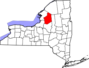 | |
| Villages | ||
| Other hamlets | ||