Ludowici, Georgia
| Ludowici, Georgia | |
|---|---|
| City | |
 Location in Long County and the state of Georgia | |
| Coordinates: 31°42′38″N 81°44′40″W / 31.71056°N 81.74444°WCoordinates: 31°42′38″N 81°44′40″W / 31.71056°N 81.74444°W | |
| Country | United States |
| State | Georgia |
| County | Long |
| Area | |
| • Total | 2.2 sq mi (5.7 km2) |
| • Land | 2.2 sq mi (5.7 km2) |
| • Water | 0 sq mi (0 km2) |
| Elevation | 66 ft (20 m) |
| Population (2010) | |
| • Total | 1,703 |
| • Density | 654.5/sq mi (252.6/km2) |
| Time zone | Eastern (EST) (UTC-5) |
| • Summer (DST) | EDT (UTC-4) |
| ZIP code | 31316 |
| Area code(s) | 912 |
| FIPS code | 13-47784[1] |
| GNIS feature ID | 0356371[2] |
Ludowici (pronounced "Loo'duh-wi'-see") is a city in Long County, Georgia, United States. The population was 1,440 at the 2000 census. The city is the county seat of Long County.[3] It is a part of the Hinesville-Fort Stewart metropolitan statistical area.
The town, which was originally called Johnston Station, had its beginnings in the 1840s when the Atlantic and Gulf Railroad established a stop referred to as "Four and a Half".[4] The station was constructed across from the house of a landowner named Allen Johnston.
The Long County Courthouse and Ludowici Well Pavilion are listed on the National Register of Historic Places listings in Long County, Georgia.
History
In 1904, German entrepreneur Carl Ludowici built the “Dixie” plant for the Ludowici Roofing Tile Co., in Johnson Station.[5][6] In 1905, when the town erected a new high school, the Ludowici family donated towards its construction costs and provided the roofing tile. In return, on August 23, 1905 the town was renamed and incorporated as Ludowici.
The Ludowici Dixie Plant in its heyday covered more than 1,100 acres and employed most people who resided in Long County. Tiles manufactured from this plant were stamped "Ludowici Dixie”. "Dixie" tile can still be found throughout Georgia and Florida, on such prominent buildings as the U.S. Federal Building in Savannah and Flagler College in St. Augustine, Florida,[7] as well as numerous homes in Ludowici and the surrounding communities. The plant closed in 1914.[7] The Ludowici Roof Tile Company stills exists but the company's plant is in New Lexington, Ohio.
Before interstate highways were constructed, all motorists traveled on regular U.S. highways. Ludowici was at the crossroads of three U.S. highways, Routes 25, 82 and 301.
The city gained notoriety during the 1950s and 1960s for its aggressive traffic enforcement policies. The AAA went so far as to specifically label Ludowici as a speed trap. Members of the local police force were allegedly engaging in manipulation of the timing of the traffic signal downtown, so as to catch unsuspecting out-of-area motorists 'running' a suddenly changed red light. The switch for the stop light was located in the barber shop. The traffic light was at an intersection that was bypassed by a shortcut (Main Street - see a local map) so that local residents would not even come to the light when making the turn at the light. Thus, all the tickets went to nonresidents without the police having to be selective since no locals would be at the light.
This activity subsequently came to an end, when then-Governor Lester Maddox stated that the practices of the Ludowici police were giving the entire state a bad reputation. Word of mouth and media exposure caused many motorists to detour around Ludowici. A 1970 TIME article said that Ludowici was "one of the last remaining speed traps in the country."[6]
Geography
According to the United States Census Bureau, Ludowici has a total area of 2.2 square miles (5.8 km²), of which 2.2 square miles (5.7 km²) is land and 0.45% is water.
Ludowici, in southeast Georgia,[6] is located 30 miles (48 km) from the coast and is nestled between the Georgia towns of Jesup, Darien, Hinesville/Ft. Stewart, and Glennville.
Demographics
| Historical population | |||
|---|---|---|---|
| Census | Pop. | %± | |
| 1910 | 541 | — | |
| 1920 | 515 | −4.8% | |
| 1930 | 615 | 19.4% | |
| 1940 | 866 | 40.8% | |
| 1950 | 1,332 | 53.8% | |
| 1960 | 1,578 | 18.5% | |
| 1970 | 1,419 | −10.1% | |
| 1980 | 1,286 | −9.4% | |
| 1990 | 1,291 | 0.4% | |
| 2000 | 1,440 | 11.5% | |
| 2010 | 1,703 | 18.3% | |
| Est. 2015 | 2,081 | [8] | 22.2% |
As of the census[1] of 2000, there were 1,440 people, 526 households, and 370 families residing in the city. The population density was 649.0 people per square mile (250.4/km²). There were 636 housing units at an average density of 286.6 per square mile (110.6/km²). The racial makeup of the city was 72.78% White, 23.82% African American, 1.18% Native American, 0.14% Asian, 0.14% Pacific Islander, 1.25% from other races, and 0.69% from two or more races. Hispanic or Latino of any race were 3.9% of the population.
There were 526 households out of which 41.3% had children under the age of 18 living with them, 46.4% were married couples living together, 19.2% had a female householder with no husband present, and 29.5% were non-families. 24.1% of all households were made up of individuals and 11.6% had someone living alone who was 65 years of age or older. The average household size was 2.74 and the average family size was 3.27.
In the city the population was spread out with 33.6% under the age of 18, 11.7% from 18 to 24, 27.4% from 25 to 44, 16.6% from 45 to 64, and 10.7% who were 65 years of age or older. The median age was 28 years. For every 100 females there were 95.4 males. For every 100 females age 18 and over, there were 87.5 males.
The median income for a household in the city was $27,386, and the median income for a family was $28,792. Males had a median income of $25,272 versus $16,250 for females. The per capita income for the city was $11,701. About 18.5% of families and 18.1% of the population were below the poverty line, including 22.9% of those under age 18 and 15.8% of those age 65 or over.
Education
Long County School District
The Long County School District holds pre-school to grade twelve, and consists of two elementary schools, a middle school, and a high school.[10] The district has 119 full-time teachers and over 3,285 students.[11]
- Smiley Elementary School
- Walker Elementary School
- Long County Middle School
- Long County High School
Private education
- Faith Baptist Christian School[12]
References
- 1 2 "American FactFinder". United States Census Bureau. Retrieved 2008-01-31.
- ↑ "US Board on Geographic Names". United States Geological Survey. 2007-10-25. Retrieved 2008-01-31.
- ↑ "Find a County". National Association of Counties. Retrieved 2011-06-07.
- ↑ “”.
- ↑ “”.
- 1 2 3 "American Scene: Ludowici, Ga." TIME. Monday April 27, 1970. Retrieved on March 3, 2012.
- 1 2 name="New Georgia Encyclopedia">“”
- ↑ "Annual Estimates of the Resident Population for Incorporated Places: April 1, 2010 to July 1, 2015". Retrieved July 2, 2016.
- ↑ "Census of Population and Housing". Census.gov. Retrieved June 4, 2015.
- ↑ Georgia Board of Education, Retrieved June 23, 2010.
- ↑ School Stats, Retrieved June 23, 2010.
- ↑ Faith Baptist Christian Academy, Retrieved June 23, 2010.
External links
- City of Ludowici webpage
- Billboard placed by Gov. Maddox to warn motorists
- Article with a possible real ref
- Time article 1959
- Ludowici Roof Tile website
- History of Ludowici-Celadon, Inc.
- New Georgia Encyclopedia article
- Vanishing South Georgia
Municipalities and communities of Long County, Georgia, United States | ||
|---|---|---|
| City | 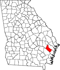 | |
| Unincorporated community | ||