Los Vilos
| Los Vilos | ||||
|---|---|---|---|---|
| City and Commune | ||||
| ||||
| Coordinates (city): 31°55′S 71°31′W / 31.917°S 71.517°WCoordinates: 31°55′S 71°31′W / 31.917°S 71.517°W | ||||
| Country |
| |||
| Region |
| |||
| Province | Choapa | |||
| Founded | 1835 | |||
| Declared Harbor | 1855 | |||
| Government[1] | ||||
| • Type | Municipality | |||
| Area[2] | ||||
| • Total | 1,860.6 km2 (718.4 sq mi) | |||
| Elevation | 11 m (36 ft) | |||
| Population (2012 Census)[2] | ||||
| • Total | 18,275 | |||
| • Density | 9.8/km2 (25/sq mi) | |||
| • Urban | 12,859 | |||
| • Rural | 4,594 | |||
| Demonym(s) | vileño(a) | |||
| Sex[2] | ||||
| • Men | 8,858 | |||
| • Women | 8,595 | |||
| Time zone | CLT (UTC−4) | |||
| • Summer (DST) | CLST (UTC−3) | |||
| Area code(s) | 56 + 53 | |||
| Website | Municipality of Los Vilos | |||
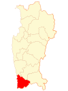
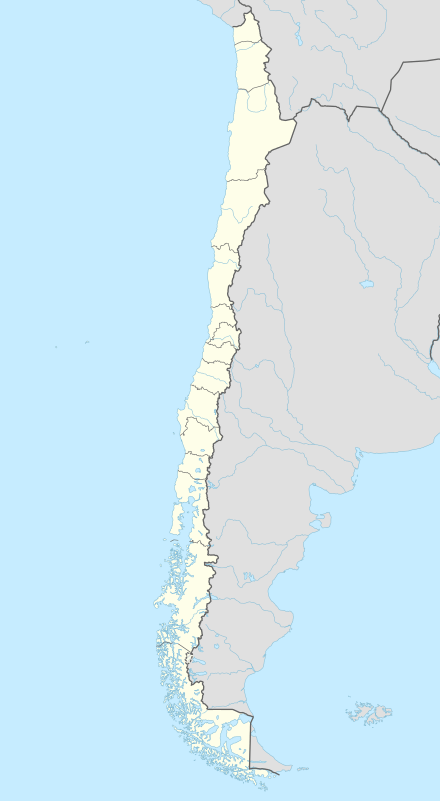
Los Vilos is both a Chilean coastal commune and a coastal city with over 9,000 inhabitants (18,275 in comuna[2]), located in the Province of Choapa, part of the IV Region of Coquimbo. Its main activity is fishing. The city also has a significant amount of tourism, mainly due to its two beaches: La Principal and Las Conchas. It is located at 246 kilometres (153 mi) from La Serena and 246 kilometres (153 mi) from Santiago.
The city was founded in 1830, and was declared a minor harbor in 1855. As of 2009, the city is still an important harbor.
Name
The name Los Vilos comes from the Mapudungún word vilo which means snake.
History
Los Vilos has existed as a small informal settlement since 1835, when the government realised that a port was needed in that region to expand the reach of commerce in the country. On January 3, 1855, it was declared a minor port by then president, Manuel Montt and by his Minister of Finance, José María Berganza, through a supreme decree of the Finance Ministry.[3]
On April of that same year a permission was granted by the government to start the construction of a dock, warehouses and commerce related buildings. On December 1857, it was determined that a town needed to be built so 25 blocks, that used to belong to the Conchali Hacienda, were designed and sold by Hernán Jequier as a public utility. The town was located around the small pre-existing settlement.
The port responded to the need to regulate the commerce in the area, so a customs office, that depended on the Valparaiso custom, was created. The economy of Los Vilos initially depended largely on commerce.
Demographics
According to the 2002 census of the National Statistics Institute, Los Vilos spans an area of 1,860.6 km2 (718 sq mi) and has 17,453 inhabitants (8,858 men and 8,595 women). Of these, 12,859 (73.7%) lived in urban areas and 4,594 (26.3%) in rural areas. The population grew by 10.4% (1,648 persons) between the 1992 and 2002 censuses.[2]
Administration
As a commune, Los Vilos is a third-level administrative division of Chile administered by a municipal council, headed by an alcalde who is directly elected every four years.[1]
Within the electoral divisions of Chile, Los Vilos is represented in the Chamber of Deputies by Mrs. Adriana Muñoz (PDC) and Mr. Luis Lemus (Ind.) as part of the 9th electoral district, (together with Combarbalá, Punitaqui, Monte Patria, Illapel, Salamanca and Canela). The commune is represented in the Senate by Adriana Muñoz (PPD) and Jorge Pizarro Soto (PDC) as part of the 4th senatorial constituency (Coquimbo Region).
Tourism
The comuna has a considerable amount of tourism, in both the Los Vilos City, and in the small coastal town of Pichidangui.[4]
References
- 1 2 "Municipality of Los Vilos" (in Spanish). Retrieved 13 November 2010.
- 1 2 3 4 5 "National Statistics Institute" (in Spanish). Retrieved 10 November 2010.
- ↑ Turismo Chile
- ↑ http://www.turlosvilos.cl/sitio/caimanes.htm Sitio Web Turístico Comuna de Los Vilos
External links
- (Spanish) Municipality of Los Vilos
