Loring, Alaska
| Loring, Alaska, Naha Bay | |
|---|---|
| Census-designated place | |
 Loring Location of Loring, Alaska | |
| Coordinates: 55°36′11″N 131°38′13″W / 55.60306°N 131.63694°W | |
| Country | United States |
| State | Alaska |
| Borough | Ketchikan Gateway |
| Government | |
| • Borough mayor | David Landis[1] |
| • State senator | Bert Stedman (R) |
| • State rep. | Dan Ortiz (I) |
| Area | |
| • Total | 0.6 sq mi (1.6 km2) |
| • Land | 0.5 sq mi (1.4 km2) |
| • Water | 0.08 sq mi (0.2 km2) |
| Population (2010) | |
| • Total | 4 - 30 varies with the season |
| • Density | 7/sq mi (2.8/km2) |
| FIPS code | 02-45020 |
Loring The official website for the community is www.loringalaska.info www.loringalaska.info created in 2000 to share history,community and area information. Loring was established in 1885 with the first post office in the District of Alaska and is a census-designated place (CDP) in Ketchikan Gateway Borough in the U.S. state of Alaska. The population was 4 at the 2010 census.Though this varies with the season when the population is around 50 in the summer months. [2]
Located due north of downtown Ketchikan on Revillagigedo Island, Loring was once Ketchikan's rival as the service center for the area's fishing and timber industries.
Geography
.jpg)
Loring is located at 55°36′11″N 131°38′13″W / 55.60306°N 131.63694°W, on the western shore of Revillagigedo Island, approximately 15 miles (24 km) north of Ketchikan as the crow flies. It is located on the northern shore of Naha Bay, an arm of Behm Canal.
According to the United States Census Bureau, the CDP has a total area of 0.62 square miles (1.6 km2), of which 0.54 square miles (1.4 km2) is land and 0.077 square miles (0.2 km2), or 12.27%, is water.[2]
References
- ↑ 2015 Alaska Municipal Officials Directory. Juneau: Alaska Municipal League. 2015. p. 10.
- 1 2 "Geographic Identifiers: 2010 Demographic Profile Data (G001): Loring CDP, Alaska". U.S. Census Bureau, American Factfinder. Retrieved March 26, 2013.
Municipalities and communities of Ketchikan Gateway Borough, Alaska, United States | ||
|---|---|---|
| Cities | 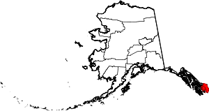 | |
| CDPs | ||
| Unincorporated community | ||
| Ghost towns | ||
Hyder is an exclave of the Ketchikan Gateway Borough and is located in the Prince of Wales–Hyder Census Area. | ||