Long Prairie, Minnesota
| City of Long Prairie | |
|---|---|
| City | |
|
Central Avenue in downtown Long Prairie in 2007 | |
| Motto: "Expanding Our Horizons" | |
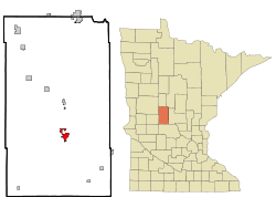 Location of Long Prairie within Todd County and state of Minnesota | |
| Coordinates: 45°58′29″N 94°51′56″W / 45.97472°N 94.86556°W | |
| Country | United States |
| State | Minnesota |
| County | Todd |
| Area[1] | |
| • Total | 2.67 sq mi (6.92 km2) |
| • Land | 2.61 sq mi (6.76 km2) |
| • Water | 0.06 sq mi (0.16 km2) |
| Elevation | 1,293 ft (394 m) |
| Population (2010)[2] | |
| • Total | 3,458 |
| • Estimate (2012[3]) | 3,409 |
| • Density | 1,324.9/sq mi (511.5/km2) |
| Time zone | CST (UTC-6) |
| • Summer (DST) | CDT (UTC-5) |
| ZIP code | 56347 |
| Area code(s) | 320 |
| FIPS code | 27-38060[4] |
| GNIS feature ID | 0647139[5] |
| Website | www.longprairie.net |

Long Prairie is a city in Todd County, Minnesota, United States. The population was 3,458 at the 2010 census.[6] It is the county seat.[7]
Geography
According to the United States Census Bureau, the city has a total area of 2.67 square miles (6.92 km2); 2.61 square miles (6.76 km2) is land and 0.06 square miles (0.16 km2) is water.[1] The Long Prairie River flows through the city.[8]
U.S. Highway 71 and Minnesota State Highways 27 and 287 are three of the main routes in the city.
History

Long Prairie's history dates back to the time when the land was inhabited first by the Sioux/Dakota and then Anishinaabe/ Ojibwe Native American tribes. In 1845, the U.S. government selected the location known as Long Prairie as a site for a USA Indian agency.[9]
Long Prairie was platted in 1867, and named after the Long Prairie River.[10]
Demographics
| Historical population | |||
|---|---|---|---|
| Census | Pop. | %± | |
| 1880 | 220 | — | |
| 1900 | 1,885 | — | |
| 1910 | 1,250 | −33.7% | |
| 1920 | 1,346 | 7.7% | |
| 1930 | 1,854 | 37.7% | |
| 1940 | 2,311 | 24.6% | |
| 1950 | 2,443 | 5.7% | |
| 1960 | 2,414 | −1.2% | |
| 1970 | 2,416 | 0.1% | |
| 1980 | 2,859 | 18.3% | |
| 1990 | 2,786 | −2.6% | |
| 2000 | 3,040 | 9.1% | |
| 2010 | 3,458 | 13.8% | |
| Est. 2015 | 3,347 | [11] | −3.2% |
| U.S. Decennial Census | |||
2010 census
As of the census[2] of 2010, there were 3,458 people, 1,290 households, and 816 families residing in the city. The population density was 1,324.9 inhabitants per square mile (511.5/km2). There were 1,391 housing units at an average density of 533.0 per square mile (205.8/km2). The racial makeup of the city was 81.8% White, 1.0% African American, 0.6% Native American, 0.6% Asian, 1.2% Pacific Islander, 12.7% from other races, and 2.1% from two or more races. Hispanic or Latino of any race were 29.9% of the population.
There were 1,290 households of which 33.6% had children under the age of 18 living with them, 48.7% were married couples living together, 9.8% had a female householder with no husband present, 4.8% had a male householder with no wife present, and 36.7% were non-families. 32.7% of all households were made up of individuals and 18.1% had someone living alone who was 65 years of age or older. The average household size was 2.58 and the average family size was 3.29.
The median age in the city was 34.1 years. 27.8% of residents were under the age of 18; 9.6% were between the ages of 18 and 24; 24.2% were from 25 to 44; 20.3% were from 45 to 64; and 18% were 65 years of age or older. The gender makeup of the city was 48.4% male and 51.6% female.
2000 census
At the 2000 census,[4] there were 3,040 people, 1,229 households and 769 families residing in the city. The population density was 1,285.2 per square mile (495.3/km²). There were 1,334 housing units at an average density of 564.0 per square mile (217.3/km²). The racial makeup of the city was 93.06% White, 0.07% African American, 1.74% Native American, 0.10% Asian, 0.03% Pacific Islander, 4.28% from other races, and 0.72% from two or more races. Hispanic or Latino of any race were 9.38% of the population.
There were 1,229 households of which 29.6% had children under the age of 18 living with them, 48.6% were married couples living together, 9.8% had a female householder with no husband present, and 37.4% were non-families. 33.2% of all households were made up of individuals and 19.1% had someone living alone who was 65 years of age or older. The average household size was about 2.36 and the average family size was 3.01.
25.4% of residents were under the age of 18, 9.2% from 18 to 24, 24.5% from 25 to 44, 19.8% from 45 to 64, and 21.2% who were 65 years of age or older. The median age was 38 years. For every 100 females there were 88.0 males. For every 100 females age 18 and over, there were 85.1 males.
The median household income was $28,237, and the median family income was $35,699. Males had a median income of $31,359 versus $20,152 for females. The per capita income for the city was $14,386. About 13.8% of families and 16.4% of the population were below the poverty line, including 23.1% of those under age 18 and 13.5% of those age 65 or over.
Notable people
- Charles P. Davis, United States Army soldier awarded the Medal of Honor for actions during the Philippine–American War
- Jodi Huisentruit, television news anchor in Iowa who disappeared in 1995 and was later declared dead
- Tom Barnard, the host of the KQRS Morning Show and voice over artist. Born in Long Prairie, but raised in North Minneapolis, Minnesota
References
- 1 2 "US Gazetteer files 2010". United States Census Bureau. Retrieved 2012-11-13.
- 1 2 "American FactFinder". United States Census Bureau. Retrieved 2012-11-13.
- ↑ "Population Estimates". United States Census Bureau. Retrieved 2013-05-28.
- 1 2 "American FactFinder". United States Census Bureau. Retrieved 2008-01-31.
- ↑ "US Board on Geographic Names". United States Geological Survey. 2007-10-25. Retrieved 2008-01-31.
- ↑ "2010 Census Redistricting Data (Public Law 94-171) Summary File". American FactFinder. U.S. Census Bureau, 2010 Census. Retrieved 23 April 2011.
- ↑ "Find a County". National Association of Counties. Retrieved 2011-06-07.
- ↑ Minnesota Atlas & Gazetteer. Yarmouth, Me.: DeLorme. 1994. p. 45. ISBN 0-89933-222-6.
- ↑ "Ho-Chunk timeline". Ho-Chunk Nation, Wisconsin. Archived from the original on November 11, 2013. Retrieved 2012-08-28.
- ↑ Upham, Warren (1920). Minnesota Geographic Names: Their Origin and Historic Significance. Minnesota Historical Society. p. 545.
- ↑ "Annual Estimates of the Resident Population for Incorporated Places: April 1, 2010 to July 1, 2015". Retrieved July 2, 2016.
External links
| Wikimedia Commons has media related to Long Prairie, Minnesota. |
- City Website
- Long Prairie – Visitor Information site
- Long Prairie / Grey Eagle Schools site
- Long Prairie Country Club
- Prairie Fest Community Festival
Municipalities and communities of Todd County, Minnesota, United States | ||
|---|---|---|
| Cities | 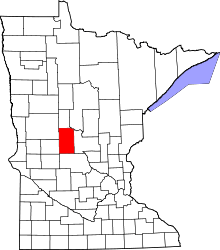 | |
| Townships | ||
| Unincorporated communities | ||
| Footnotes | ‡This populated place also has portions in an adjacent county or counties | |
Coordinates: 45°58′29″N 94°51′56″W / 45.97472°N 94.86556°W