Long Island, Andaman
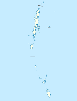 Long Island Location of Long Island | |
| Geography | |
|---|---|
| Location | Bay of Bengal |
| Coordinates | 12°23′N 92°56′E / 12.38°N 92.93°ECoordinates: 12°23′N 92°56′E / 12.38°N 92.93°E |
| Archipelago | Andaman Islands |
| Adjacent bodies of water | Indian Ocean |
| Total islands | 1 |
| Major islands |
|
| Area | 14.05 km2 (5.42 sq mi)[1] |
| Length | 8.7 km (5.41 mi) |
| Width | 2.0 km (1.24 mi) |
| Coastline | 23.81 km (14.795 mi) |
| Highest elevation | 75 m (246 ft)[2] |
| Administration | |
| District | North and Middle Andaman |
| Island group | Andaman Islands |
| Island sub-group | East Baratang Group |
| Taluk | Rangat Taluk |
Largest settlement |
Long Island village |
| Demographics | |
| Demonym | Hindi |
| Population | 1032 (2011) |
| Pop. density | 73.45 /km2 (190.23 /sq mi) |
| Ethnic groups | Hindu, Andamanese |
| Additional information | |
| Time zone | |
| PIN | 744203[3] |
| Telephone code | 031927 [4] |
| Official website |
www |
| ISO Code | IN-AN-00[5] |
| Literacy | 84.4% |
| Avg. summer temperature | 30.2 °C (86.4 °F) |
| Avg. winter temperature | 23.0 °C (73.4 °F) |
| Sex ratio | 1.2♂/♀ |
| unit_pref | Metric |
| Census Code | 35.639.0004 |
| Official Languages | Hindi, English |
Long Island is an island of the Andaman Islands. It belongs to the North and Middle Andaman administrative district, part of the Indian union territory of Andaman and Nicobar Islands.[6] the island is lying 80 km (50 mi) north from Port Blair.
Geography
The island belongs to the East Baratang Group and lies east of Porlob Island.
Administration
Politically, Long Island, along neighboring East Baratang Group, is part of Rangat Taluk.[7]
Demographics
There are 3 villages on the island: Long Village, Middle Village, and Lalaji Bay. Parkinson point (the northern tip of the island), was previously also inhabited. The island has its own power house, Boat Building Yard, Senior Secondary School, bank, wireless facilities, hospital, Range Forest Office and even police outpost. Long Island is a dreamland settlement without any road network.
Transportation
It's reachable by boat 4 times a week from Phoenix Bay Jetty in Port Blair, or from Yerrata Jetty in Rangat. [8]
Tourism
Marg Bay and Lalaji Bay[9] are 2 immaculate beaches famous as a popular picnic spot in this island. The island is a perfect location for beach camping in makeshift tents due to its unpolluted atmosphere and calm environment. The hotels [10] are mainly managed b the forest department. A visit to nearby stunning Guitar Island is also recommended. [11]
References
| Wikivoyage has a travel guide for Long Island (Andamans). |
- ↑ "Islandwise Area and Population - 2011 Census" (PDF). Government of Andaman.
- ↑ "Sailing Directions (enroute) | India and the Bay of Bengal" (PDF) (173). National Geospatial-intelligence Agency, United States Government. 2014. Retrieved 2016-09-23.
- ↑ "A&N Islands - Pincodes". 22 September 2016. Retrieved 22 September 2016.
- ↑ "STD Codes of Andaman and Nicobar". allcodesindia.in. Retrieved 2016-09-23.
- ↑ Registration Plate Numbers added to ISO Code
- ↑ "Village Code Directory: Andaman & Nicobar Islands" (PDF). Census of India. Retrieved 2011-01-16.
- ↑ "DEMOGRAPHIC – A&N ISLANDS" (PDF). andssw1.and.nic.in. Retrieved 2016-09-23.
- ↑
- ↑ beach
- ↑
- ↑ visit