Lone Star, South Carolina
| Lone Star, South Carolina | |
|---|---|
| Country | United States |
| State | South Carolina |
| Counties | Calhoun |
| Elevation | 171 ft (52 m) |
| Time zone | EST |
| • Summer (DST) | EDT (UTC) |
Lone Star is an unincorporated community in Calhoun County, South Carolina, United States. The community has the ZIP Code of 29030 and lies at approximately 33.63 latitude and -80.59 longitude, with an elevation of 171 feet. It is part of the Columbia, South Carolina Metropolitan Statistical Area.
South Carolina Highway 33 runs between Lone Star and Orangeburg.
References

U.S. Geologic Survey map
- HomeTownLocator.com: Lone Star, South Carolina
- HomeTownLocator.com: Populated Places in Calhoun County
Municipalities and communities of Calhoun County, South Carolina, United States | ||
|---|---|---|
| Towns | 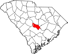 | |
| Unincorporated communities | ||
Coordinates: 33°37′32″N 80°35′22″W / 33.62556°N 80.58944°W
This article is issued from Wikipedia - version of the 2/2/2014. The text is available under the Creative Commons Attribution/Share Alike but additional terms may apply for the media files.