Lohaghat
| Lohaghat लोहाघाट | |
|---|---|
| city | |
 Lohaghat  Lohaghat Location in Uttarakhand, India | |
| Coordinates: 29°25′N 80°06′E / 29.42°N 80.10°ECoordinates: 29°25′N 80°06′E / 29.42°N 80.10°E | |
| Country | India |
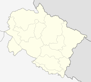
| State | Uttarakhand |
| District | Champawat |
| Area | |
| • Total | 4.5 km2 (1.7 sq mi) |
| Elevation | 1,754 m (5,755 ft) |
| Population (2011) | |
| • Total | 45,333 |
| • Density | 10,000/km2 (26,000/sq mi) |
| Languages | |
| • Official | Hindi |
| • Native | Kumaoni |
| Time zone | IST (UTC+5:30) |
| Area code(s) | 05965 |
| Vehicle registration | UK 03 |
Lohaghat is a town and a nagar panchayat (Notified Area Council, N.A.C.) in Champawat district in the Indian state of Uttarakhand. Lohaghat is a hill station with many tourist spots around.
Demographics
As of the 2011 India census,[1] Lohaghat had a population of 45,333. Males constitute 48% of the population and females 52%. The literacy rate of Lohaghat city is 80%. Male literacy is 82%, and female literacy is 78%. Population of children with age of 0-6 is 6745 which is 15 % of total population of Lohaghat (NP).
Tourism
Lohaghat on the banks of Lohawati River in Champawat district is one of the important places for its temples. Located at an altitude of 1706 metres, Lohaghat is a few kilometers from Pithoragarh. This ancient town of Lohaghat has historical and mythological importance which attracts a number of tourists. Mostly devotees and pilgrims from all over drop into Lohaghat before visiting Advaita Ashram which is also called the Mayawati Ashram. A sleepy little town of Uttaranchal it shot to fame because of the beautiful temples and fascinating locales nearby.
Spread over an area of 4.5 km2, Lohaghat is one of the most beautiful places in Uttaranchal specially made popular because of its historical and mythological associations.
Situated 13 km from Champawat, and 62 km away from Pithoragarh on way to Tanakpur. Lohaghat is close to several tourist spots in the region, Shyamla Taal, Devidhura, Gurudwara Ritha Sahib, Abbot Mount (8 km), Vanasur fort (Vanasur-Ka-Kila) (7 km), Mayawati Ashram (Advaita Ashrama) (9 km), Galchaura, Suin(Pawa), and the Forti village.
It is famous for Bagwal fight carnival which takes place at Devidhura (In Maa Baarahi temple) on auspicious day of Raksha Bandhan day. Devidhura is 45 km from Lohaghat.[2]
Nearby Ritha-Sahib is a famous Sikh gurudwara and sweet Rithas that are unique in the world and Pancheshwar is famous for river-rafting and adventurous sports. 20 km far from Lohaghat, there is scenic tourist spot called Pati.
Nearest railhead is Tanakpur Railway station is 89 km away from Lohaghat.

Tourist attractions
Mayawati Ashram – Located at a distance of 9 km from Lohaghat this is famous for the Advaita Ashram which attracts pilgrims and tourists from all over the world.
Advaita Ashrama at Mayavati is a branch centre of the worldwide Ramakrishna Math and was founded in 1899 by the English-disciple couple of Swami Vivekananda, Captain and Mrs Sevier. The first head of this ashrama was Swami Swarupananda, a disciple of Swami Vivekananda. This ashrama houses the editorial office of Prabuddha Bharata a monthly English journal. There is also a charitable hospital run by this ashrama.
Abbot Mount – Situated 7 km from Lohaghat this is one of the most serene locales near Lohaghat. Spend a few moments amidst serenity in Abbot Mount.
Overview

It is a place of mythological importance, and dedicated to Hindu God, Lord Shiva. P. Barron on his visit had said,"Why go to Kashmir, if there is heaven in the world, so its in Lohaghat". This place has a historic importance as well. There are also remains of the fort of mythological demon king Banasur, who was killed by Lord Krishna.
Apart from being a favourite destination for tourists, this place is famous for its celebration of Holi and Janamashtmi.The Khadi bazaar of the town is an added attraction, and the scenic Galchaura.
Transport
The nearest railhead is at Tanakpur, approximately 90 km away. Naini Saini Airport would be the nearest airport, once build. It is under construction and is about 5 km from Pithoragarh.
See also
References
- ↑ "Census of India 2001: Data from the 2001 Census, including cities, villages and towns (Provisional)". Census Commission of India. Archived from the original on 2004-06-16. Retrieved 2008-11-01.
- ↑ KV Lohaghat