Ločki Vrh, Benedikt
| Ločki Vrh | |
|---|---|
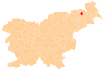
 Ločki Vrh Location in Slovenia | |
| Coordinates: 46°35′48.03″N 15°55′8.84″E / 46.5966750°N 15.9191222°ECoordinates: 46°35′48.03″N 15°55′8.84″E / 46.5966750°N 15.9191222°E | |
| Country |
|
| Traditional region | Styria |
| Statistical region | Drava |
| Municipality | Benedikt |
| Area | |
| • Total | 1.38 km2 (0.53 sq mi) |
| Elevation | 298.4 m (979.0 ft) |
| Population (2002) | |
| • Total | 85 |
| [1] | |
Ločki Vrh (pronounced [ˈloːtʃki ˈʋəɾx]) is a small settlement in the Slovene Hills (Slovene: Slovenske gorice) in the Municipality of Benedikt in northeastern Slovenia. Traditionally, the area was part of Styria and is now included in the Drava Statistical Region.[2]
An intact Roman-period burial mound in a forest near the settlement has so far not been excavated.[3]
References
External links
This article is issued from Wikipedia - version of the 6/19/2016. The text is available under the Creative Commons Attribution/Share Alike but additional terms may apply for the media files.