Lewisville, Ohio
| Lewisville, Ohio | |
|---|---|
| Village | |
 Location of Lewisville, Ohio | |
 Location of Lewisville in Monroe County | |
| Coordinates: 39°45′52″N 81°13′0″W / 39.76444°N 81.21667°WCoordinates: 39°45′52″N 81°13′0″W / 39.76444°N 81.21667°W | |
| Country | United States |
| State | Ohio |
| County | Monroe |
| Township | Summit |
| Area[1] | |
| • Total | 0.37 sq mi (0.96 km2) |
| • Land | 0.37 sq mi (0.96 km2) |
| • Water | 0 sq mi (0 km2) |
| Elevation[2] | 1,201 ft (366 m) |
| Population (2010)[3] | |
| • Total | 176 |
| • Estimate (2012[4]) | 176 |
| • Density | 475.7/sq mi (183.7/km2) |
| Time zone | Eastern (EST) (UTC-5) |
| • Summer (DST) | EDT (UTC-4) |
| ZIP code | 43754 |
| Area code(s) | 740 |
| FIPS code | 39-42980[5] |
| GNIS feature ID | 1076237[2] |
Lewisville is a village in Monroe County, Ohio, United States. The population was 176 at the 2010 census.[6]
Lewisville is served by the Monroe County District Library from its administrative offices in Woodsfield, Ohio.
Geography
Lewisville is located at 39°45′52″N 81°13′0″W / 39.76444°N 81.21667°W (39.764411, -81.216781).[7]
According to the United States Census Bureau, the village has a total area of 0.37 square miles (0.96 km2), all of it land.[1]
Demographics
| Historical population | |||
|---|---|---|---|
| Census | Pop. | %± | |
| 1850 | 96 | — | |
| 1870 | 124 | — | |
| 1880 | 120 | −3.2% | |
| 1900 | 170 | — | |
| 1910 | 291 | 71.2% | |
| 1920 | 230 | −21.0% | |
| 1930 | 231 | 0.4% | |
| 1940 | 252 | 9.1% | |
| 1950 | 217 | −13.9% | |
| 1960 | 193 | −11.1% | |
| 1970 | 294 | 52.3% | |
| 1980 | 285 | −3.1% | |
| 1990 | 261 | −8.4% | |
| 2000 | 233 | −10.7% | |
| 2010 | 176 | −24.5% | |
| Est. 2015 | 176 | [8] | 0.0% |
2010 census
As of the census[3] of 2010, there were 176 people, 76 households, and 48 families residing in the village. The population density was 475.7 inhabitants per square mile (183.7/km2). There were 97 housing units at an average density of 262.2 per square mile (101.2/km2). The racial makeup of the village was 98.3% White, 0.6% Asian, and 1.1% from two or more races. Hispanic or Latino of any race were 0.6% of the population.
There were 76 households of which 25.0% had children under the age of 18 living with them, 50.0% were married couples living together, 6.6% had a female householder with no husband present, 6.6% had a male householder with no wife present, and 36.8% were non-families. 31.6% of all households were made up of individuals and 14.5% had someone living alone who was 65 years of age or older. The average household size was 2.11 and the average family size was 2.67.
The median age in the village was 48.5 years. 17% of residents were under the age of 18; 6.2% were between the ages of 18 and 24; 23.3% were from 25 to 44; 33% were from 45 to 64; and 20.5% were 65 years of age or older. The gender makeup of the village was 46.6% male and 53.4% female.
2000 census
As of the census[5] of 2000, there were 233 people, 95 households, and 64 families residing in the village. The population density was 625.4 people per square mile (243.1/km²). There were 110 housing units at an average density of 295.2 per square mile (114.8/km²). The racial makeup of the village was 99.14% White, 0.43% Asian, and 0.43% from two or more races.
There were 95 households out of which 28.4% had children under the age of 18 living with them, 57.9% were married couples living together, 9.5% had a female householder with no husband present, and 31.6% were non-families. 30.5% of all households were made up of individuals and 21.1% had someone living alone who was 65 years of age or older. The average household size was 2.32 and the average family size was 2.91.
In the village the population was spread out with 23.6% under the age of 18, 6.4% from 18 to 24, 24.5% from 25 to 44, 24.9% from 45 to 64, and 20.6% who were 65 years of age or older. The median age was 41 years. For every 100 females there were 77.9 males. For every 100 females age 18 and over, there were 79.8 males.
The median income for a household in the village was $24,286, and the median income for a family was $31,042. Males had a median income of $33,750 versus $18,036 for females. The per capita income for the village was $11,150. About 6.5% of families and 10.1% of the population were below the poverty line, including none of those under the age of eighteen and 19.6% of those sixty five or over.
References
- 1 2 "US Gazetteer files 2010". United States Census Bureau. Archived from the original on January 24, 2012. Retrieved 2013-01-06.
- 1 2 "US Board on Geographic Names". United States Geological Survey. 2007-10-25. Retrieved 2008-01-31.
- 1 2 "American FactFinder". United States Census Bureau. Retrieved 2013-01-06.
- ↑ "Population Estimates". United States Census Bureau. Archived from the original on June 17, 2013. Retrieved 2013-06-17.
- 1 2 "American FactFinder". United States Census Bureau. Archived from the original on September 11, 2013. Retrieved 2008-01-31.
- ↑ "Profile of General Population and Housing Characteristics: 2010 Demographic Profile Data (DP-1): Lewisville village, Ohio". U.S. Census Bureau, American Factfinder. Archived from the original on September 11, 2013. Retrieved June 1, 2012.
- ↑ "US Gazetteer files: 2010, 2000, and 1990". United States Census Bureau. 2011-02-12. Retrieved 2011-04-23.
- ↑ "Annual Estimates of the Resident Population for Incorporated Places: April 1, 2010 to July 1, 2015". Retrieved July 2, 2016.
- ↑ "Census of Population and Housing". Census.gov. Archived from the original on May 11, 2015. Retrieved June 4, 2015.
Municipalities and communities of Monroe County, Ohio, United States | ||
|---|---|---|
| Villages | 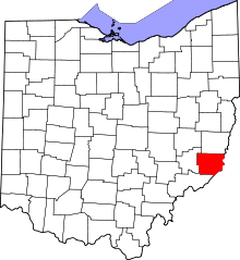 | |
| Townships | ||
| CDPs | ||
| Unincorporated communities | ||
| Ghost town | ||
| Footnotes | ‡This populated place also has portions in an adjacent county or counties | |