Leonora, Western Australia
| Leonora Western Australia | |||||||
|---|---|---|---|---|---|---|---|
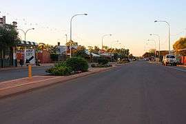 Tower Street, Leonora | |||||||
 Leonora | |||||||
| Coordinates | 28°53′00″S 121°19′51″E / 28.883343°S 121.330744°ECoordinates: 28°53′00″S 121°19′51″E / 28.883343°S 121.330744°E | ||||||
| Population | 779 (2011 census)[1] | ||||||
| Established | 1897 | ||||||
| Postcode(s) | 6438 | ||||||
| Elevation | 376 m (1,234 ft) | ||||||
| Location |
| ||||||
| LGA(s) | Shire of Leonora | ||||||
| State electorate(s) | Kalgoorlie | ||||||
| Federal Division(s) | O'Connor | ||||||
| |||||||
Leonora is a town in the Goldfields-Esperance region of Western Australia, located 833 kilometres (518 mi) northeast of the state capital, Perth, and 237 kilometres (147 mi) north of the city of Kalgoorlie.
At the 2011 census, Leonora had a population of 779, 24% of which were of Aboriginal descent.[1] The area has a semi-arid climate, with a mean annual rainfall of 233 millimetres (9 in). Mean daily maximum temperatures range from 18 °C (64 °F) for July to 37 °C (99 °F) for January.[2]
Leonora is primarily a mining town. There are a number of major gold mines in the Shire, as well as the Murrin Murin laterite nickel project. The area supports a significant pastoral industry.
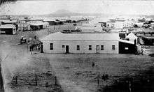
The first European explorer was John Forrest, who visited the area in 1869.[3] On 21 June 1869 Forrest's party made camp near a conspicuous hill, which Forrest named Mount Leonora, after his six-year-old niece Frances (Fanny) Leonora Hardey.[4] In 1894, gold was discovered in the area by a prospector named Morrisey, and in the following two years a number of rich finds resulted in rapid development of the area. The Sons of Gwalia gold mine brought Leonora to the attention of the world. By 1897 a residential and business area had been established, and the town was gazetted as Leonora in 1897. [5]
Leonora had a single track passenger tramway linking the town and nearby Gwalia, from 1901 to 1921. Initially steam driven, the service was electric from November 1908, and petrol powered from 1915.
In 2003, work commenced on a desalination plant intended to improve the town's water quality. It was designed to supply 2.5 million litres of treated water per day. Construction was expected to be completed by Christmas that year.[6]
In 2010, the Rudd Government relocated asylum seekers from Christmas Island to the 'Leonora Alternative Place of Detention', an immigration detention centre, previously used as a mine workers hostel, in Leonora. The Abbott Government closed the facility in February 2014.[7][8]
See also
References
- 1 2 Australian Bureau of Statistics (31 October 2012). "Leonora (L) (Urban Centre/Locality)". 2011 Census QuickStats. Retrieved 17 June 2014.
- ↑ Bureau of Meteorology. "Monthly climate statistics - Leonora". Climate statistics for Australian locations. Commonwealth of Australia. Retrieved 7 April 2014.
- ↑ Forrest, John (1875). Explorations in Australia. London: Sampson Low, Marston, Low, & Searle. Retrieved 2012-05-06.
- ↑ "Woman Pioneer". Daily News. Perth, WA. 17 August 1927. p. 4. Retrieved 13 January 2016.
- ↑ "A brief history of Gwalia". Shire of Leonora. Retrieved 26 October 2015.
- ↑ "Work to start on Leonora desalination plant". ABC. 2003-06-02. Retrieved 2015-01-12.
- ↑ "Asylum seekers to be sent to WA mining camp". ABC News. Australian Broadcasting Corporation. 1 June 2010. Retrieved 1 June 2010.
- ↑ "Shire of Leonora disappointed over Government decision to close immigration detention centre". ABC News. Australian Broadcasting Corporation. 14 January 2014. Retrieved 7 April 2014.
External links
![]() Media related to Leonora, Western Australia at Wikimedia Commons
Media related to Leonora, Western Australia at Wikimedia Commons