Leiper Canal
| Leiper Canal | |
|---|---|
|
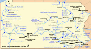
Map of historic Pennsylvania canals and connecting railroads | |
| Specifications | |
| Locks | 3 |
| Status | Historic, abandoned |
| History | |
| Original owner | George Leiper |
| Date completed | 1829 |
| Date closed | 1852 |
| Geography | |
| Start point | Leiper stone quarry near Springfield |
| End point | Delaware River at Eddystone |
| Connects to | Delaware River |
Early in the 19th century, the Leiper Canal ran about 3 miles (5 km)[1] along Crum Creek in Delaware County, Pennsylvania. George Leiper, who financed the canal, used it between 1829 and 1852 to haul stone in flat-bottomed boats from his quarry near Springfield to the navigable Delaware River at Eddystone. The system, which had three locks, replaced an industrial tramway.[2] Crum Creek's mouth is at 39°51′28″N 75°19′14″W / 39.85778°N 75.32056°WCoordinates: 39°51′28″N 75°19′14″W / 39.85778°N 75.32056°W.[3]
The horse-drawn tramway, the Leiper Railroad, carried stone from the quarry for 18 years before the opening of the canal.[4] The tramway was built by Leiper's father, Thomas Leiper, whose request to build a canal in 1791 was denied by the Pennsylvania Legislature. However, the Legislature of 1824 approved a second canal proposal by Thomas Leiper, and the construction project was carried out by his son.[5] The Leiper Canal was one of several privately funded canals such as the Union Canal and the Schuylkill Canal that operated in Pennsylvania during the same era as the Pennsylvania Canal.
The Thomas Leiper Estate was added to the National Register of Historic Places in 1970.[6] The Thomas Leiper House has been turned into a public museum in Wallingford.[7]
See also
Notes
- ↑ This is the distance from the Thomas Leiper House, 521 Avondale Road in Wallingford, Pennsylvania, to the confluence of Crum Creek with the Delaware River.
- ↑ Shank, William H. (1986). The Amazing Pennsylvania Canals, 150th Anniversary Edition. York, Pennsylvania: American Canal and Transportation Center. p. 74. ISBN 0-933788-37-1.
- ↑ "Crum Creek". Geographic Names Information System. United States Geological Survey. August 2, 1979. Retrieved March 20, 2009.
- ↑ McMasters, John Bach (1920). A History of the People of the United States from the Revolution to the Civil War. New York and London: D. Appleton and Company. p. 494.
- ↑ "Nether Providence Through the Years". Nether Providence Historical Society. Retrieved November 11, 2007.
- ↑ National Park Service (2010-07-09). "National Register Information System". National Register of Historic Places. National Park Service.
- ↑ "Delaware County History: Historic Sites". delcohistory.org. Retrieved January 20, 2008.
External links
- The Leiper Canal
- Thomas Leiper, Founder, and His Impact on Delaware County
- Township Treasures: The Thomas Leiper House
- Pennsylvania Canal Society
- American Canal Society
- National Canal Museum