Lebanon, Nebraska
| Lebanon, Nebraska | |
|---|---|
| Village | |
|
Downtown Lebanon | |
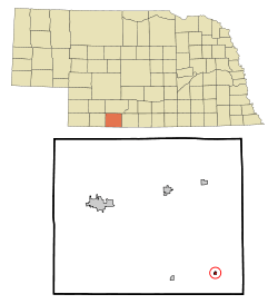 Location of Lebanon, Nebraska | |
| Coordinates: 40°2′57″N 100°16′35″W / 40.04917°N 100.27639°WCoordinates: 40°2′57″N 100°16′35″W / 40.04917°N 100.27639°W | |
| Country | United States |
| State | Nebraska |
| County | Red Willow |
| Area[1] | |
| • Total | 0.16 sq mi (0.41 km2) |
| • Land | 0.16 sq mi (0.41 km2) |
| • Water | 0 sq mi (0 km2) |
| Elevation | 2,398 ft (731 m) |
| Population (2010)[2] | |
| • Total | 80 |
| • Estimate (2012[3]) | 80 |
| • Density | 500.0/sq mi (193.1/km2) |
| Time zone | Central (CST) (UTC-6) |
| • Summer (DST) | CDT (UTC-5) |
| ZIP code | 69036 |
| Area code(s) | 308 |
| FIPS code | 31-26455[4] |
| GNIS feature ID | 0830656[5] |
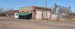
Lebanon is a village in Red Willow County, Nebraska, United States. The population was 80 at the 2010 census.
History
Lebanon was platted in 1887 when the Burlington & Missouri River Railroad was extended to that point.[6] Its name commemorates the Cedars of Lebanon.[7]
Geography
Lebanon is located at 40°2′57″N 100°16′35″W / 40.04917°N 100.27639°W (40.049211, -100.276348).[8]
According to the United States Census Bureau, the village has a total area of 0.16 square miles (0.41 km2), all of it land.[1]
Demographics
| Historical population | |||
|---|---|---|---|
| Census | Pop. | %± | |
| 1910 | 197 | — | |
| 1920 | 245 | 24.4% | |
| 1930 | 262 | 6.9% | |
| 1940 | 238 | −9.2% | |
| 1950 | 213 | −10.5% | |
| 1960 | 143 | −32.9% | |
| 1970 | 118 | −17.5% | |
| 1980 | 102 | −13.6% | |
| 1990 | 75 | −26.5% | |
| 2000 | 70 | −6.7% | |
| 2010 | 80 | 14.3% | |
| Est. 2015 | 78 | [9] | −2.5% |
2010 census
As of the census[2] of 2010, there were 80 people, 33 households, and 21 families residing in the village. The population density was 500.0 inhabitants per square mile (193.1/km2). There were 50 housing units at an average density of 312.5 per square mile (120.7/km2). The racial makeup of the village was 100.0% White.
There were 33 households of which 36.4% had children under the age of 18 living with them, 51.5% were married couples living together, 3.0% had a female householder with no husband present, 9.1% had a male householder with no wife present, and 36.4% were non-families. 27.3% of all households were made up of individuals and 9.1% had someone living alone who was 65 years of age or older. The average household size was 2.42 and the average family size was 2.90.
The median age in the village was 36.5 years. 26.2% of residents were under the age of 18; 11.4% were between the ages of 18 and 24; 20.1% were from 25 to 44; 31.3% were from 45 to 64; and 11.3% were 65 years of age or older. The gender makeup of the village was 56.3% male and 43.8% female.
2000 census
As of the census[4] of 2000, there were 70 people, 34 households, and 21 families residing in the village. The population density was 436.5 people per square mile (168.9/km²). There were 48 housing units at an average density of 299.3 per square mile (115.8/km²). The racial makeup of the village was 100.00% White.
There were 34 households out of which 20.6% had children under the age of 18 living with them, 58.8% were married couples living together, and 35.3% were non-families. 35.3% of all households were made up of individuals and 26.5% had someone living alone who was 65 years of age or older. The average household size was 2.06 and the average family size was 2.59.
In the village the population was spread out with 20.0% under the age of 18, 7.1% from 18 to 24, 21.4% from 25 to 44, 24.3% from 45 to 64, and 27.1% who were 65 years of age or older. The median age was 47 years. For every 100 females there were 100.0 males. For every 100 females age 18 and over, there were 100.0 males.
As of 2000 the median income for a household in the village was $19,688, and the median income for a family was $30,833. Males had a median income of $33,750 versus $8,125 for females. The per capita income for the village was $15,406. There were 16.7% of families and 25.9% of the population living below the poverty line, including 55.0% of under eighteens and none of those over 64.
References
- 1 2 "US Gazetteer files 2010". United States Census Bureau. Retrieved 2012-06-24.
- 1 2 "American FactFinder". United States Census Bureau. Retrieved 2012-06-24.
- ↑ "Population Estimates". United States Census Bureau. Retrieved 2013-05-29.
- 1 2 "American FactFinder". United States Census Bureau. Retrieved 2008-01-31.
- ↑ "US Board on Geographic Names". United States Geological Survey. 2007-10-25. Retrieved 2008-01-31.
- ↑ "Lebanon, Red Willow County". Center for Advanced Land Management Information Technologies. University of Nebraska. Retrieved 22 August 2014.
- ↑ Fitzpatrick, Lillian L. (1960). Nebraska Place-Names. University of Nebraska Press. p. 117. ISBN 0-8032-5060-6. A 1925 edition is available for download at University of Nebraska—Lincoln Digital Commons.
- ↑ "US Gazetteer files: 2010, 2000, and 1990". United States Census Bureau. 2011-02-12. Retrieved 2011-04-23.
- ↑ "Annual Estimates of the Resident Population for Incorporated Places: April 1, 2010 to July 1, 2015". Retrieved July 2, 2016.
- ↑ "Census of Population and Housing". Census.gov. Retrieved June 4, 2015.
Municipalities and communities of Red Willow County, Nebraska, United States | ||
|---|---|---|
| Cities | ||
| Villages | ||
| Unincorporated communities | ||