Le Tarent
| Le Tarent | |
|---|---|
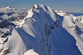 Le Tarent from La Para | |
| Highest point | |
| Elevation | 2,548 m (8,360 ft) |
| Prominence | 1,002 m (3,287 ft) [1] |
| Coordinates | 46°22′55.9″N 7°8′50.9″E / 46.382194°N 7.147472°ECoordinates: 46°22′55.9″N 7°8′50.9″E / 46.382194°N 7.147472°E |
| Geography | |
 Le Tarent Location in Switzerland | |
| Location | Vaud, Switzerland |
| Parent range | Vaud Alps |
Le Tarent is a mountain in the western Bernese Alps, overlooking Les Diablerets in the canton of Vaud. At 2,548 metres above sea level, it is the highest mountain of the range lying north of the Col du Pillon. The mountain, which lies near the border with the canton of Bern, is composed of several subsidiary summits, the highest being the Châtillon (2,478 m) and La Para (2,540 m).
References
- ↑ Retrieved from the Swisstopo topographic maps. The key col is the Col du Pillon (1,546 m).
External links
This article is issued from Wikipedia - version of the 11/15/2016. The text is available under the Creative Commons Attribution/Share Alike but additional terms may apply for the media files.