Latexo, Texas
| Latexo, Texas | |
|---|---|
| City | |
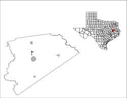
 Location of Latexo, Texas | |
 | |
| Coordinates: 31°23′21″N 95°28′29″W / 31.38917°N 95.47472°WCoordinates: 31°23′21″N 95°28′29″W / 31.38917°N 95.47472°W | |
| Country | United States |
| State | Texas |
| County | Houston |
| Area | |
| • Total | 1.0 sq mi (2.6 km2) |
| • Land | 1.0 sq mi (2.6 km2) |
| • Water | 0.0 sq mi (0.0 km2) |
| Elevation | 397 ft (121 m) |
| Population (2000) | |
| • Total | 331 |
| Time zone | Central (CST) (UTC-6) |
| • Summer (DST) | CDT (UTC-5) |
| ZIP code | 75849 |
| Area code(s) | 936 |
| FIPS code | 48-41644[1] |
| GNIS feature ID | 1360972[2] |
Latexo (/ləˈtɛksoʊ/ la-TEK-soh) is a city in Houston County, Texas, United States. The population was 331 at the 2010 census.
History
Just after 1900 the Louisiana Texas Orchard Company purchased 3,000 acres (12 km2) surrounding the settlement and platted a town named Latexo, an acronym of the company's name.[3] There have been five schools built over the years in the community and the city of Latexo.
The first Bethel school building was on a dirt road that ran parallel with the railroad tracks, about 500 feet south of the railroad crossing on the north end of the city of Latexo. This building was later occupied as the home of Cleveland Willis.
The second Bethel School built in the community was located on a street that went east from what was at that time the main road that ran south along the railroad tracks. This site in the 1960s and later years was known as the home site of the Stokes Reed family.
This building was later sold (c. 1930) to the Baptist Church and was used as such for many years.
The third site of the school was located about two houses east of the second site and was the location of what was referred to as the old Ed Burton home; but was the Bill McKinney home in 1961, later the Clifford Price home. The third school was moved in 1930 to the present day location.
Two new buildings have been built on the same school property, replacing the previous building.
Geography
Latexo is located at 31°23′21″N 95°28′29″W / 31.38917°N 95.47472°W (31.389285, -95.474699).[4]
According to the United States Census Bureau, the city has a total area of 1.0 square mile (2.6 km2), all of it land.
Demographics
| Historical population | |||
|---|---|---|---|
| Census | Pop. | %± | |
| 1980 | 312 | — | |
| 1990 | 289 | −7.4% | |
| 2000 | 272 | −5.9% | |
| 2010 | 322 | 18.4% | |
| Est. 2015 | 308 | [5] | −4.3% |
As of the census[1] of 2000, there were 272 people, 116 households, and 70 families residing in the city. The population density was 276.0 people per square mile (106.1/km²). There were 136 housing units at an average density of 138.0 per square mile (53.0/km²). The racial makeup of the city was 90.07% White, 3.31% African American, 21.37% Native American, 0.37% Asian, 3.68% from other races, and 2.21% from two or more races. Hispanic or Latino of any race were 5.51% of the population.
There were 116 households out of which 29.3% had children under the age of 18 living with them, 46.6% were married couples living together, 11.2% had a female householder with no husband present, and 38.8% were non-families. 36.2% of all households were made up of individuals and 16.4% had someone living alone who was 65 years of age or older. The average household size was 2.34 and the average family size was 3.04.
In the city the population was spread out with 26.5% under the age of 18, 9.6% from 18 to 24, 27.2% from 25 to 44, 21.7% from 45 to 64, and 15.1% who were 65 years of age or older. The median age was 39 years. For every 100 females there were 88.9 males. For every 100 females age 18 and over, there were 81.8 males.
The median income for a household in the city was $22,750, and the median income for a family was $35,833. Males had a median income of $29,583 versus $18,750 for females. The per capita income for the city was $15,603. About 21.4% of families and 22.7% of the population were below the poverty line, including 27.2% of those under the age of eighteen and 12.7% of those sixty five or over.
Education
The City of Latexo is served by the Latexo Independent School District.
References
- 1 2 "American FactFinder". United States Census Bureau. Retrieved 2008-01-31.
- ↑ "US Board on Geographic Names". United States Geological Survey. 2007-10-25. Retrieved 2008-01-31.
- ↑ Temple, Robert D. Edge Effects: The Border-Name Places, (2nd edition, 2009), iUniverse, ISBN 978-0-595-47758-6, page 324.
- ↑ "US Gazetteer files: 2010, 2000, and 1990". United States Census Bureau. 2011-02-12. Retrieved 2011-04-23.
- ↑ "Annual Estimates of the Resident Population for Incorporated Places: April 1, 2010 to July 1, 2015". Retrieved July 2, 2016.
- ↑ "Census of Population and Housing". Census.gov. Retrieved June 4, 2015.
Municipalities and communities of Houston County, Texas, United States | ||
|---|---|---|
| Cities | 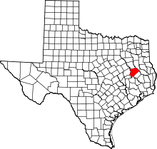 | |
| Unincorporated communities |
| |
| Ghost towns |
| |
| Footnotes | ‡This populated place also has portions in an adjacent county or counties | |