Langelsheim
| Langelsheim | ||
|---|---|---|
| ||
 Langelsheim | ||
Location of Langelsheim within Goslar district 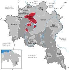
 | ||
| Coordinates: 51°56′17″N 10°20′06″E / 51.93806°N 10.33500°ECoordinates: 51°56′17″N 10°20′06″E / 51.93806°N 10.33500°E | ||
| Country | Germany | |
| State | Lower Saxony | |
| District | Goslar | |
| Government | ||
| • Mayor | Henning Schrader (SPD) | |
| Area | ||
| • Total | 48.72 km2 (18.81 sq mi) | |
| Population (2015-12-31)[1] | ||
| • Total | 11,697 | |
| • Density | 240/km2 (620/sq mi) | |
| Time zone | CET/CEST (UTC+1/+2) | |
| Postal codes | 38685 | |
| Dialling codes | 05326 | |
| Vehicle registration | GS | |
| Website | www.langelsheim.de | |

Langelsheim is a town in the district of Goslar, in Lower Saxony, Germany.
Geography
The municipality is situated between the river Innerste and its tributary Grane, on the northern edge of the Harz mountain range and the Harz National Park, located about 8 km (5.0 mi) northwest of Goslar.
City subdivisions
- Astfeld (2.471 inhabitants)
- Bredelem (517 inhabitants)
- Langelsheim (6.115 inhabitants)
- Lautenthal (2.049 inhabitants)
- Wolfshagen im Harz (2.579 inhabitants)
History
The place once called Langenizze developed in the 10th century out of a hill fort at the Kahnstein mountain, erected by the Ottonian dynasty. Langelsheim was the site of historic ironworks, first documented in the 13th century, where ore from the Mines of Rammelsberg was smelted.
Demographics

Population statistics
|
|
|
|
Politics
Town council
2006 local elections:
International relations
Main article: List of twin towns and sister cities in Germany
Langelsheim is twinned with:
-
 Emmer-Compascuum, Emmen, Netherlands
 - Nieuw-Weerdinge, Emmen, Netherlands
- Roswinkel, Emmen, Netherlands
Notable people
- Henry E. Steinway, born Heinrich Engelhard Steinweg February 22, 1797 in Wolfshagen, piano maker
- Jan Assmann, born July 7, 1938, egyptologist
- Hans-Werner Bothe, born September 23, 1952, philosopher and neurosurgeon
- Timo Rose, born February 22, 1977, motion picture director and musician
References
External links
| Wikimedia Commons has media related to Langelsheim. |
- Langelsheim at DMOZ
Towns and municipalities in Goslar (district) | ||
|---|---|---|
This article is issued from Wikipedia - version of the 9/3/2016. The text is available under the Creative Commons Attribution/Share Alike but additional terms may apply for the media files.