Langadas
| Langadas Λαγκαδάς | |
|---|---|
|
An aerial picture of Langadas. | |
 Langadas | |
|
Location within the region  | |
| Coordinates: 40°45′N 23°04′E / 40.750°N 23.067°ECoordinates: 40°45′N 23°04′E / 40.750°N 23.067°E | |
| Country | Greece |
| Administrative region | Central Macedonia |
| Regional unit | Thessaloniki |
| Government | |
| • Mayor | Ioannis Karayiannis (Independent; since 2010) |
| Area | |
| • Municipality | 1,222.7 km2 (472.1 sq mi) |
| • Municipal unit | 197.411 km2 (76.221 sq mi) |
| Elevation | 113 m (371 ft) |
| Population (2011)[1] | |
| • Municipality | 41,103 |
| • Municipality density | 34/km2 (87/sq mi) |
| • Municipal unit | 19,587 |
| • Municipal unit density | 99/km2 (260/sq mi) |
| Community[1] | |
| • Population | 7,764 (2011) |
| • Area (km2) | 31.761 |
| Time zone | EET (UTC+2) |
| • Summer (DST) | EEST (UTC+3) |
| Website | http://www.lagadas.gr |

Langadas (Greek: Λαγκαδάς, Turkish: Langaza) is a large town, cultural center, and a municipality in the northeast part of Thessaloniki regional unit, Greece. Population 19,587 (2011).
Municipality
The municipality Lagadas was formed at the 2011 local government reform by the merger of the following 7 former municipalities, that became municipal units:[2]
The municipality Langadas has an area of 1,222.65 km2, the municipal unit Langadas has an area of 197.411 km2, and the community Langadas has an area of 31.761 km2.[3]
Notable natives
- Zübeyde Hanım (1857–1923), Mustafa Kemal Atatürk's mother
References
- 1 2 "Απογραφή Πληθυσμού - Κατοικιών 2011. ΜΟΝΙΜΟΣ Πληθυσμός" (in Greek). Hellenic Statistical Authority.
- ↑ Kallikratis law – Ministry of the Interior (Greece) (Greek)
- ↑ "Population & housing census 2001 (incl. area and average elevation)" (PDF) (in Greek). National Statistical Service of Greece.
Administrative division of the Central Macedonia Region | ||
|---|---|---|
| ||
| Regional unit of Chalkidiki | 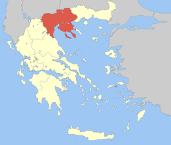 | |
| Regional unit of Imathia | ||
| Regional unit of Kilkis | ||
| Regional unit of Pella | ||
| Regional unit of Pieria | ||
| Regional unit of Serres | ||
| Regional unit of Thessaloniki | ||
| ||
This article is issued from Wikipedia - version of the 11/10/2016. The text is available under the Creative Commons Attribution/Share Alike but additional terms may apply for the media files.