Emmanouil Pappas (municipality)
| Emmanouil Pappas Εμμανουήλ Παππάς | |
|---|---|
 | |
 Emmanouil Pappas | |
|
Location within the region  | |
| Coordinates: 41°05′N 23°43′E / 41.083°N 23.717°ECoordinates: 41°05′N 23°43′E / 41.083°N 23.717°E | |
| Country | Greece |
| Administrative region | Central Macedonia |
| Regional unit | Serres |
| Area | |
| • Municipality | 338.8 km2 (130.8 sq mi) |
| Population (2011)[1] | |
| • Municipality | 14,664 |
| • Municipality density | 43/km2 (110/sq mi) |
| • Municipal unit | 8,118 |
| Community[1] | |
| • Population | 601 (2011) |
| Time zone | EET (UTC+2) |
| • Summer (DST) | EEST (UTC+3) |
| Vehicle registration | ΕΡ |
Emmanouil Pappas (Greek: Εμμανουήλ Παππάς) is a municipality in the Serres regional unit, Greece. The seat of the municipality is in Chryso.[2] The municipality takes its name after a local historical figure who played an important part as a leader in the Greek War of Independence against Ottoman rule. Emmanouil Pappas was born in the village that was previously called Dovista (Δοβίστα), probably of Slavic origin, though historians are uncertain of the exact root of that word. One conjecture involves the mispronunciation of the Latin 'Dove est', meaning 'where is it?', because, apparently, the village was undetectable from a distance.
Municipality
The municipality Emmanouil Pappas was formed at the 2011 local government reform by the merger of the following 2 former municipalities, that became municipal units:[2]
References
- 1 2 "Απογραφή Πληθυσμού - Κατοικιών 2011. ΜΟΝΙΜΟΣ Πληθυσμός" (in Greek). Hellenic Statistical Authority.
- 1 2 Kallikratis law Greece Ministry of Interior (Greek)
Administrative division of the Central Macedonia Region | ||
|---|---|---|
| ||
| Regional unit of Chalkidiki | 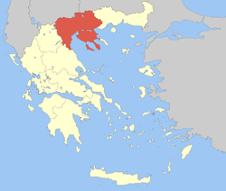 | |
| Regional unit of Imathia | ||
| Regional unit of Kilkis | ||
| Regional unit of Pella | ||
| Regional unit of Pieria | ||
| Regional unit of Serres | ||
| Regional unit of Thessaloniki | ||
| ||